Two healthy chicks occupy the nest...

of this Osprey who clearly has a bead on me as I capture this image of the siblings. The smaller chick was quite vocal, and with two youngsters, I can understand why the house is a mess.

Adult Osprey with two juveniles (Pandion haliaetus).

Shot this afternoon with a tripod-mounted Canon 5D Mark IV camera and Canon EF 500 mm f/4 prime lens from 120 yards (~110 meters).

Behind the mask...

there often clings a tiny sleeping bat. One or more are typically present when I need to retrieve my hidden house key during the summer. Delightful.

Little brown bat (Myotis lucifugus).

At least 40 noses...

are peeking out from the bottom of the bat house as the residents enjoy a pleasant day following a several day long heat wave. They’re wondering why the blood doesn’t rush to my feet as I snap this image.

Little brown myotis (Myotis lucifugus).

A properly constructed bat house...

must also be sited appropriately for bats to find and occupy. Bats are fiercely loyal to favorable roosts and will return year after year as the colony grows in number. This two-chambered bat box has been hanging in this location above my back deck, on the south side of the house, for nearly 20 years. Today more than 200 little brown bats (Myotis lucifugus) occupy it during the summer, some even giving birth.

Benefits: Fewer insects around the house and each year I gather several pounds of nitrogen-rich bat guano and give to my gardening friends. Sitting on the back deck at dusk and watching them emerge is pretty cool, too.

Hang a bat house. Bats need friends!

This is the volume of guano produced by the occupants of the bat house over the last several months, a clear indication of a large and healthy colony of bats.

My dear late wife, Donna Hensley, was a bat biologist and she compiled the first editions of this authoritative book while working at Bat Conservation International: The Bat House Guide.

An unroofed hydrocarbon trap...

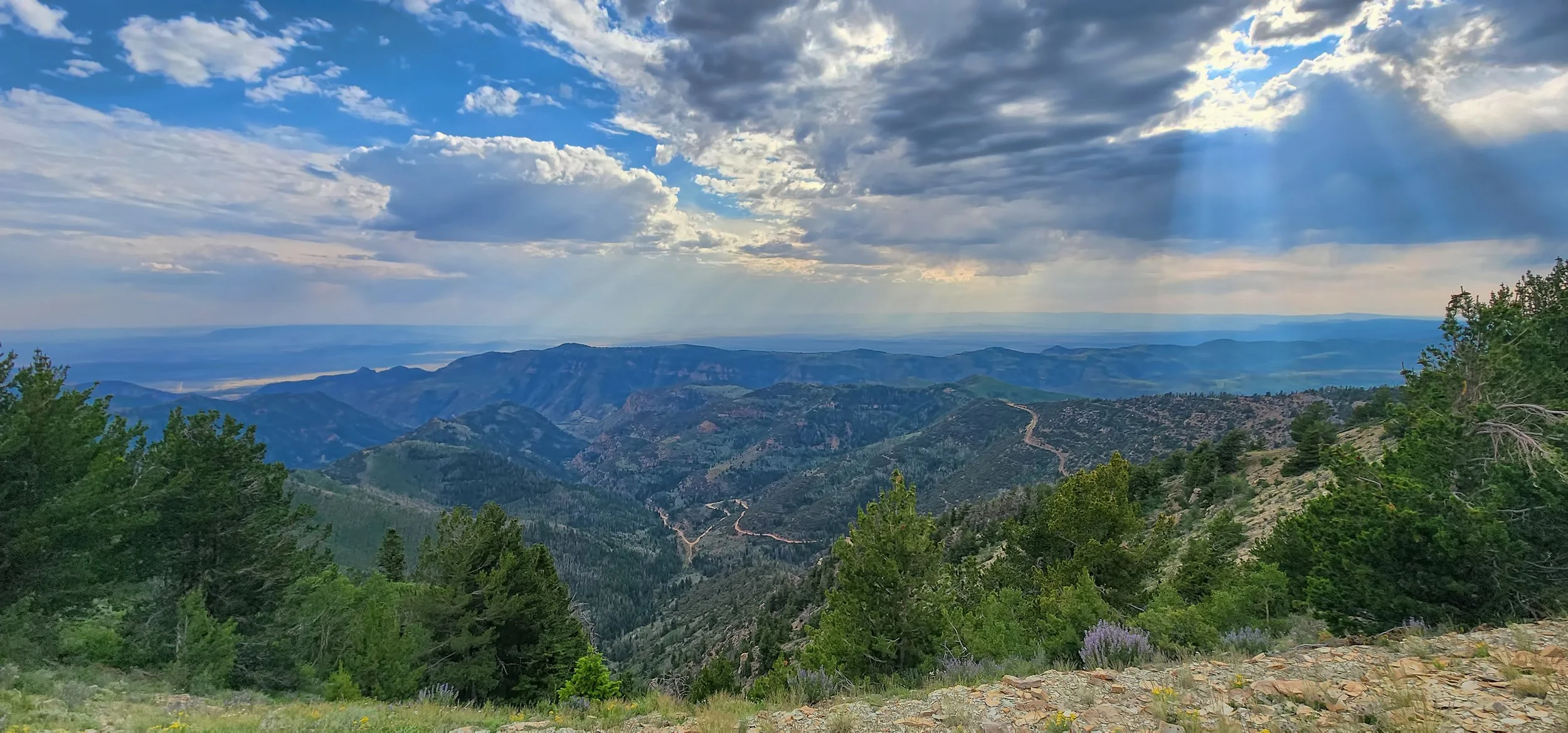
occurs below Bruin Point, Utah in the Green River Formation (Eocene) due to canyon erosion, thereby allowing the volatile compounds to freely migrate to the surface with only bitumen remaining in the sandstone.

View toward the west from Bruin Point, Utah (10,131 feet (3,088 meters)) into Water Canyon. The access road is exceptionally steep and requires a high clearance vehicle.

Block of asphaltic sandstone from the Green River Formation that was quarried below Bruin Point in the early 1800s.

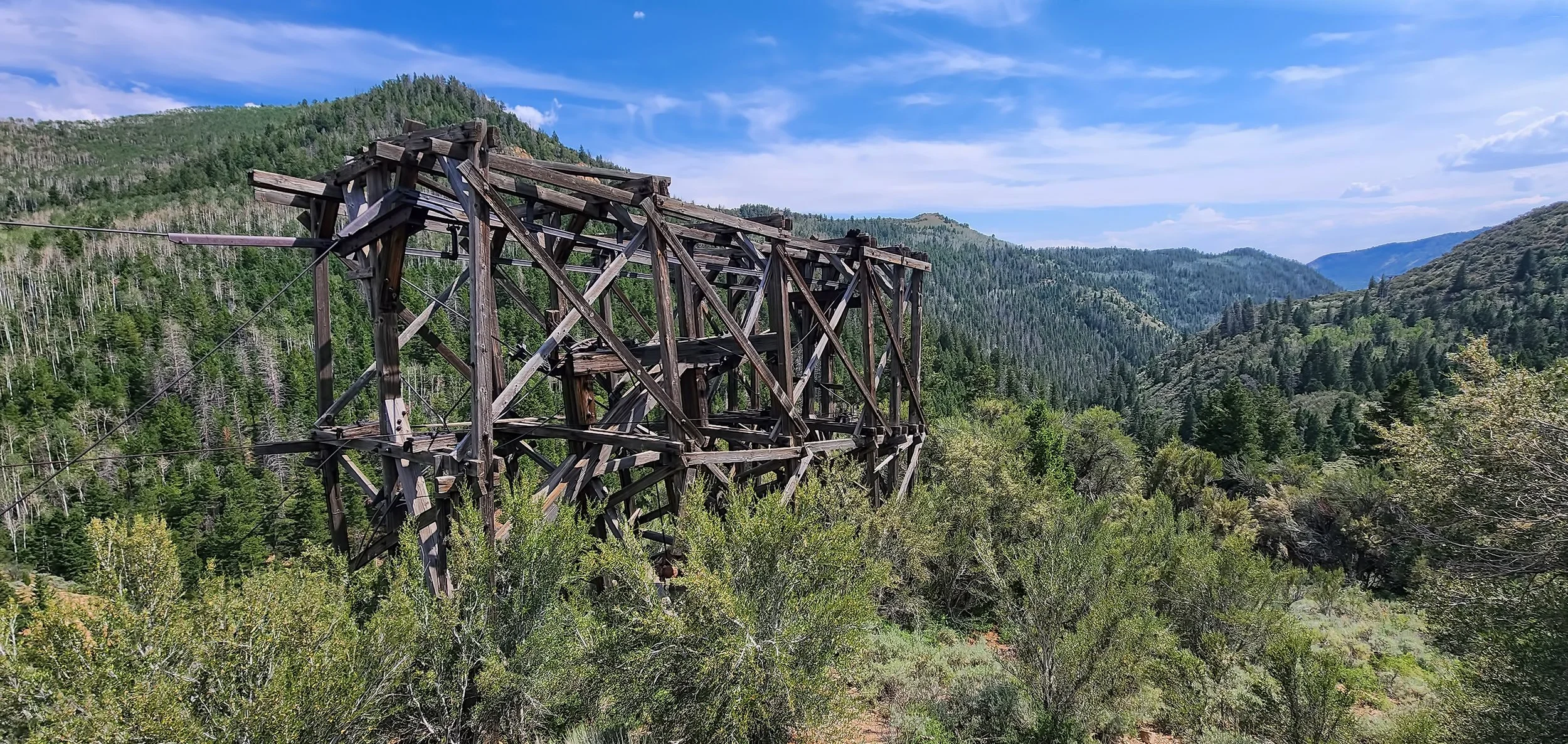
Gravity-powered aerial tramway relic below Bruin Point, circa 1920s.

The La Garita Caldera...

is the site of one of the largest volcanic eruptions in Earth’s history approximately 28 million years ago (Eocene). That enormous geologic event has left quite a bruise on south central Colorado and also created rich mineral deposits in the region.

Oblique aerial view towards the north showing the 20 mile wide (32 km) La Garita Caldera structure from Google Earth. Snowshoe Mountain is a resurgent dome in the core of the caldera.

The upper Rio Grande Valley on the western side of the La Garita caldera.

Much of the valley bottom is mantled with glacial till in terminal and lateral moraines and with glacial outwash.

Bristol Head mountain stands at 12,712 feet (3,875 meters) high with a smaller resurgent dome on the left.

Caldera-filling sedimentary rocks of the Creede Formation (Oligocene) near Creede, Colorado reflecting a lacustrine environment of deposition.

It's hummingbird heaven...

in the high country of Colorado.

Adult male Broad-tailed Hummingbird (Selasphorus platycercus).

Broad-tailed Hummingbird (Selasphorus platycercus).

Male Rufous Hummingbird (Selasphorus rufus).

Female Rufous Hummingbird (Selasphorus rufus).

Hanging out in the high country...

with a buddy from graduate school at a guest ranch near Creede, Colorado. Here are several of the local residents.

Our remote cabin for the week at about 9,200 feet (2,800 meters) in elevation.

Greater Scaup (Aythya marila).

Tree Swallow (Tachycineta bicolor).

Golden-mantled ground squirrel (Callospermophilus lateralis).

Milky Way over Molas Pass...

in the high country of Colorado last night at 11,100 feet above sea level. It was certainly quite chilly around midnight when this image was captured.

Snowdon Peak (13,077 feet) and the Milky Way reflected in Little Molas Lake. Look closely above the galactic core and you’ll spy a short meteor trail.

The subalpine scene at sundown.

Raindrop impressions...

superimposed on mudcracks in fine-grained sediments. The preservation potential for these tiny sedimentary structures in the geologic record is not high, but their delicate nature makes them interesting to examine.

Average craterlet size is approximately 0.25 inches (~6 mm) in diameter.

Episodic scouring and filling...

of the steep gradient, coarse-grained and ephemeral Placer Creek channel through time, coupled with headcutting by knickpoint migration through the stream crossing, has created a challenge in upper Castle Valley for road maintenance. Compare and contrast the conditions that existed five years ago and today.

Placer Creek crossing on 1 May 2019. Note crushed culvert and concrete on downstream side of roadway. By attempting to maintain this knickpoint in the stream profile for the long term only exacerbated the erosion that eventually occurred here.

Placer Creek crossing on 30 June 2024. Significant scour has deepened the channel once again. The knickpoint has migrated upstream and behind the two large boulders on the left.

The road crossing is now graded to a more stable position in the short term, at the same elevation of the stream channel both upstream and downstream, now that the knickpoint has migrated upstream and no longer occurs right at the crossing as seen in the early image.

View upstream showing the knickpoint in the stream channel that will continually erode upstream with future events.

Potholes pregnant with rainwater...

from recent thunderstorms spot the slickrock surface at the Moab Brands trail system north of Moab. Here’s a view north into the heart of Utahraptor State Park and the Klondike Bluffs in Arches National Park, and further beyond to the Book Cliffs and Roan Plateau on the distant horizon. A beautiful morning for a long ride in solitude.

Severe thunderstorm and flash flood warnings...

have been posted again for Castle Valley, six days after an intense flash flood that inundated a wide swath of the valley with mudflows. Since then the Town has done absolutely nothing to excavate the sediment-filled ditches and restore their capacity so that they can efficiently convey storm runoff and protect private property.

Incoming thunderstorm cell from the west-northwest over Arches National Park.

Radar image of thunderstorm cell rolling over Castle Valley from Windy.

Runoff from 0.25 inches of rain in less than an hour quickly fills the ditches.

Placer Creek a short distance above its confluence with Castle Creek late this afternoon. The noise of chattering boulders impacting one another in the turbulent flow was quite loud. (Click on image to enbiggen.)