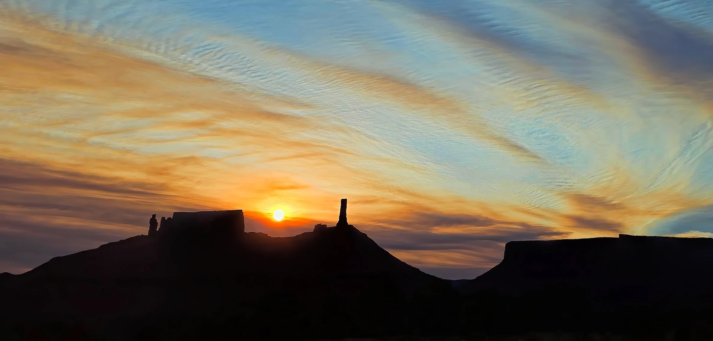
pass across Porcupine Rim this evening, and, unfortunately, nary a drop of rain fell in the valley. But fortunately there weren’t any lightening strikes. Here’s one storm cell, backlit by the setting Sun at dusk.

A window of good air quality...
allows for an 18 mile (29 km) ride this morning. Oh, the joy!
AFTERNOON: Unfortunately, that didn’t last long. By noon the air quality is deteriorating as the winds pick up and smoke density increases again.
Another smoky sunrise...
greets the dawn, the result of raging wildfires across the region. Air quality is unhealthy and getting worse.

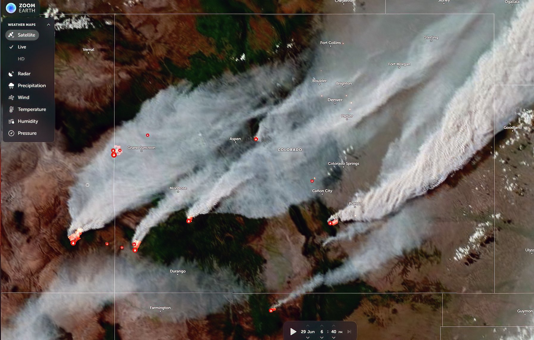
Last night’s satellite image captured early in the evening showing fire smoke plumes and heat sources in southeastern Utah and Colorado.
MID-DAY UPDATE: Air quality continues to deteriorate throughout the day. Here are a couple of views around 1:00 pm MDT.

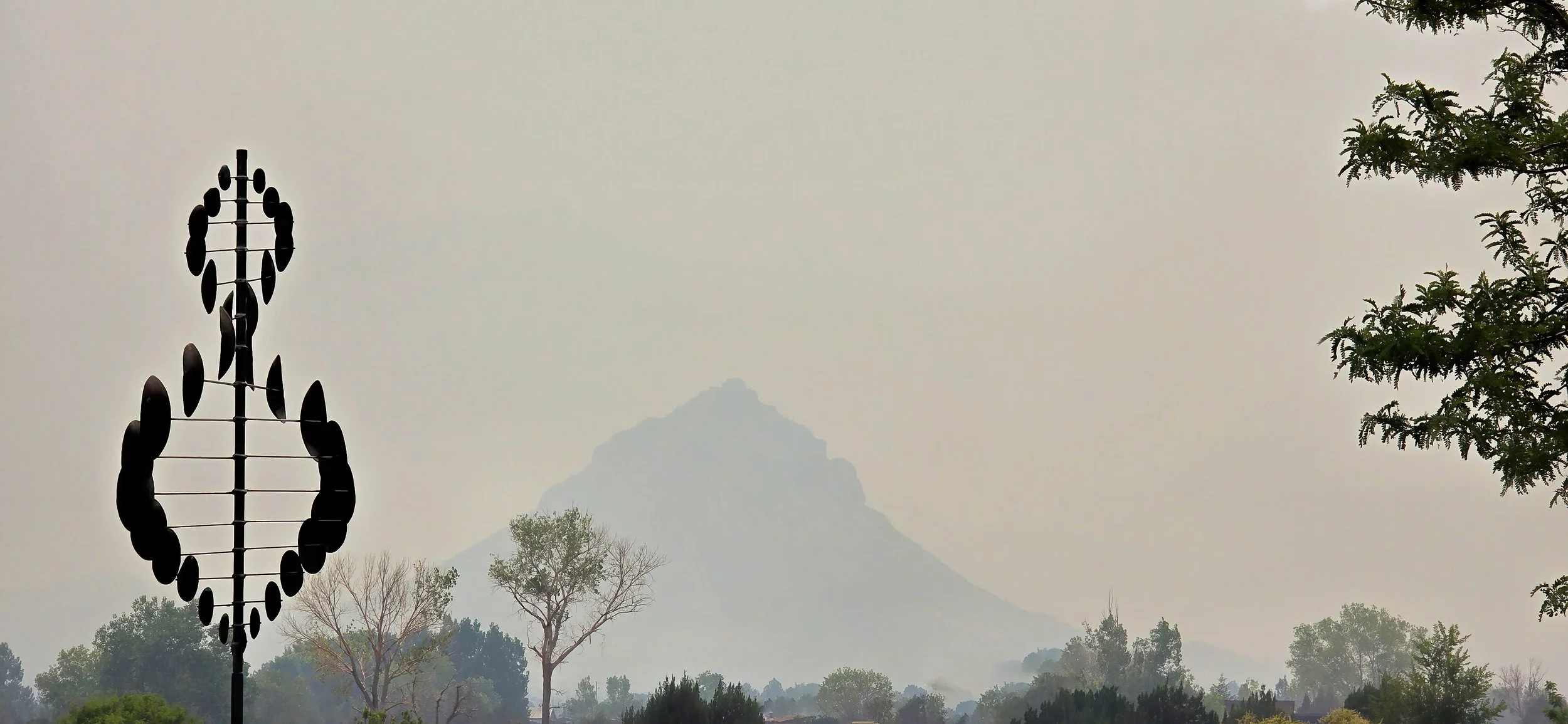
UPDATE at 5:00 pm MDT: Air quality has turned to very unhealthy. Round Mountain is no longer visible and the Tower has all but vanished from sight. Hell on Earth.

7:30 pm MDT: A late-day shift in the winds is driving the edge of the smoke plume across Parriott Mesa. Air quality is improving rapidly. Hallelujah!
Fire smoke floods Castle Valley...
once again at dawn, this time from the Snyder fire on the Utah-Colorado state line southwest of Fruita, Colorado and from the Babylon fire in the Abajo Mountains. It’s going to be a horrible, terrible, no good summer throughout the West I’m afraid.

ADDED: Full smoky Moon this evening.
Winds and light rains...
have washed the wretched fire smoke from the skies, returning the high desert to good air quality and allowing for the resumption of my early morning rides after a five day-long hiatus. Here’s my shadow claiming first tracks on the rain-dimpled singletrack this morning. Dee-lightful.
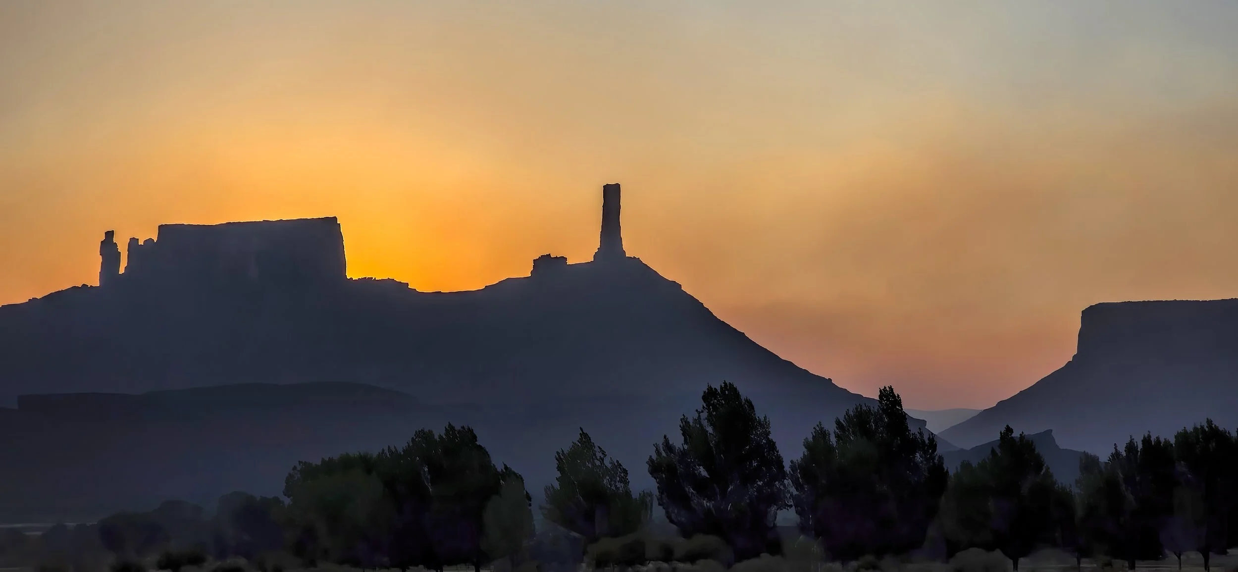
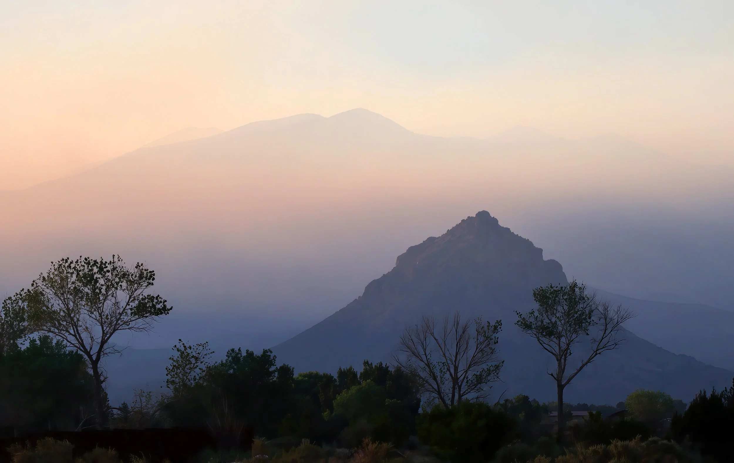
A smoky and lurid sunrise...
greets Castle Valley this morning. While the colorful refraction of the Sun’s rays through the smoke plume can be lovely, I still prefer smoke free skies.

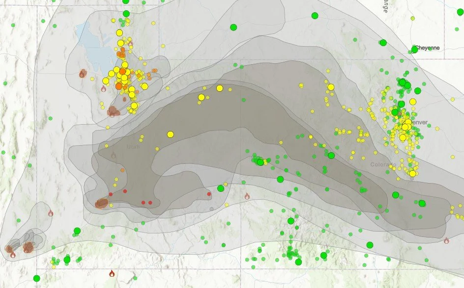
ADDED: Mid-day smoke plume map. Air quality this afternoon has significantly deteriorated and is horrible. It’s going to be one of those summers.
Another indispensable website and app during fire season: Watch Duty. I highly recommend an annual membership for $25 to support their valuable work (no commission earned).

ADDED: Mid-afternoon satellite image of smoke plume from the Cottonwood Fire near Beaver, Utah.

The La Sal Mountains have nearly vanished in the thick smoky haze at 3:00 pm MDT.

Downwinders: Air quality is now well into the unhealthy range in the Moab - Castle Valley area and likely to get worse. Here’s the smoke plume at 5:00 pm MDT. Round Mountain has completely disappeared from view.

24 June 2026 UPDATE: Shortly after sunrise, around 7:00 am MDT. Air quality remains firmly in the unhealthy category. Ugh.
A mid-day smoky haze...
diminishes air quality across Utah and Colorado, frustrating my attempt at solstice sunrise photography earlier in the morning. A large range fire southwest of Provo is responsible. I dread fire season.

The hazy view at high noon.

Useful link to Fire and Smoke Map 4.2. (You may have to turn on the plume mapping function in the settings.)
A parched bunny on the bird bath...
during the first 100 degree day of the year.
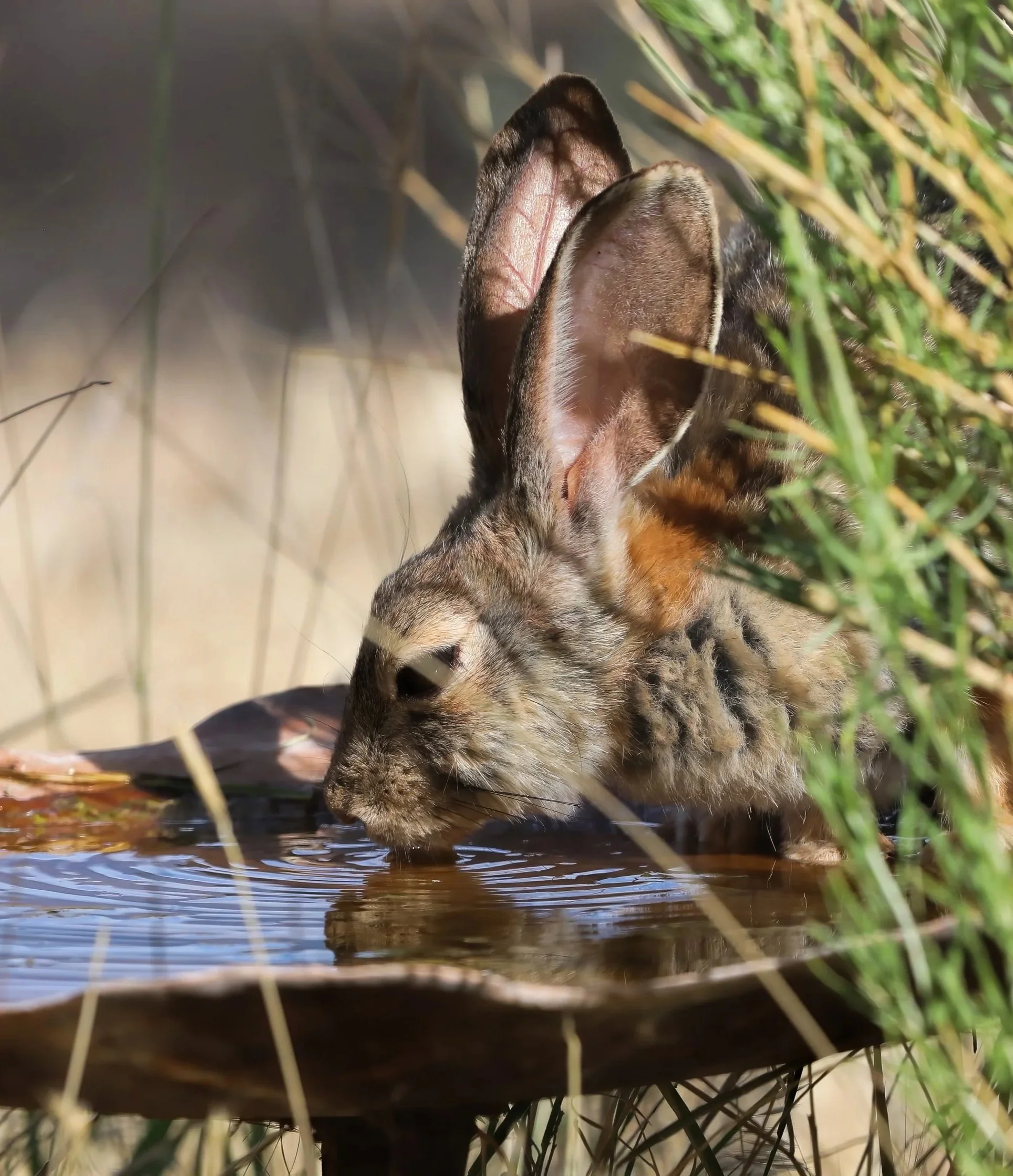
Desert cottontail (Sylvilagus audubonii).
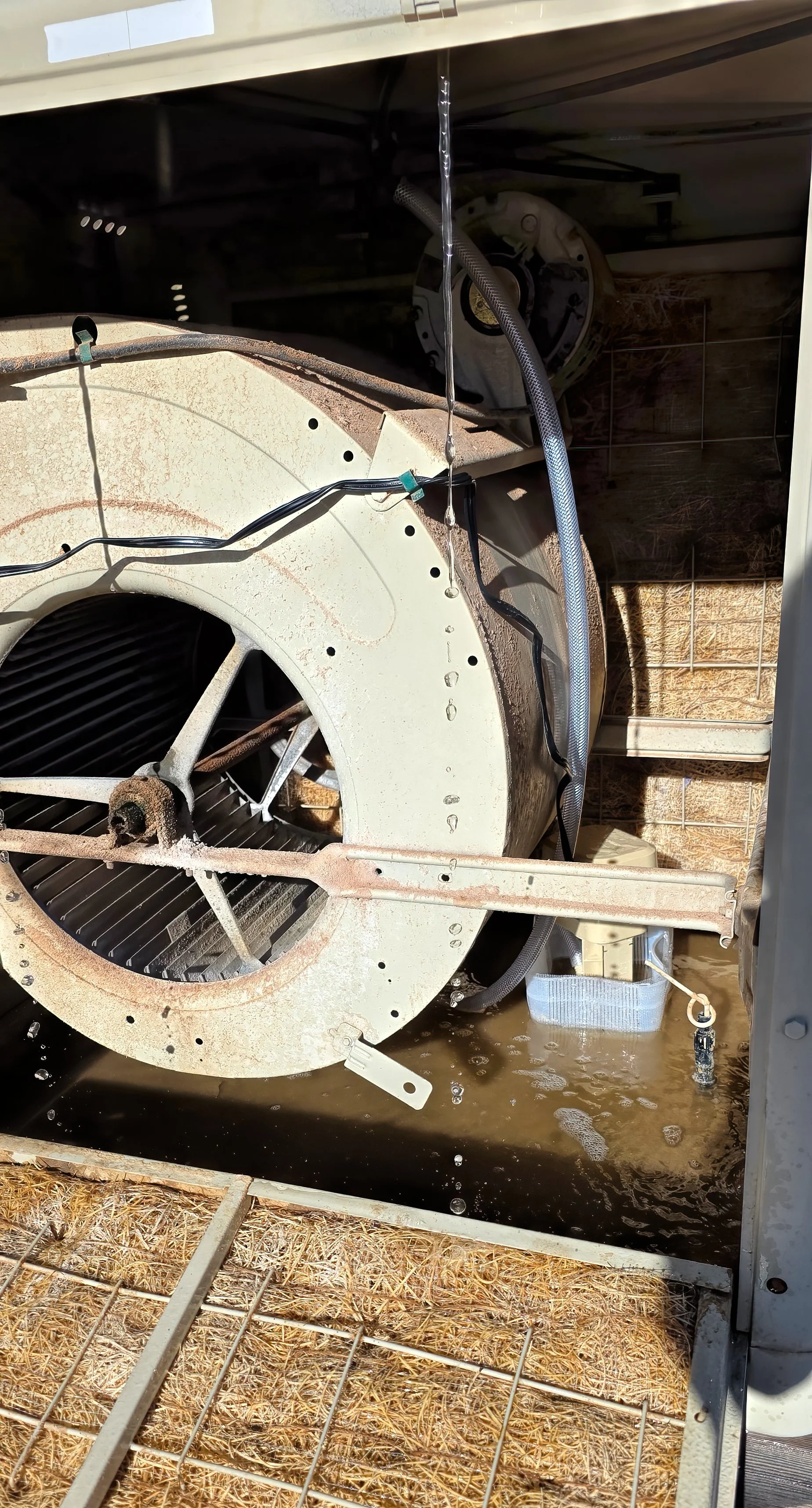
The refurbished evaporative cooler...
is ready for the forecast high temperatures this weekend. The blower was lubricated and the original water pump was replaced with a new one that is much quieter, while the aspen wood pads were replaced last year. I’m grateful that a Wi-Fi connection to the Internet wasn’t required for the pump. It’s very simple tech that works extraordinarily well.
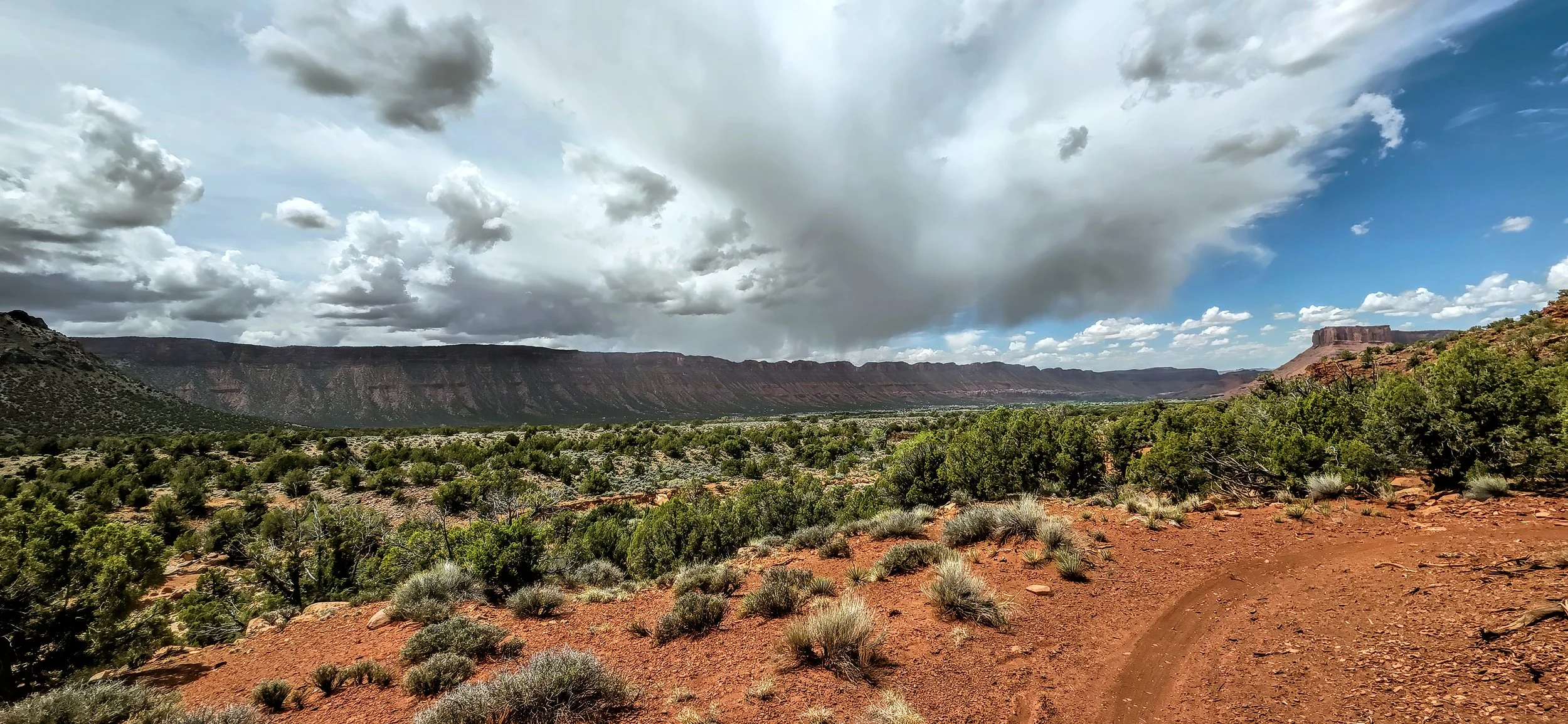
Dodging storm cells...
over Castle Valley during my daily ride on the singletrack. As good as the riding is right now, I really wish it would rain more.
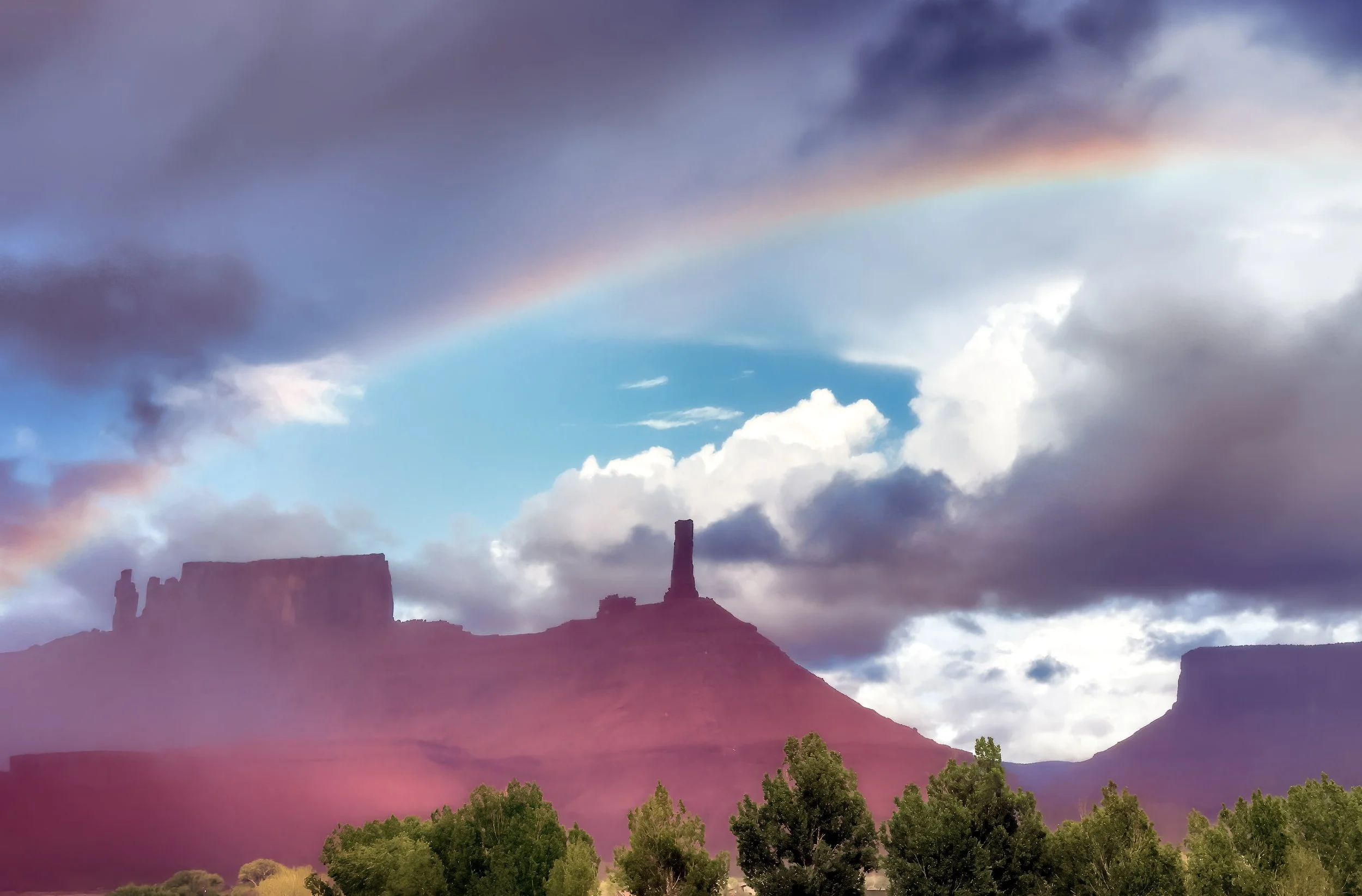
April showers make a rainbow...
in the light mist late in the day. Nearly a half an inch of rain fell today.
The snow-cloaked high desert...
the day after the storm. Cold. Bright. Silent. Absolutely magnificent.
Here are several expansive views. Click on images to enlarginate.
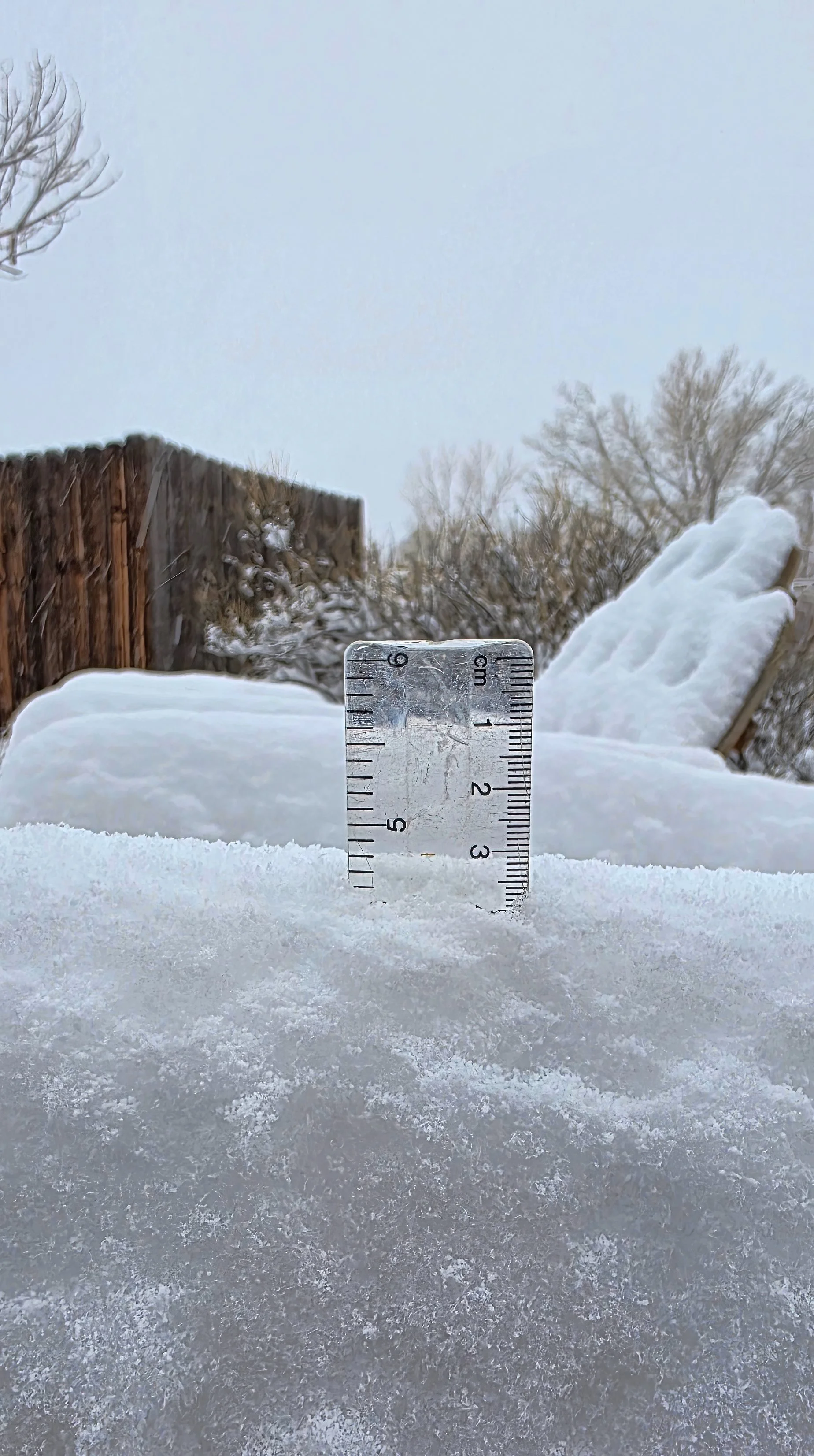
Winter finally arrives...
in Castle Valley with nearly five inches (~12 cm) of snow falling overnight. What a difference a day, and night, makes.
Given the shock and hardship this is presenting the local birds, the daily grain allotment has been doubled at the feeding stations.
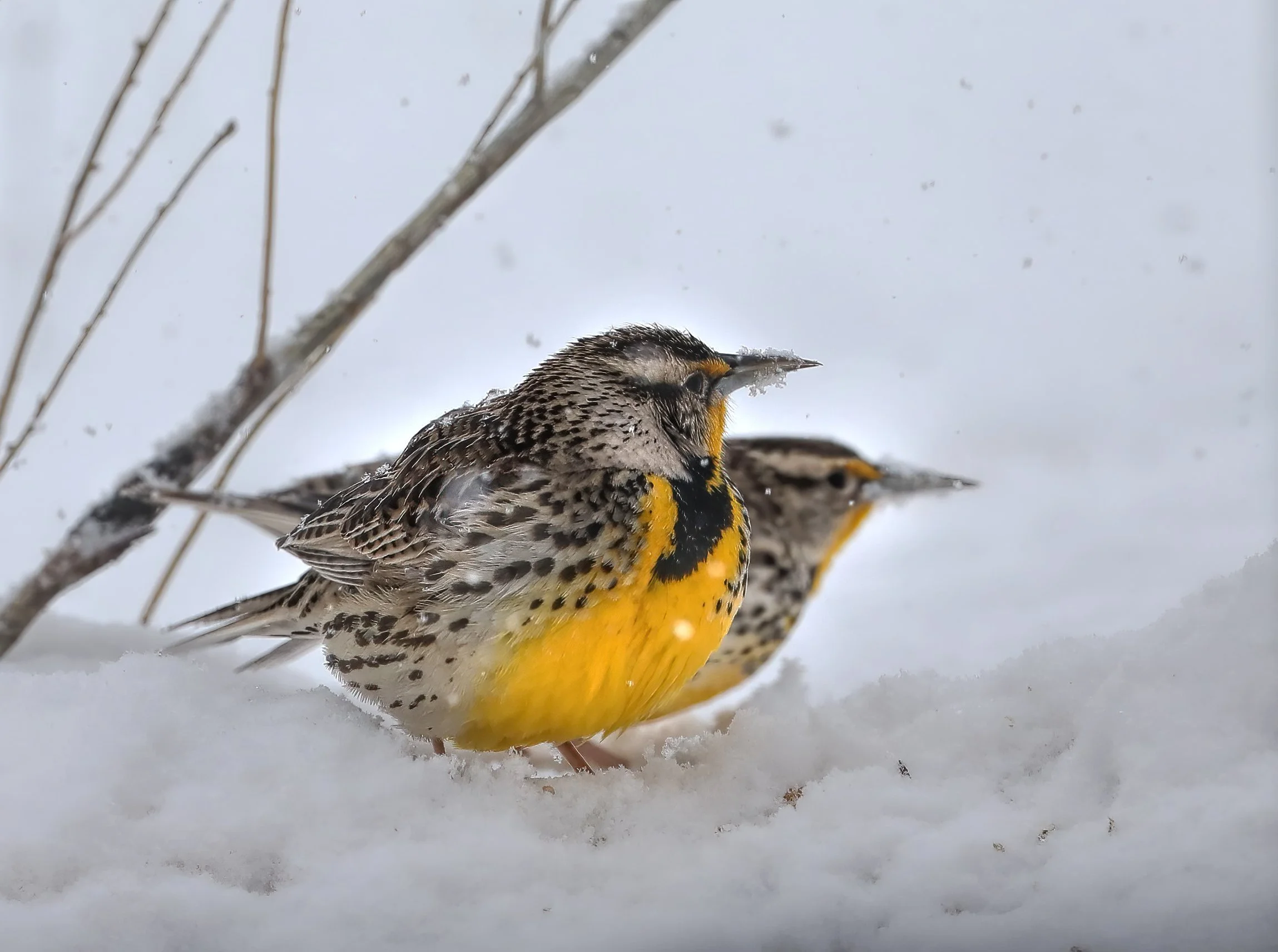
Western Meadowlark (Sturnella neglecta).
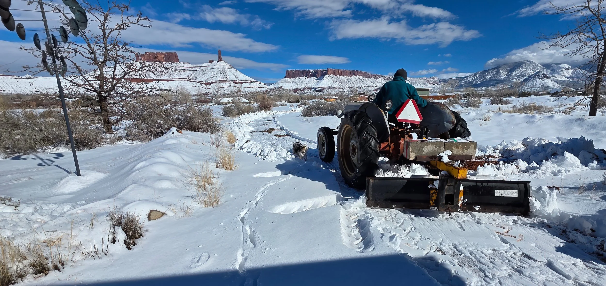
AFTERNOON UPDATE: The sun comes out after an additional several inches of snowfall. It’s very nice to have a helpful neighbor with the proper tools. I’m certain he’s having fun.
This dry and mild winter...
has allowed me to ride nearly every day, steadily racking up the miles, now at 77% of the distance around the Earth at the equator since September 2020. That’s 19,174 miles or 30,860 kilometers!
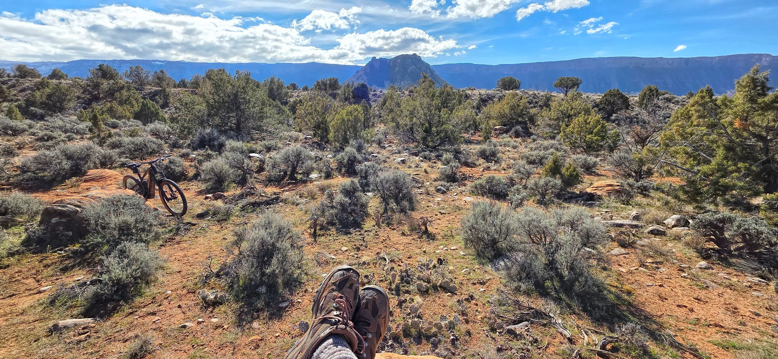
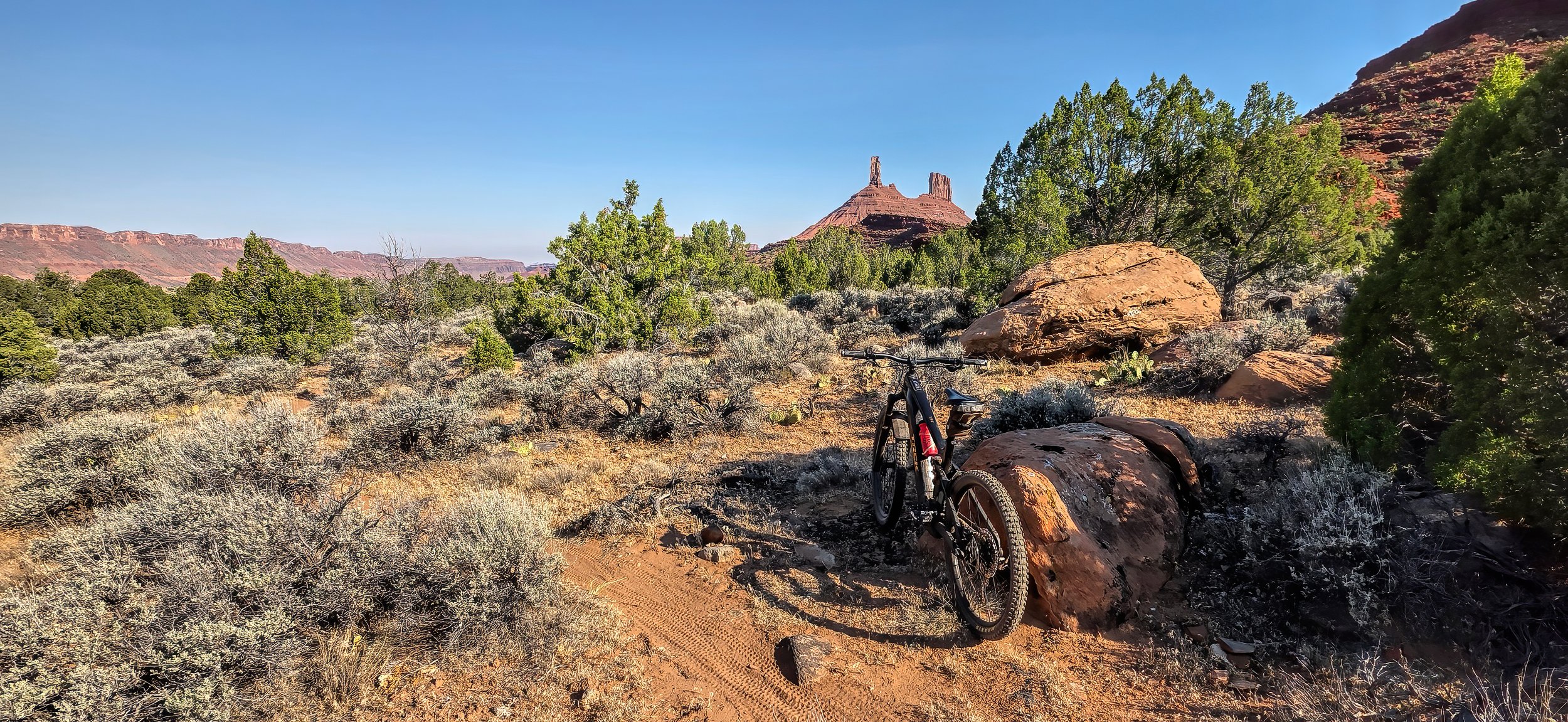
Taking a break at Middle Earth on the singletrack today.
Areas of considerable danger...
exist on slopes above treeline that face north and east according to the Utah Avalanche Center. Strong winds can be seen blowing across the high summits in the La Sal Mountains creating dangerous cornices and wind slab conditions in the snowpack.
The first valley floor snow...
this winter is occurring right now in Castle Valley, following nearly a half-inch (~13 mm) of rain earlier in the day.
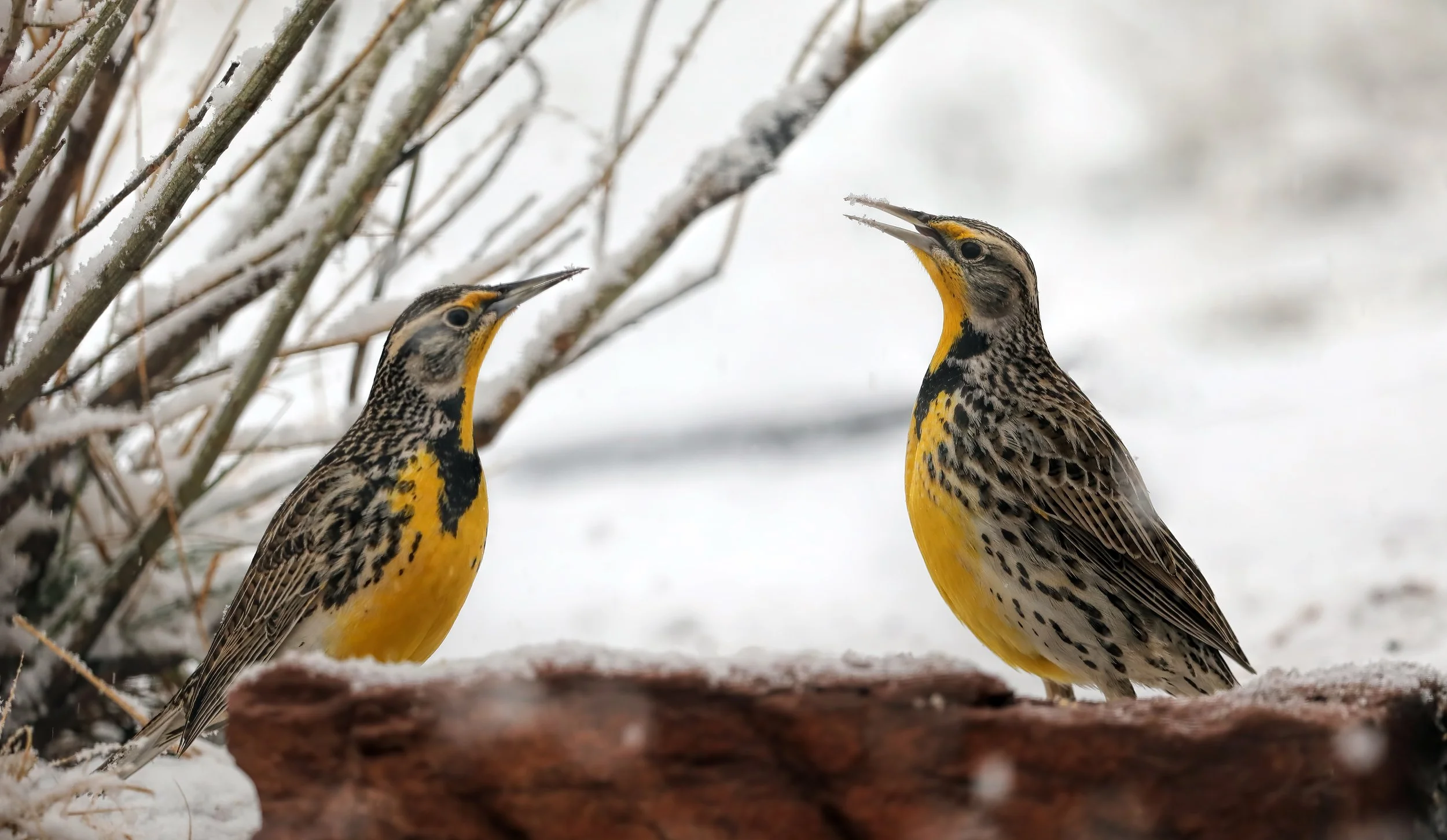
A pair of Western Meadowlarks (Sturnella neglecta) bickering in the snow.
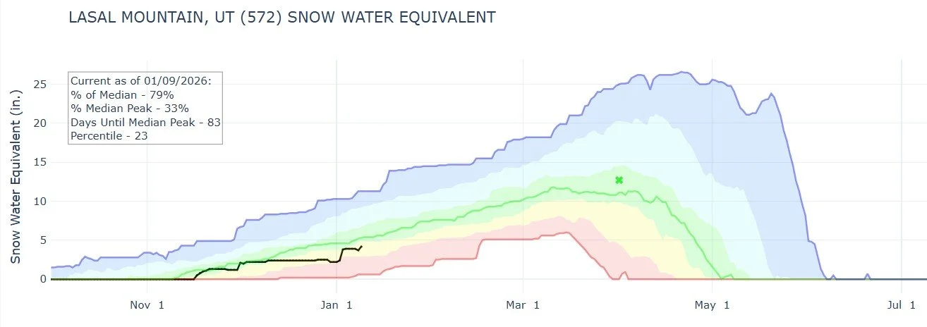
The day after: Snowpack in the La Sal Mountains has risen to 79% of the historical median with 83 days to go to the median peak.
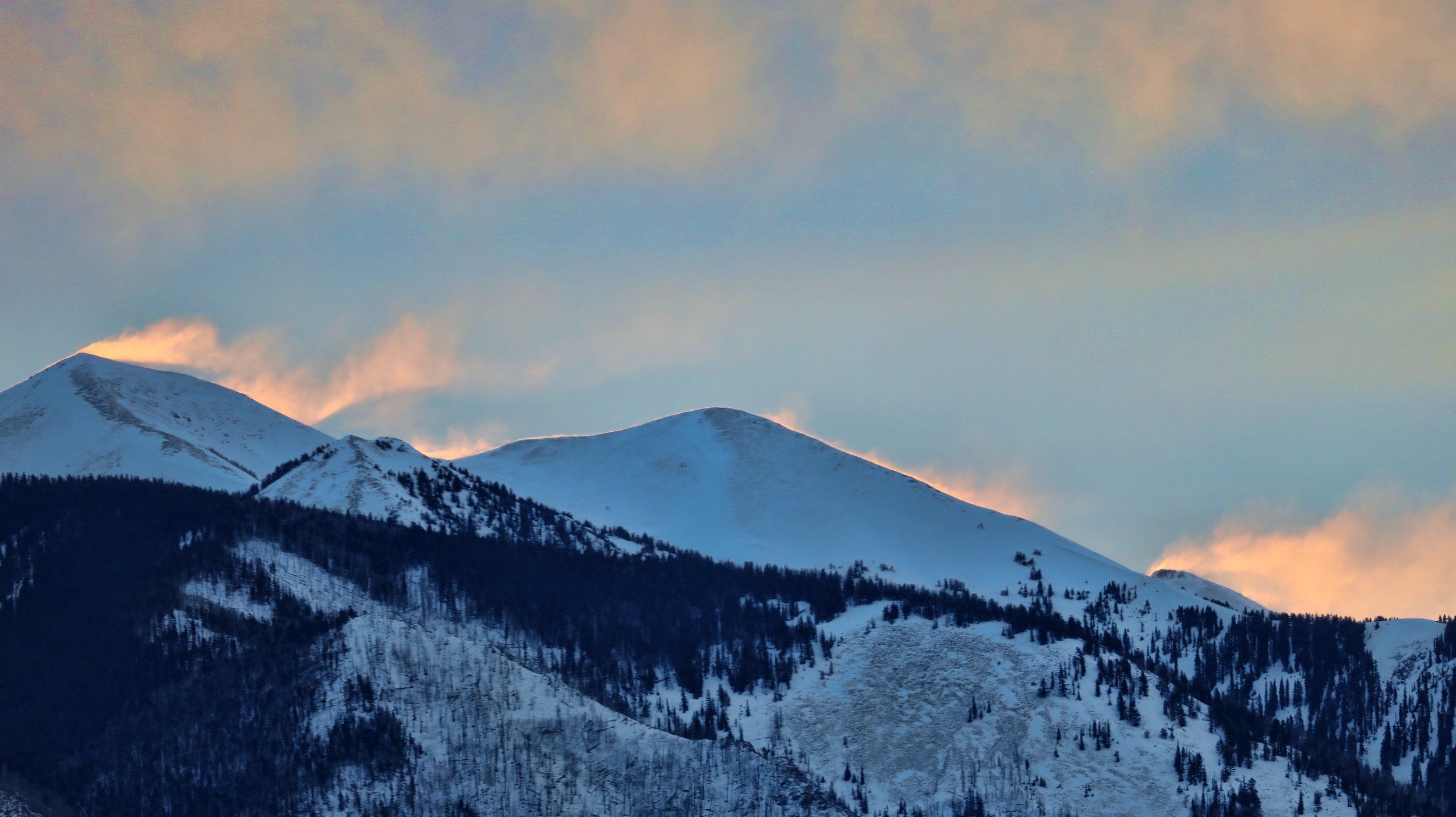
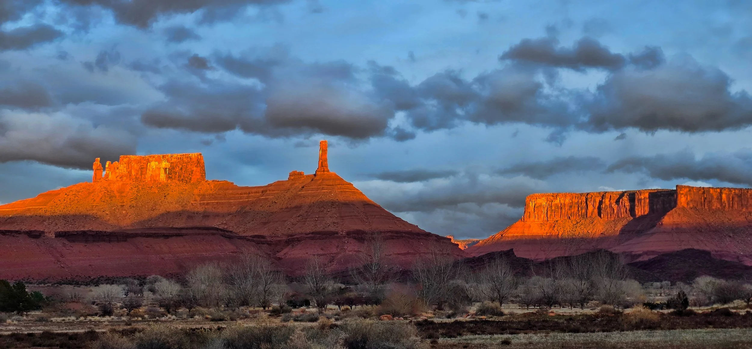
A winter storm is brewing...
that may bring snow and rain to the valley tomorrow. Here’s sunset this evening.
A dreary but welcome beginning...
to the new year sees the arrival of some moisture to the valley. About 0.1 inches (2.5 mm) of rain has fallen by midday.
Atmospherics against Porcupine Rim.
The year ends...
under very dry and mild conditions with an unimpressive snowpack in the high country. Look closely, the rising waxing gibbous Moon can be seen in the center of this image.
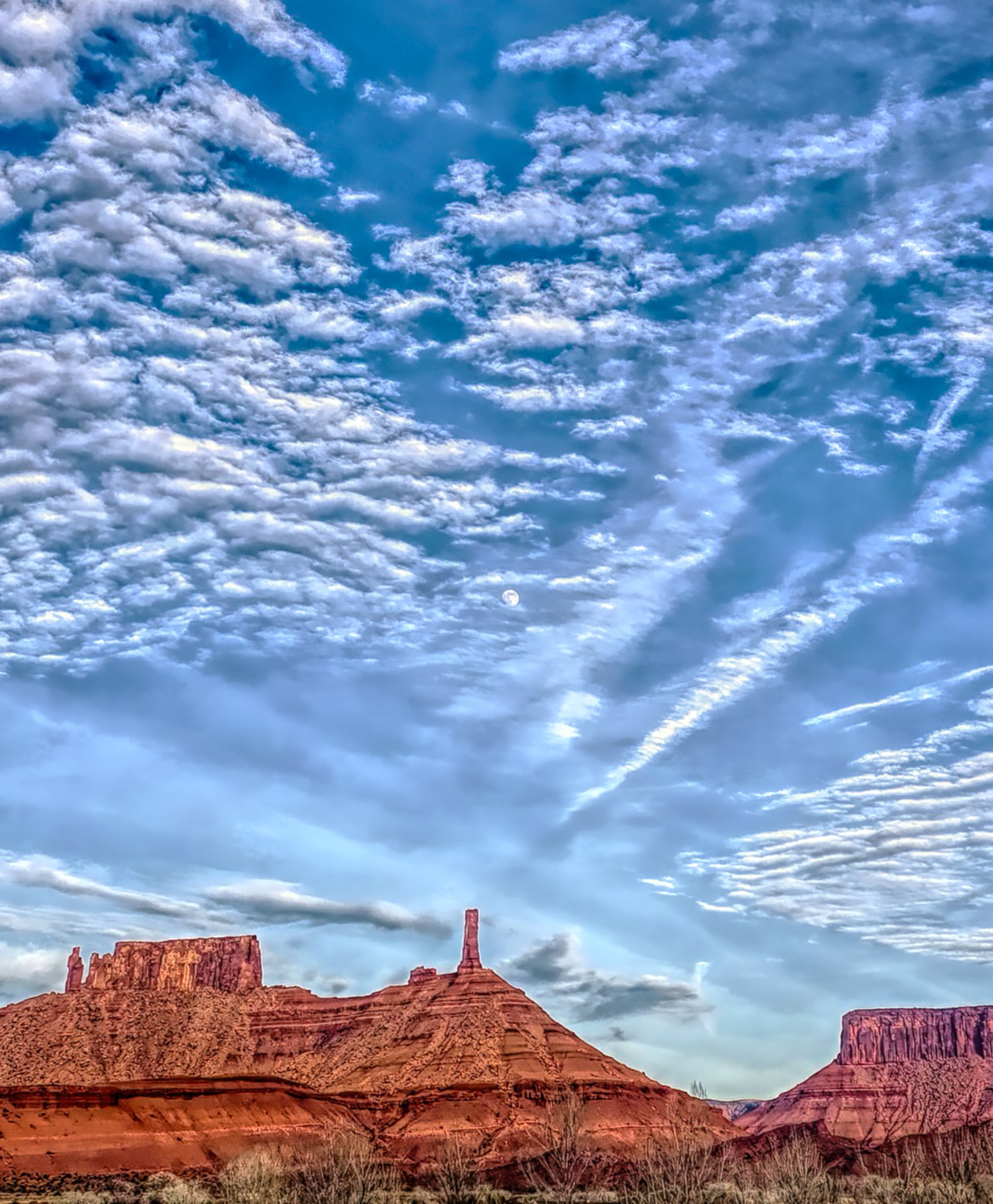
Snowpack in the La Sal Mountains is about half normal at the end of the calendar year 2025.
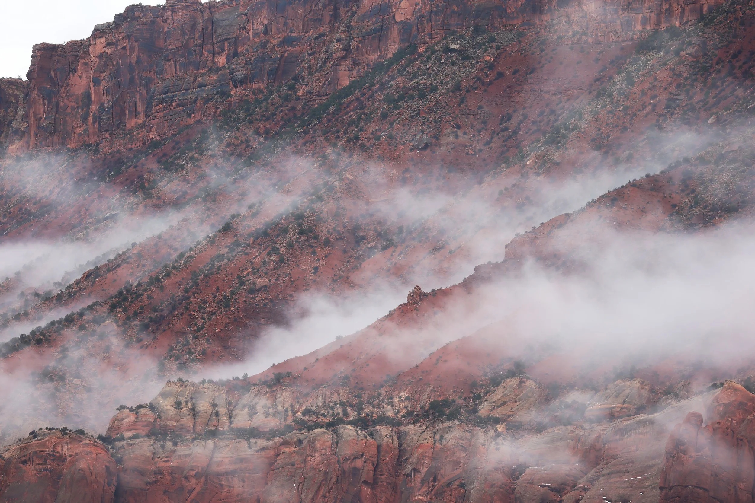
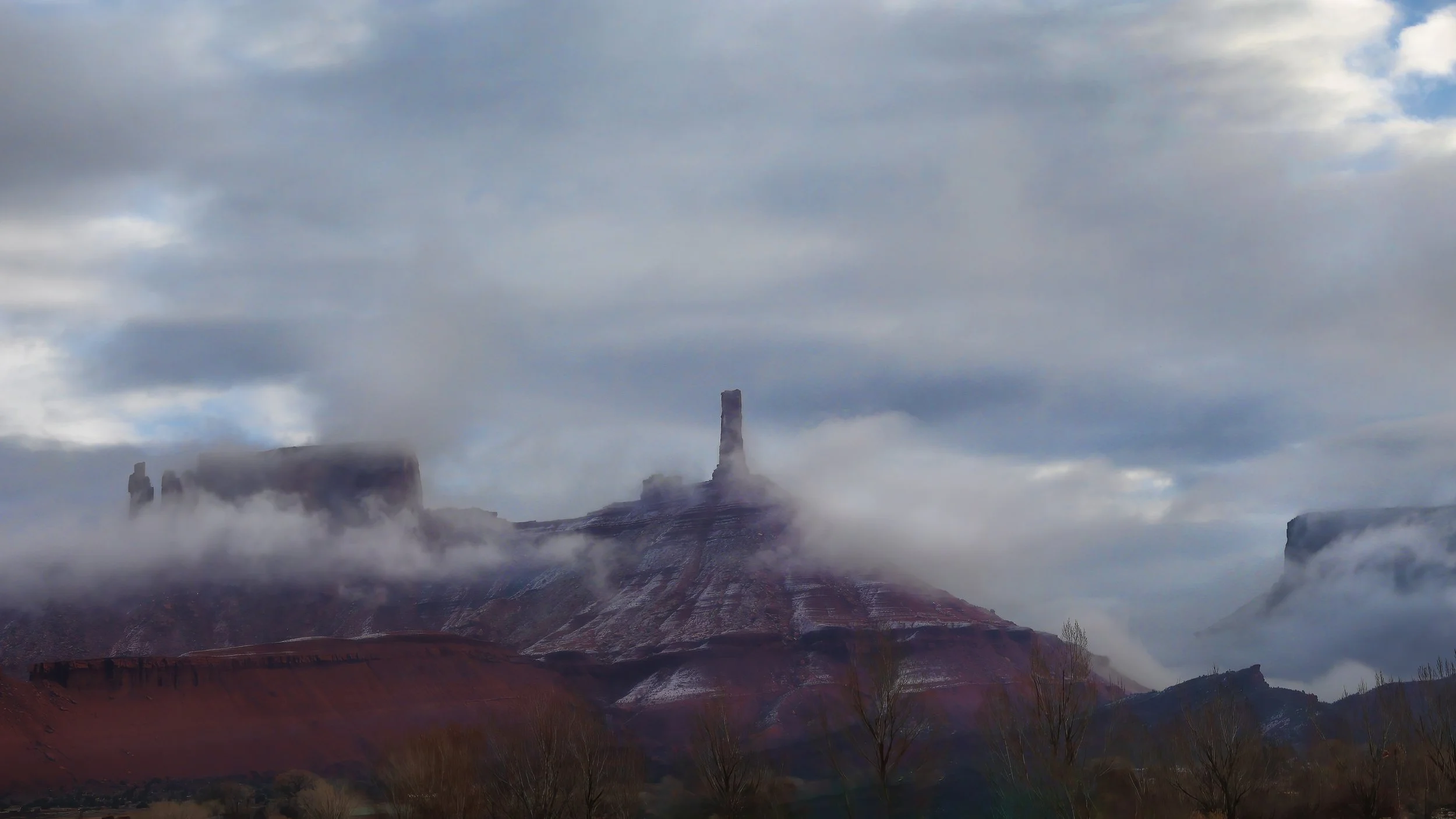
The Tower briefly emerges...
and then becomes obscured by low clouds as the latest early winter storm slowly passes, the first of which that dropped snow flurries on the valley this season. Meanwhile, the high country is off to a good start, sitting at 100% median snow water equivalent for this point in the water year.

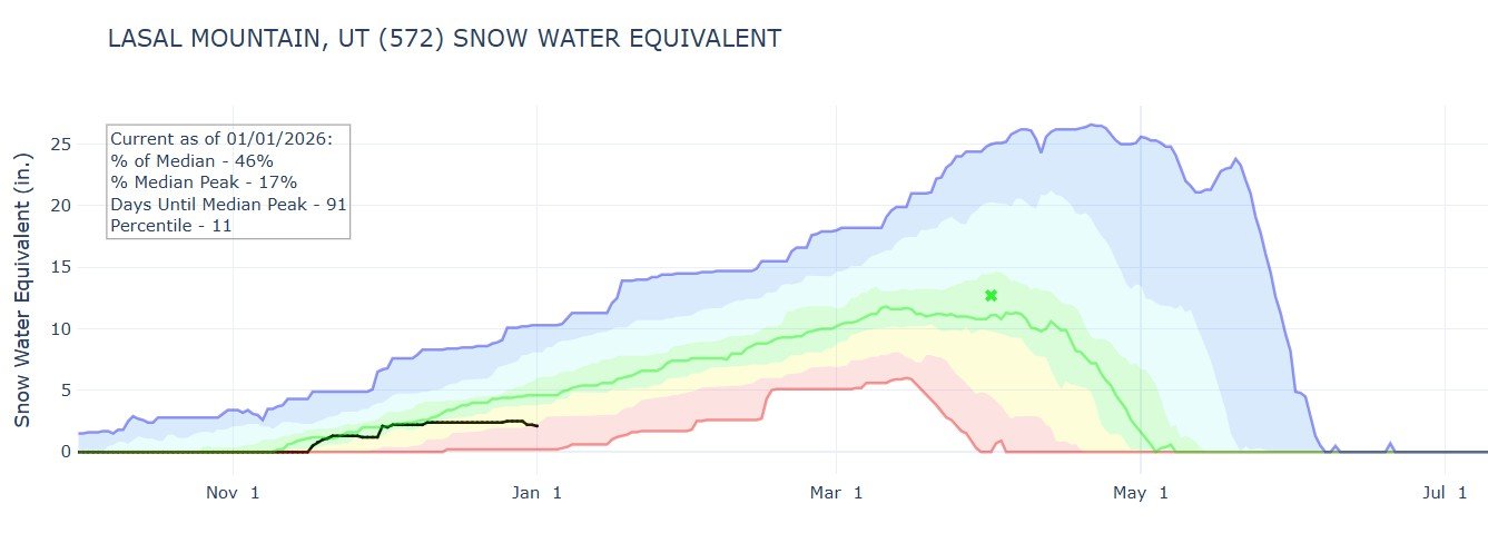
Time series plot of snow water equivalent for the Lasal Mountain SNOTEL site.