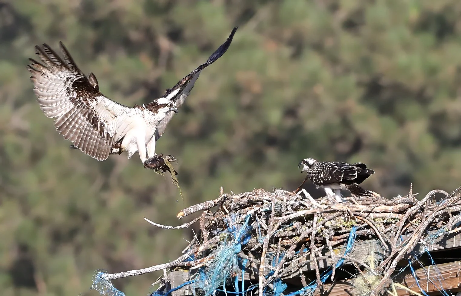
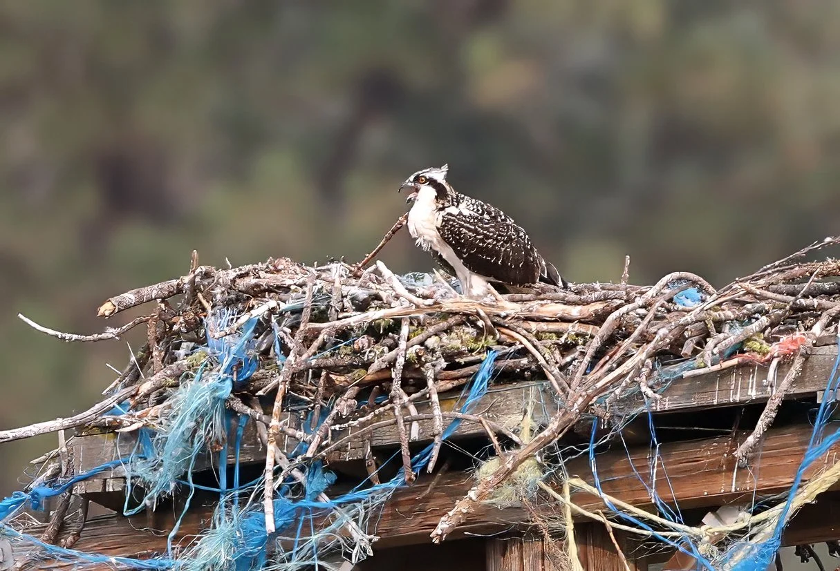
to Junior in the nest this evening. Looks like it’s carp sashimi on the menu. They’re not called fish hawks for nothing!
American Osprey (Pandion haliaetus).
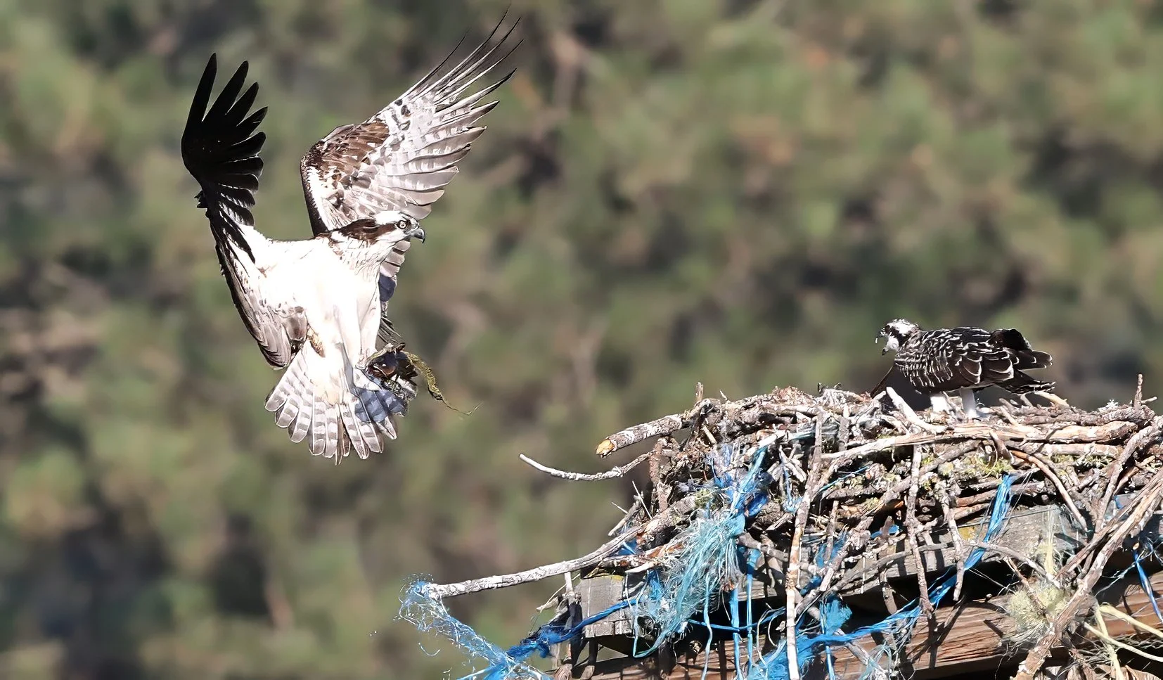
to Junior in the nest this evening. Looks like it’s carp sashimi on the menu. They’re not called fish hawks for nothing!
American Osprey (Pandion haliaetus).


it is imperative that one continues training and honing their skills through time, so today I once again took the magnificent Zamboni out on the ice at the University Recreation Center. It was a terrific review on the operation of the boxy behemoth conducted by geology undergraduate student Silas. Informative and fun!

Silas backs the Zamboni out of the garage and onto the ice.

Yours truly behind the wheel, zooming along at 5 mph (8 kph)! Although I wanted to feel the wind in my hair, I wore the ball cap to keep my hair out of my eyes at this blistering speed.
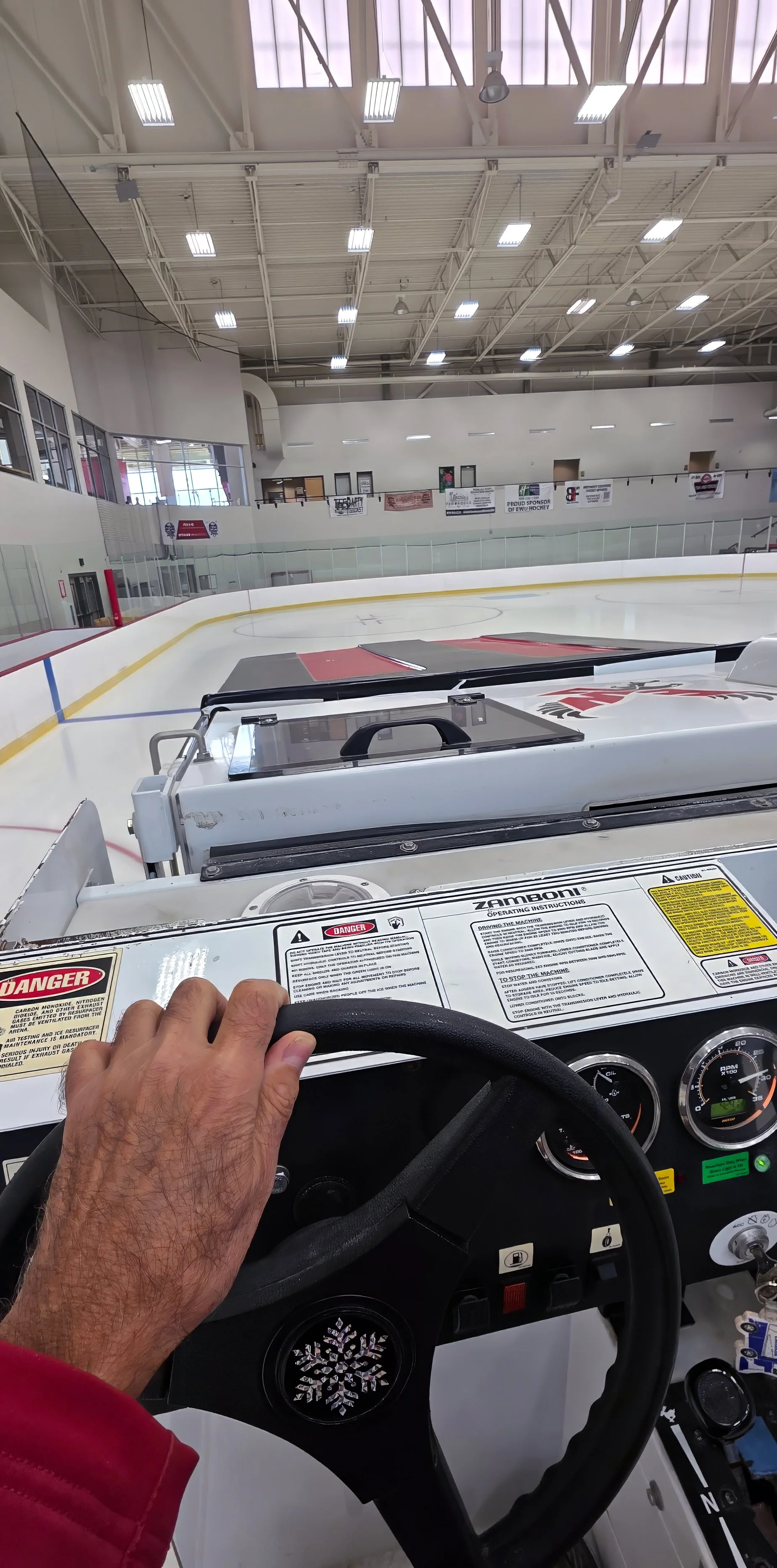
Driver’s point-of-view over the long hood. It does take some real skill to command this three ton beast but it pirouettes on a dime.
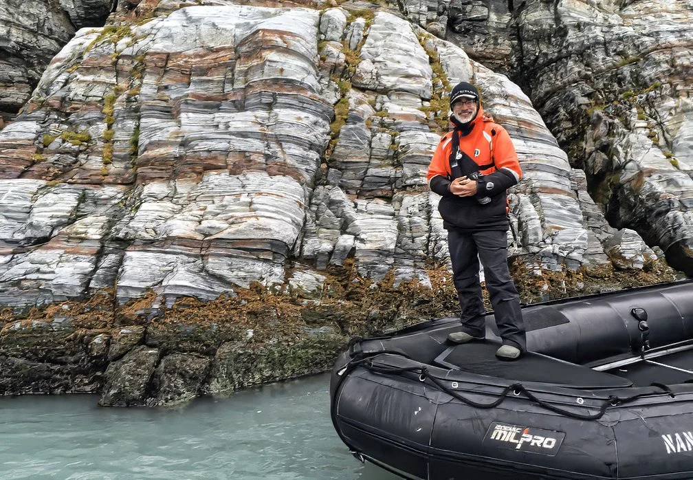
But, honestly, Zodiac MilPro MK4s are way more fun to drive! Happy geologist and Zodiac captain examining turbidites at Gold Harbour, South Georgia, in 2018.
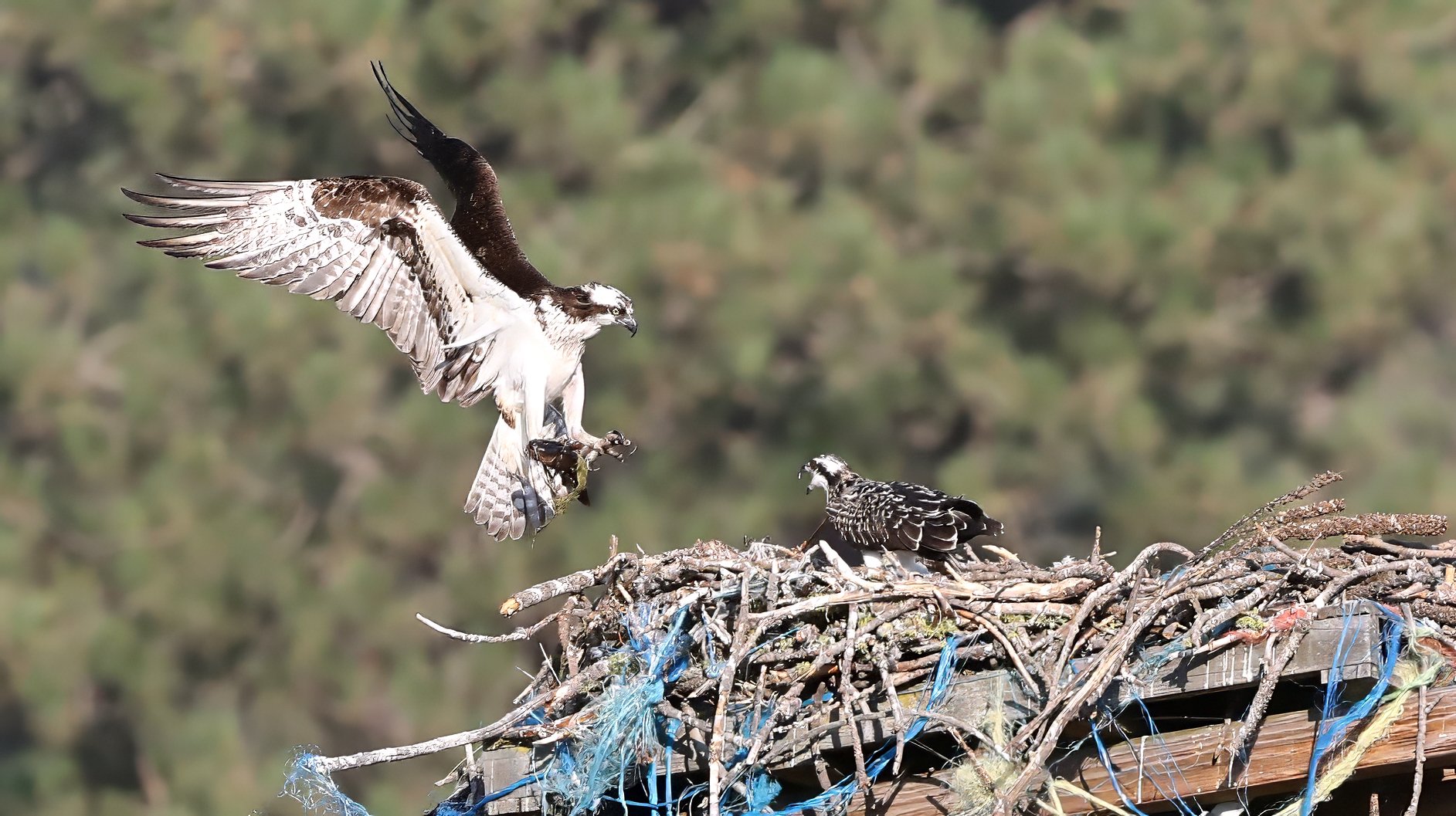
did not summon Mama with a delivery of fresh fish during Operation Osprey Watch this evening. Junior is just beginning to wiggle its wings and it will be a while before it’s flight capable.
American Osprey chick (Pandion haliaetus).
is a very different riding experience than in red rock country. It’s a nice change of pace and environment, but I miss the vertical challenges of canyon country and there’s no downhill flow.

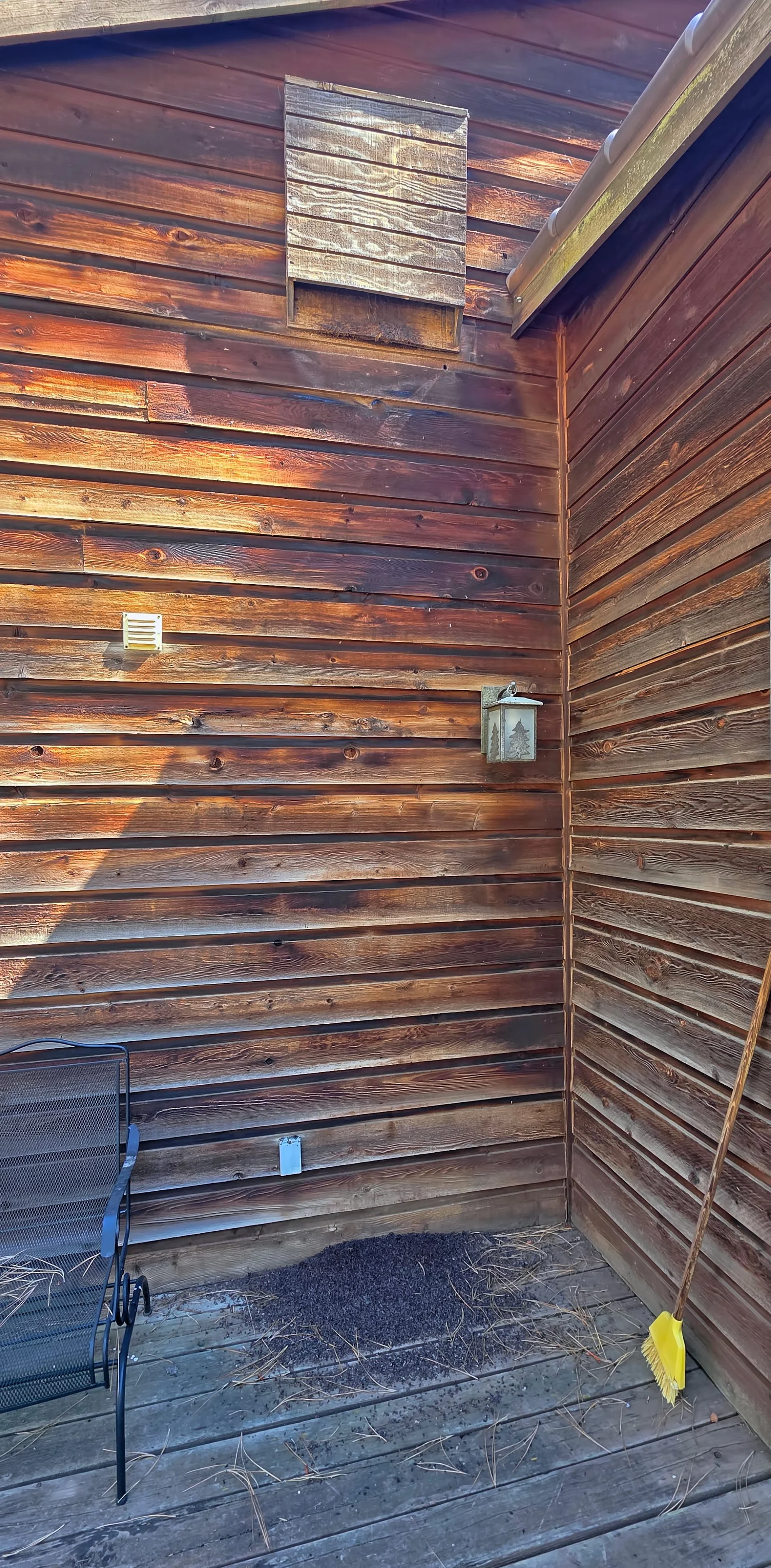
and clinging to the cedar siding is a solitary bat, hanging head down next to my secret house key. It clearly prefers solitude as opposed to occupying the nearby bat house with more than 200 residents.

Little brown bat (Myotis lucifugus).
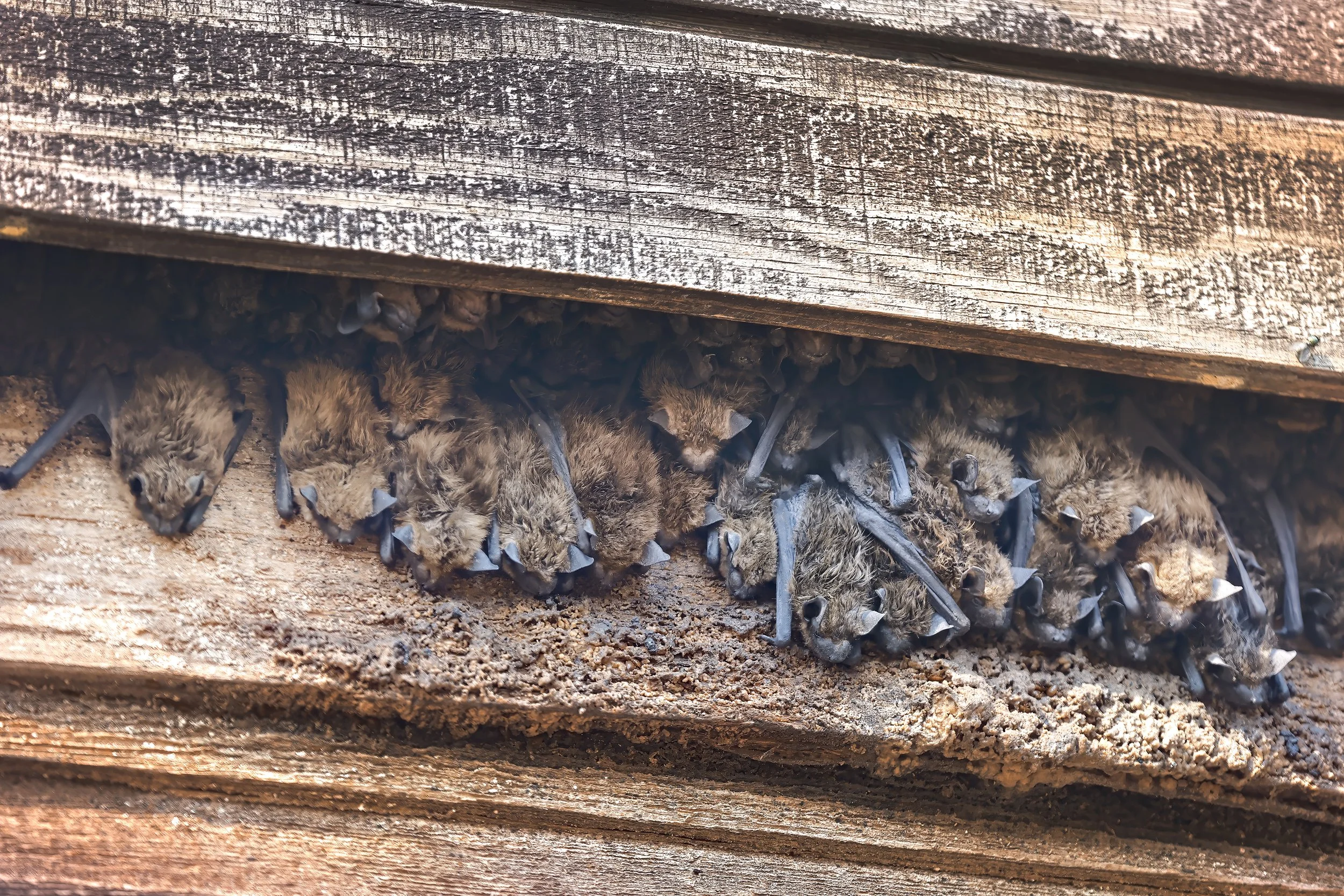
Here’s the bottom of the two-chambered bat house this afternoon with 40+ individuals peeking out in this image. It’s crowded in there!
Bats need friends! If you’d like to build and successfully locate a bat house the classic guide was published in 1994 (now out-of-print) and co-authored by my late wife: Bat House Builder’s Handbook.
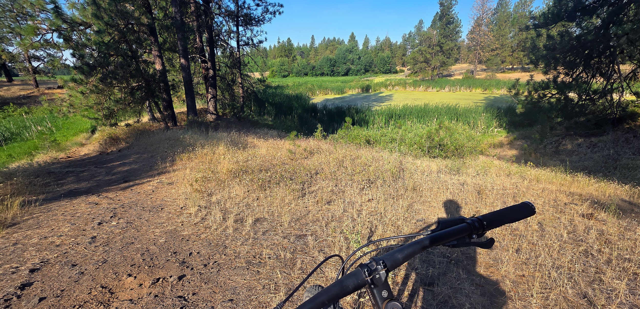
shortened my morning ride by about a mile.
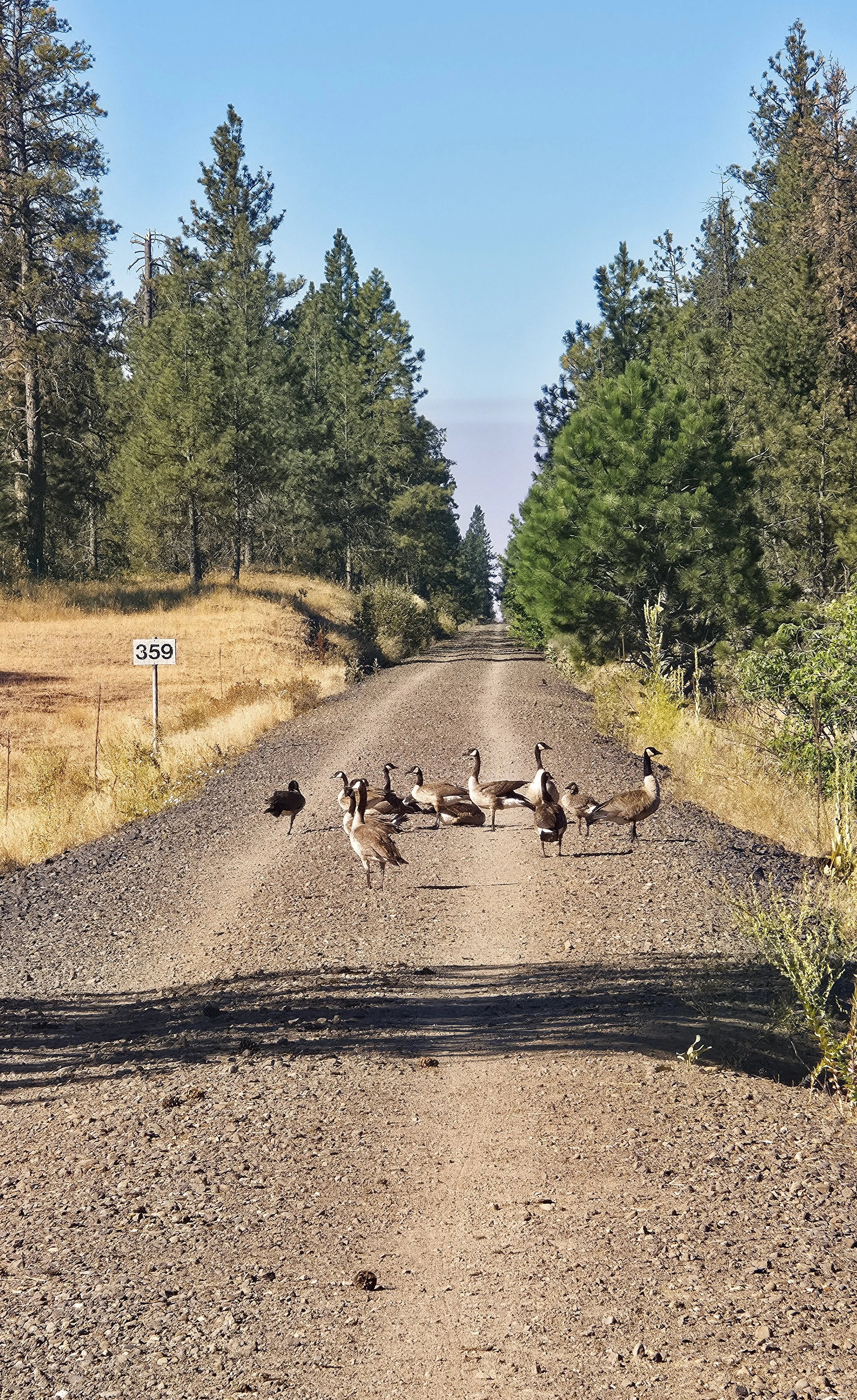
Canada Goose (Branta canadensis).
relaxing on a log in the wetlands early this morning.
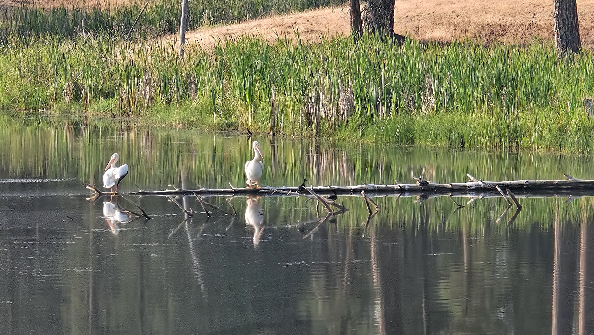
American White Pelican (Pelecanus erythrorhynchos).
with remotely operated and solar powered Flock cameras, engaging in unconstitutionally broad and warrantless surveillance of all citizens. Eight such spy cameras have been installed in my rural community in eastern Washington in a clear violation of civil liberties, and seemingly in violation of state law as well. Shame on the mayor, members of the city council and police chief. George Orwell's 1949 novel 1984 was meant to be a cautionary tale and not an instruction manual for government!
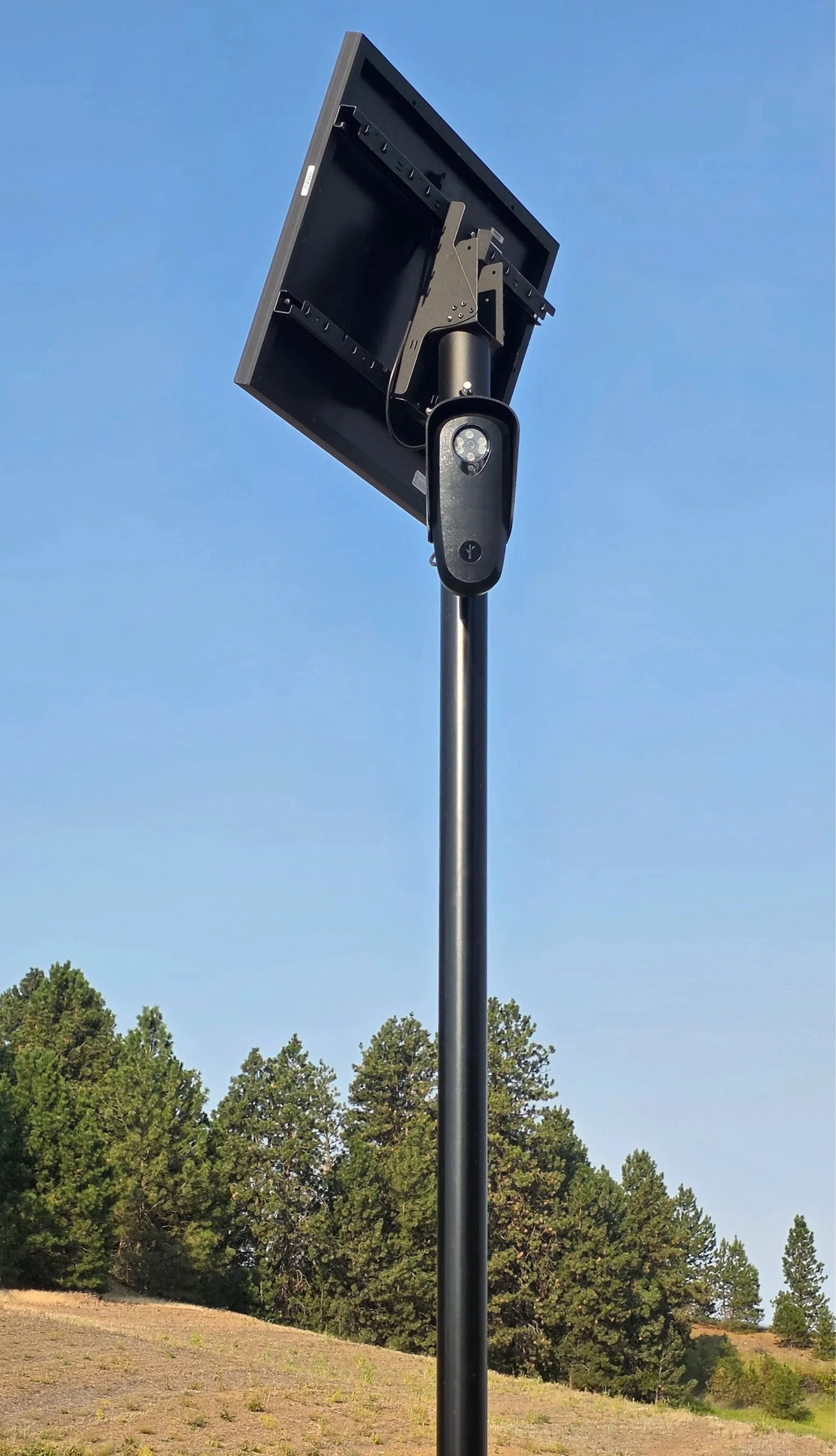
Flock spy camera violating the 4th Amendment.
Helpful link: See if you are being spied upon where you live.
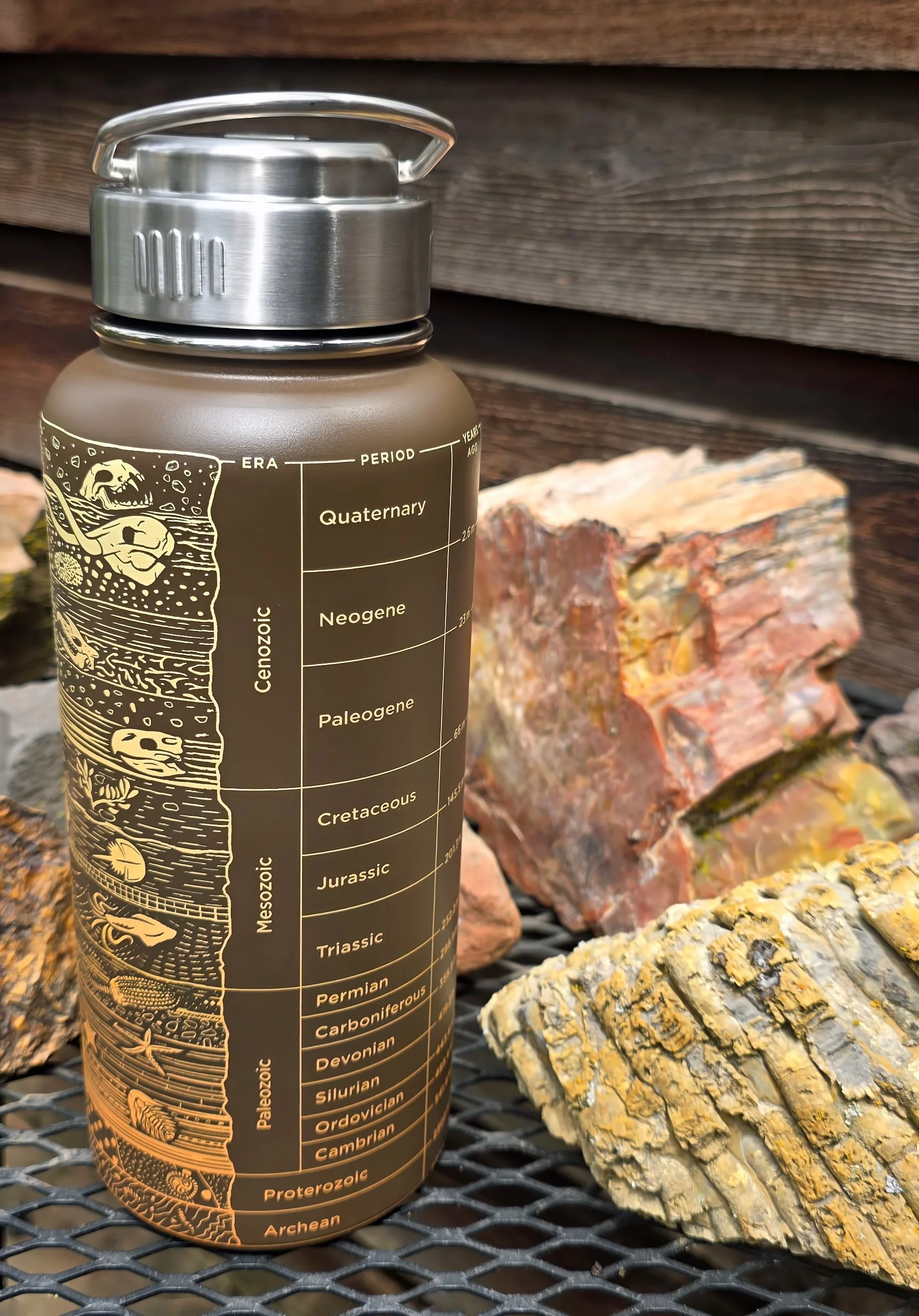
across all disciplines are available at Cognitive Surplus. Here’s a stainless steel thermos bottle with the geologic time scale nicely printed on the exterior that arrived today for this geo-nerd. (No commission earned.)
because the sticky leaves can easily attach to fabric, this showy plant is found in sandy and disturbed soils. Appropriately named, the fully open blossom seen below is nearly the size of your hand.

Giant blazingstar (Mentzelia laevicaulis).
on the Pend Oreille River at the US-Canadian border, a concrete arch-gravity dam constructed in 1967 for hydroelectric generation, was nothing short of excellent. A big thank you goes to the engineers from Seattle City Light that owns and operates the structure for a terrific exploration of the facility.
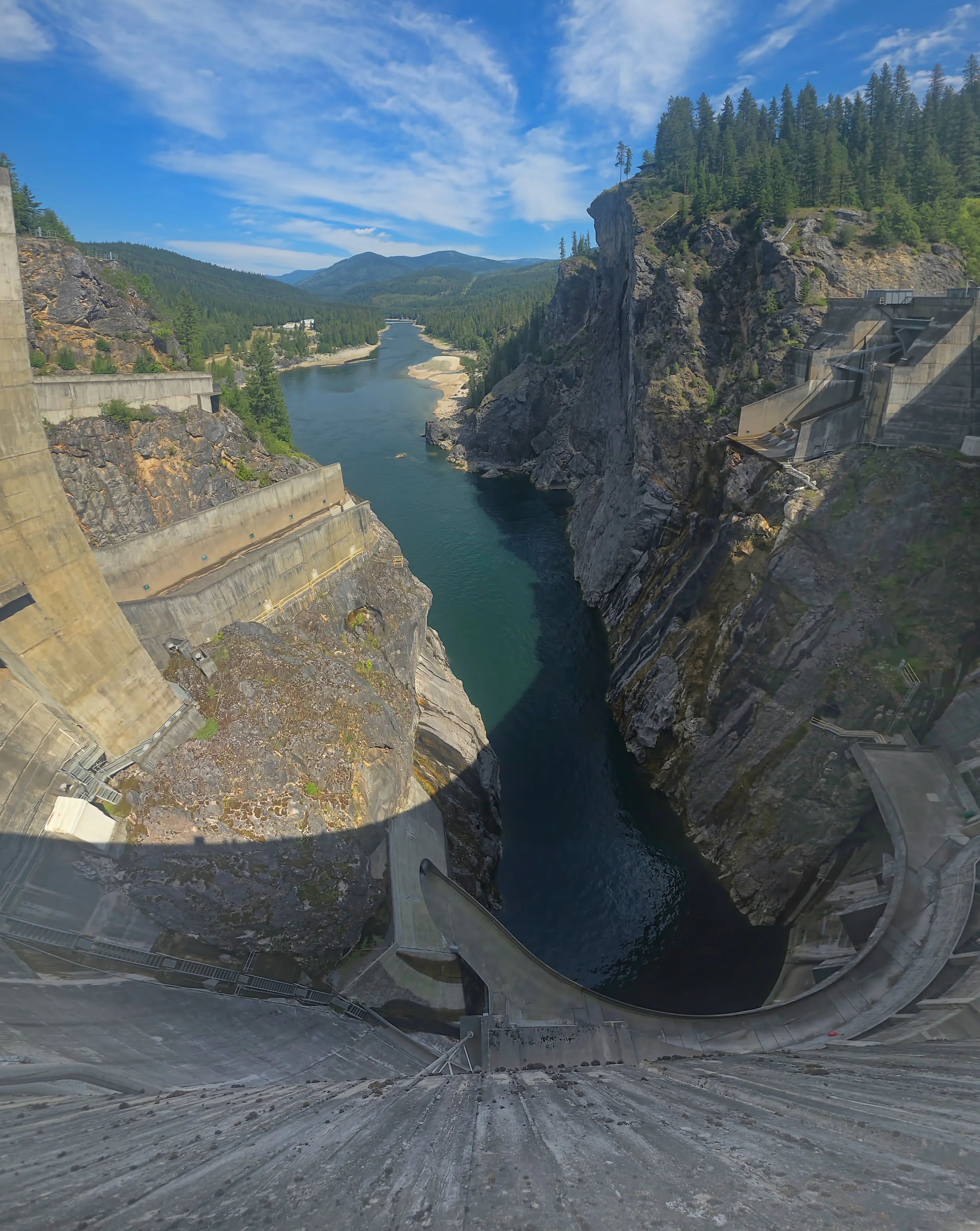
View due north, down river and into Canada from the top of the arch dam, 338 feet (103 m) above the water surface.
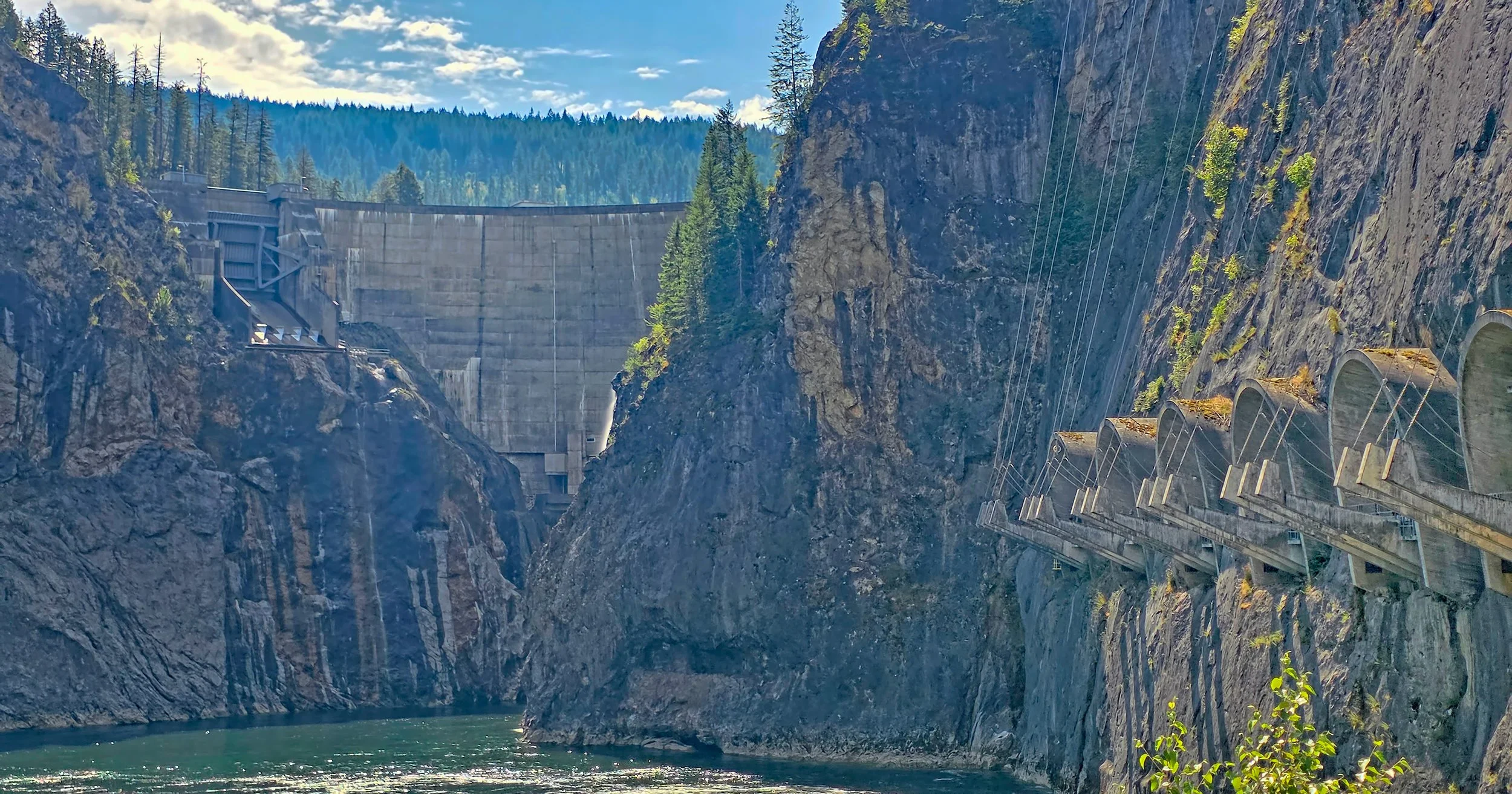
View of Boundary Dam from river level, with the six transformer stations on the right where high voltage power lines exit the underground powerhouse.
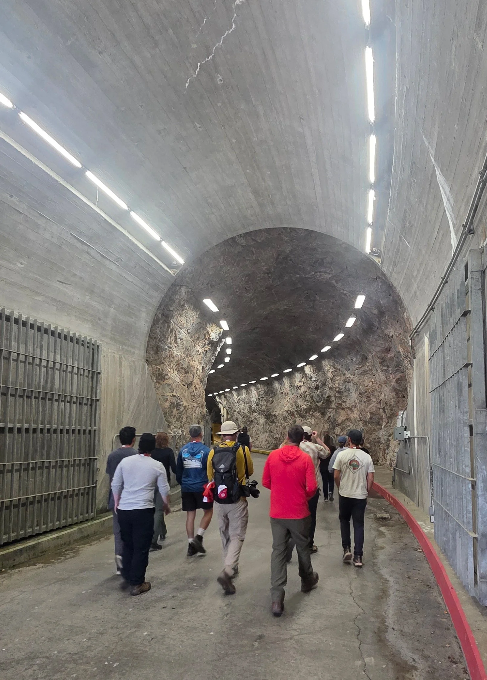
Service tunnel entrance to the subterranean powerhouse, including the generator hall, transformer stations, the control room for operation of the structure and administrative offices.
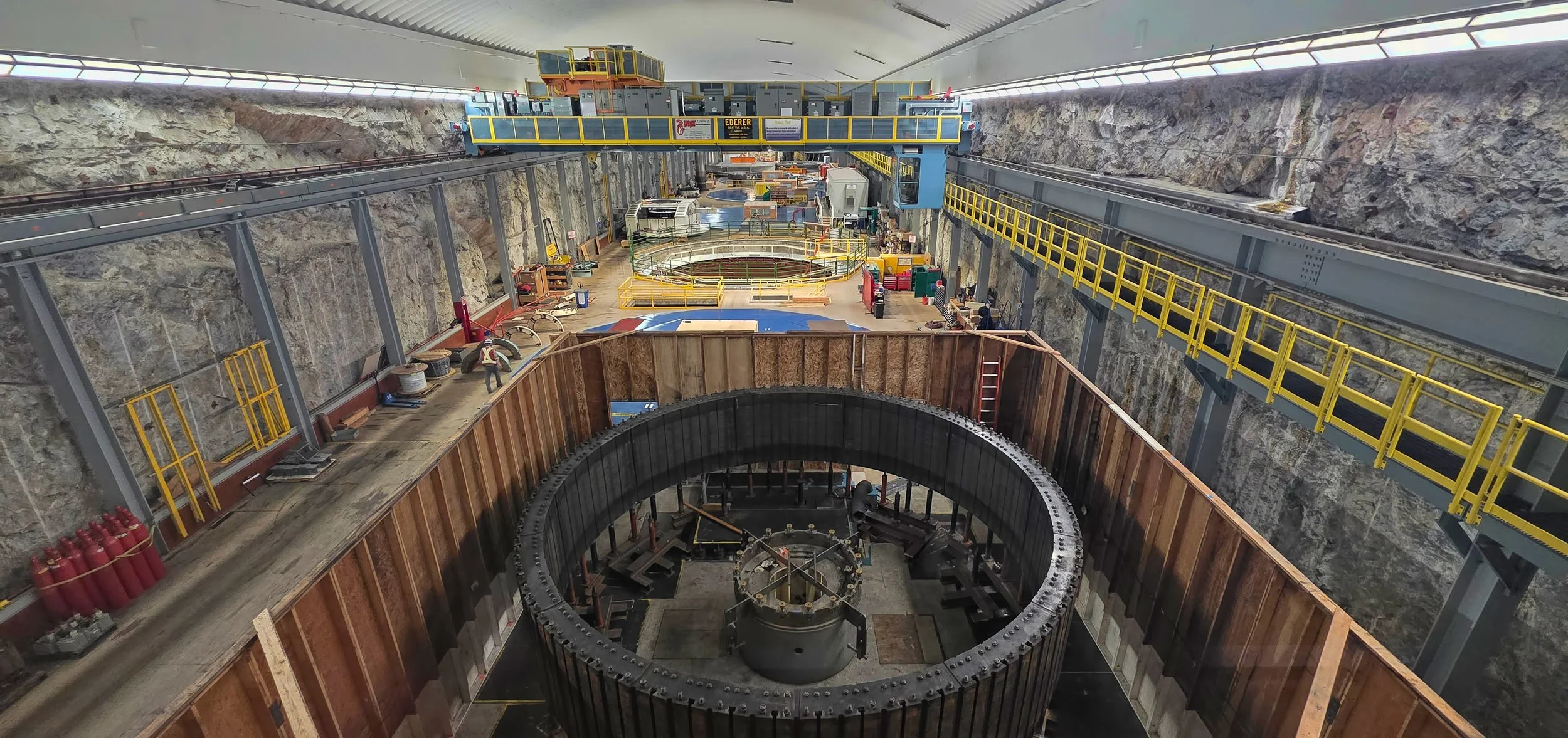
Generator Hall, an enormous chamber excavated out of limestone bedrock, showing six turbines with one undergoing refurbishment.
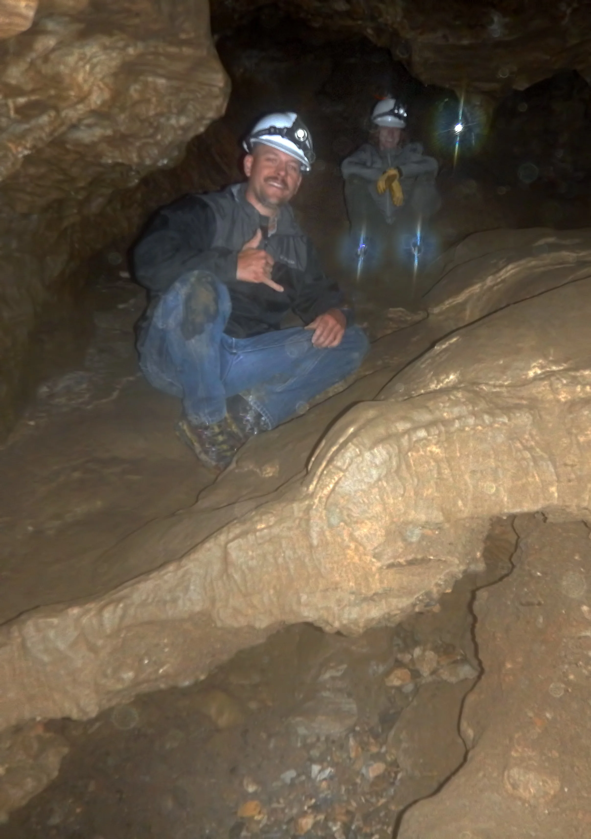
in Crawford State Park, Washington where university students learn cave science and mapping techniques. A former colleague invited me back into service given my long experience and expertise in the subterranean environment, and which turned out to be a thoroughly enjoyable two day-long project with a dozen undergraduate students.
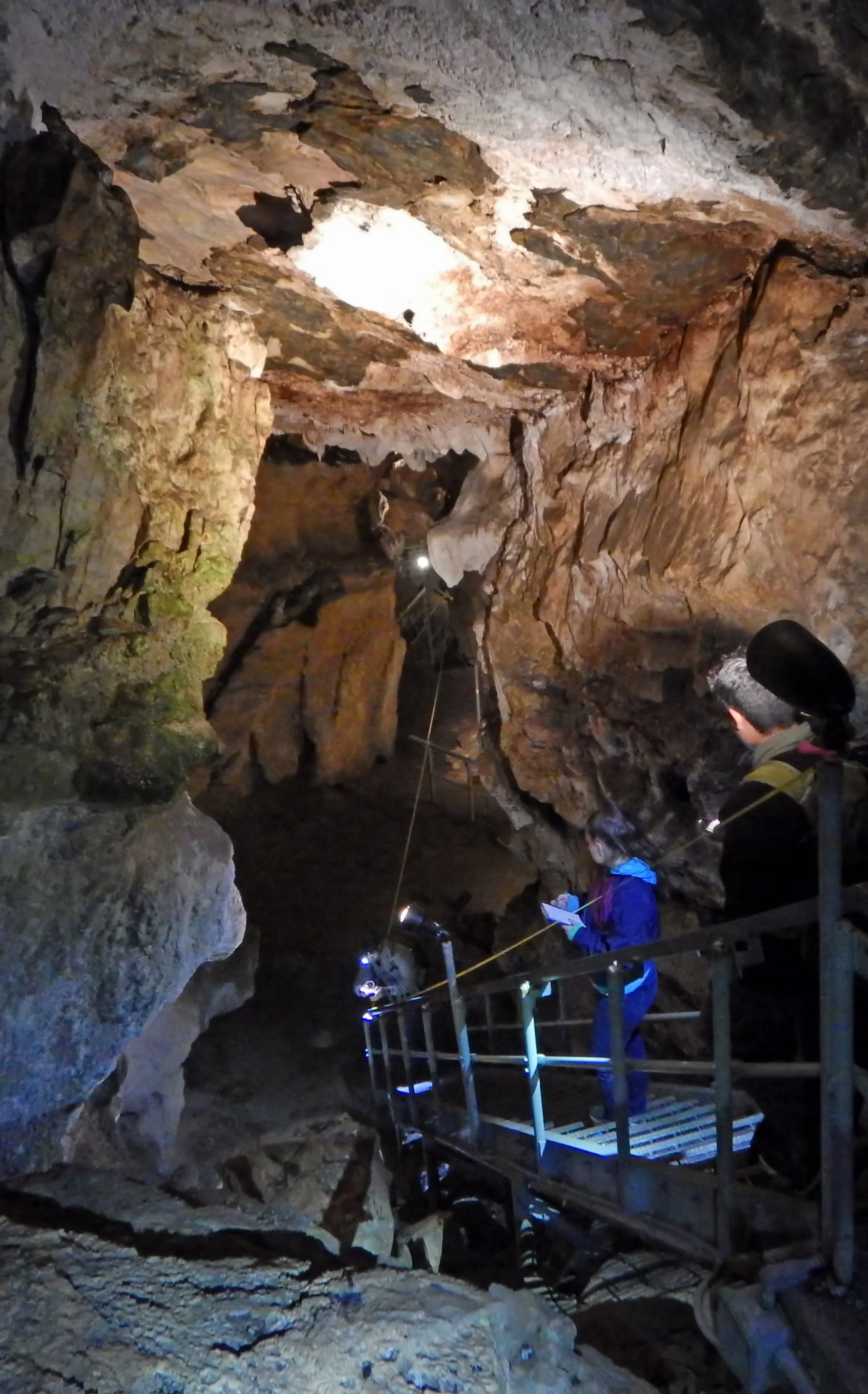
Students learning to survey the illuminated upper part of the cave through which guided commercial tours are offered using tape and compass techniques.
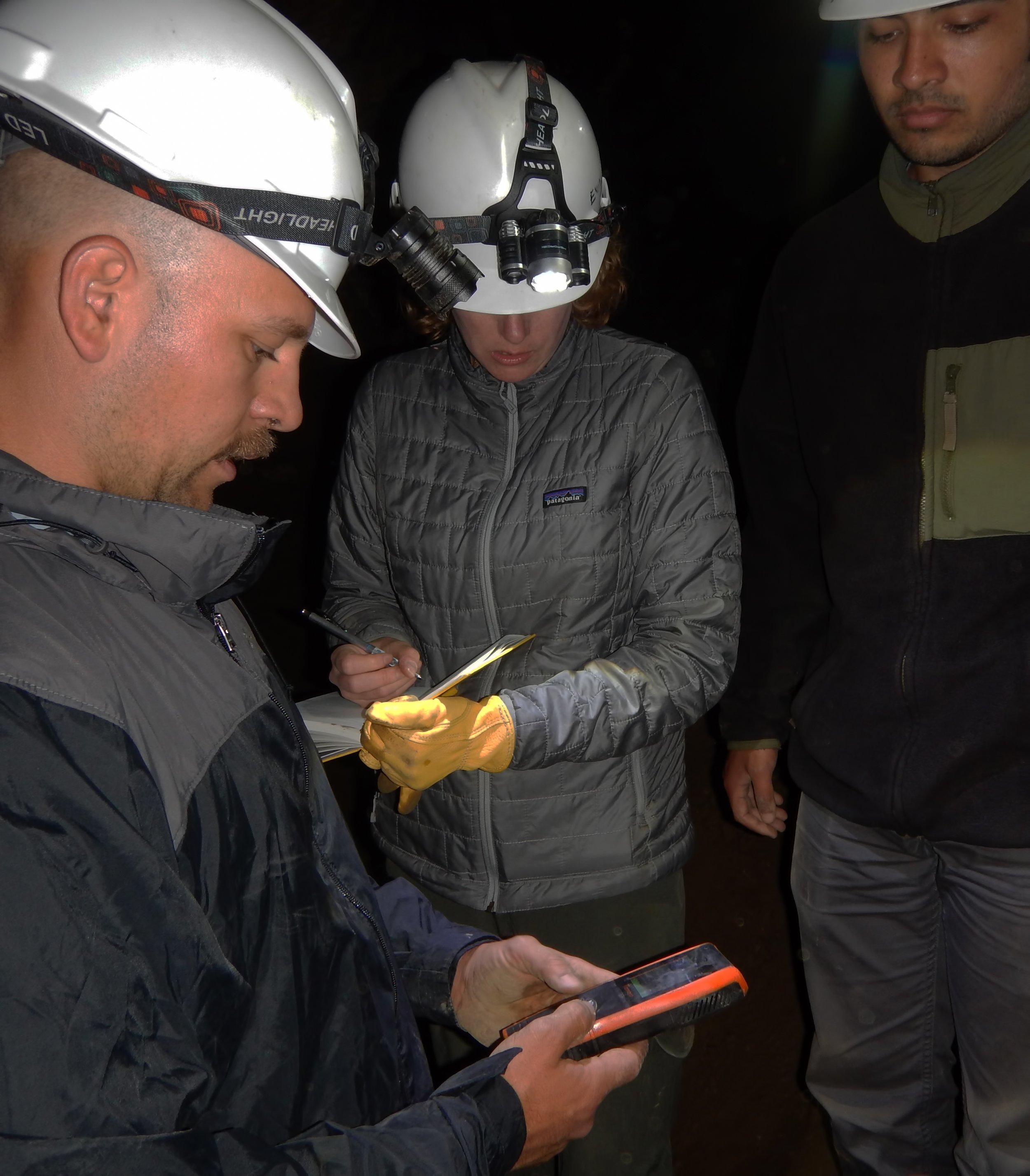
Students recording carbon dioxide concentration in the cavern atmosphere.
Jazzed students exploring the wild, deeper part of the cave in a steeply descending passage. Note the flowstone false floor spanning sediments of glacial origin that were washed into the cave during the Pleistocene, and now are presently eroding by water flowing into the cavern from the surface.

Closeup view of delicate crystalline rimstone on the floor of the cave. Field of view is about three feet (one meter) wide.
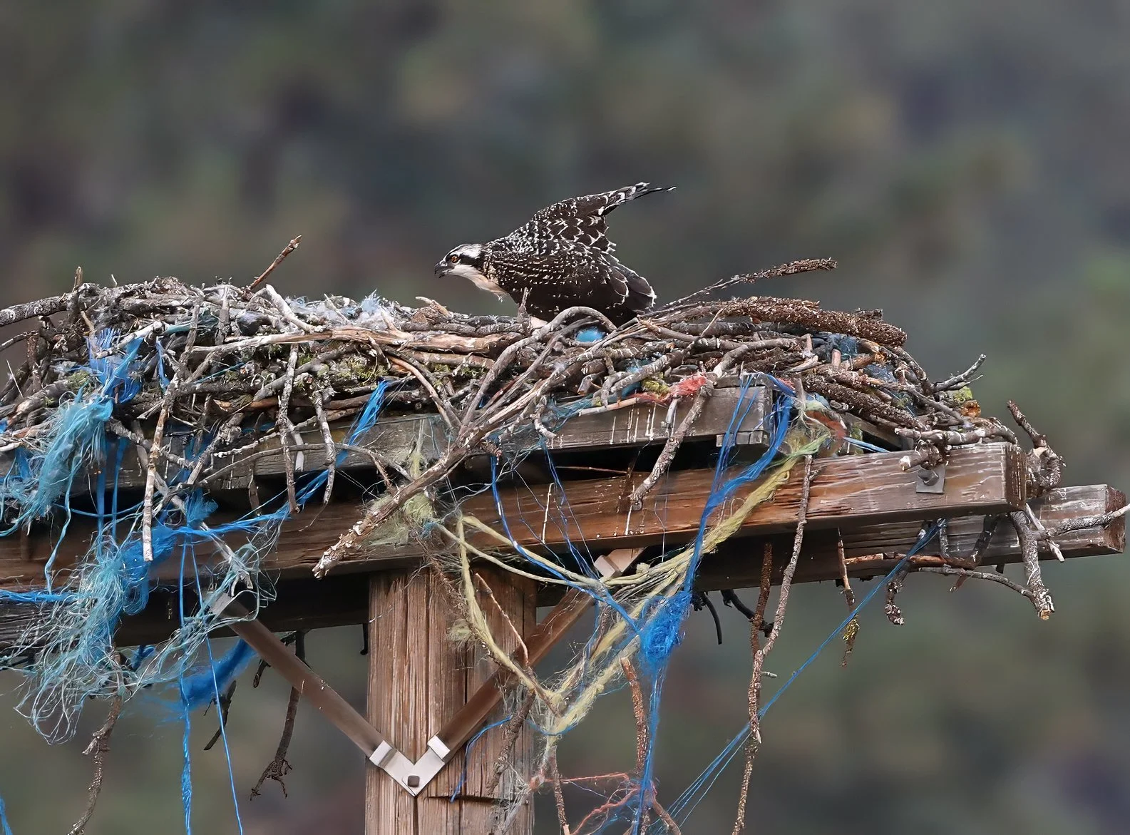
this summer as the platform nest is once again occupied, much to my delight. Mama’s housekeeping hasn’t seemed to improve in the interim. There may be a second, smaller fledge in the nest, too.
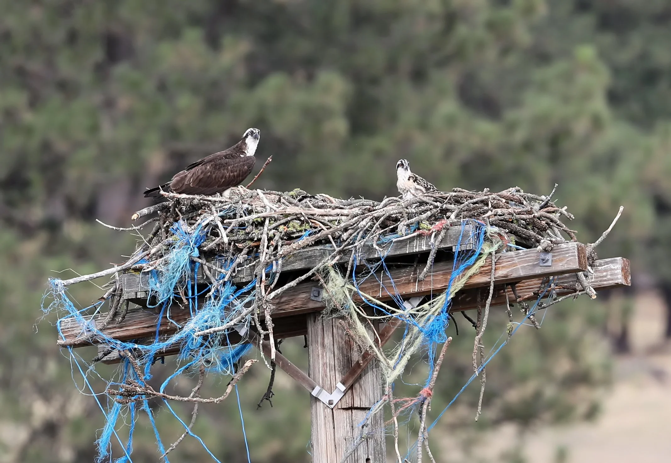
American Osprey (Pandion haliaetus).
accumulates on the back deck below a double-chambered bat house. Some lucky gardener friend of mine is going to receive more than five pounds (2.3 kg) of premium organic free range bat guano in the near future.
Bats need friends! Provide free housing and they will eat insects and produce nitrogen-rich guano.
in a sub-alpine meadow near Butte, Montana where I spent the night on Homestake Pass. The air and sky were clear, the stars were brilliant, and it got wonderfully chilly.

Prairie dogs (genus Cynomys).
from pluvial Lake Bonneville occurred through this gap in southeastern Idaho known as Red Rock Pass. The volume of the great gush is estimated at five thousand cubic kilometers (1,200 cubic miles!) of water, released about 14,000 years ago in a catastrophic megaflood that likely lasted weeks to months and scoured the Snake River Plain in Idaho downstream from this site.
Red Rock Pass, a few miles south of Downey, Idaho on US 91. View is to the south, or upstream during the big spill. The vast expanse of Lake Bonneville would have existed on the far side of the skyline ridge, reaching across a third of Utah. Once the rising lake water began spilling across this low point along its shoreline and into the adjacent valley, a great unraveling was unleashed. The unconsolidated surficial alluvium and the underlying sedimentary rocks forming the bedrock sill rapidly eroded, much as a dam collapses when overtopped.
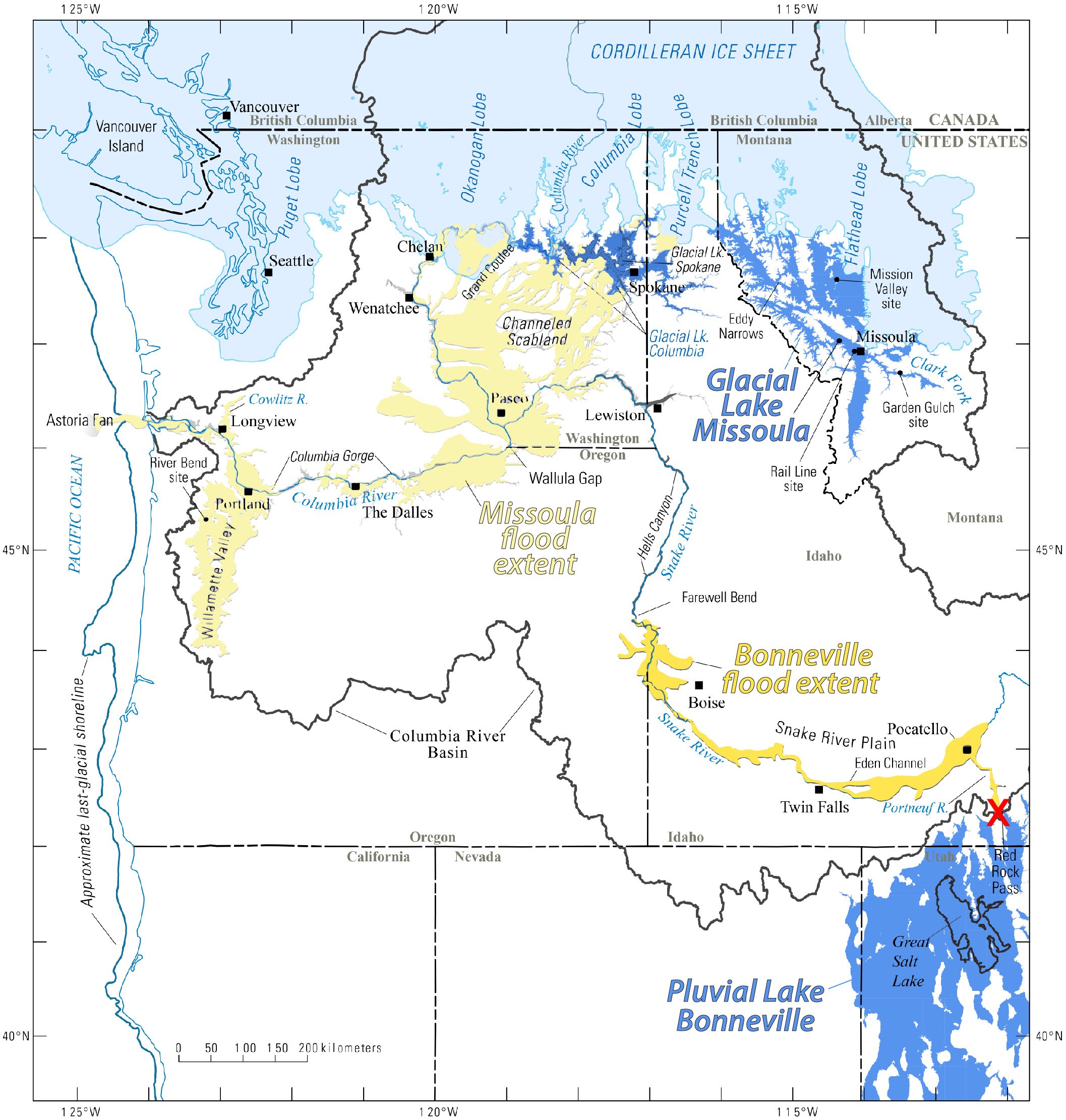
Red X marks the spot (near lower right) of Red Rock Pass, the spillover point for Lake Bonneville. The torrent of floodwater exiting the basin through the gap lowered the overall lake level approximately 105 m (350 feet). Map from Idaho State University.
More here about this tremendous flood from the Idaho State University: Lake Bonneville flood.
to escape the heat and smoke. Time to migrate to greener country. All packed and ready to rock.

pass across Porcupine Rim this evening, and, unfortunately, nary a drop of rain fell in the valley. But fortunately there weren’t any lightning strikes. Here’s one storm cell, backlit by the setting Sun at dusk.

continues to indicate the compromised air quality that persists at night due to suspended fire smoke throughout southeastern Utah.
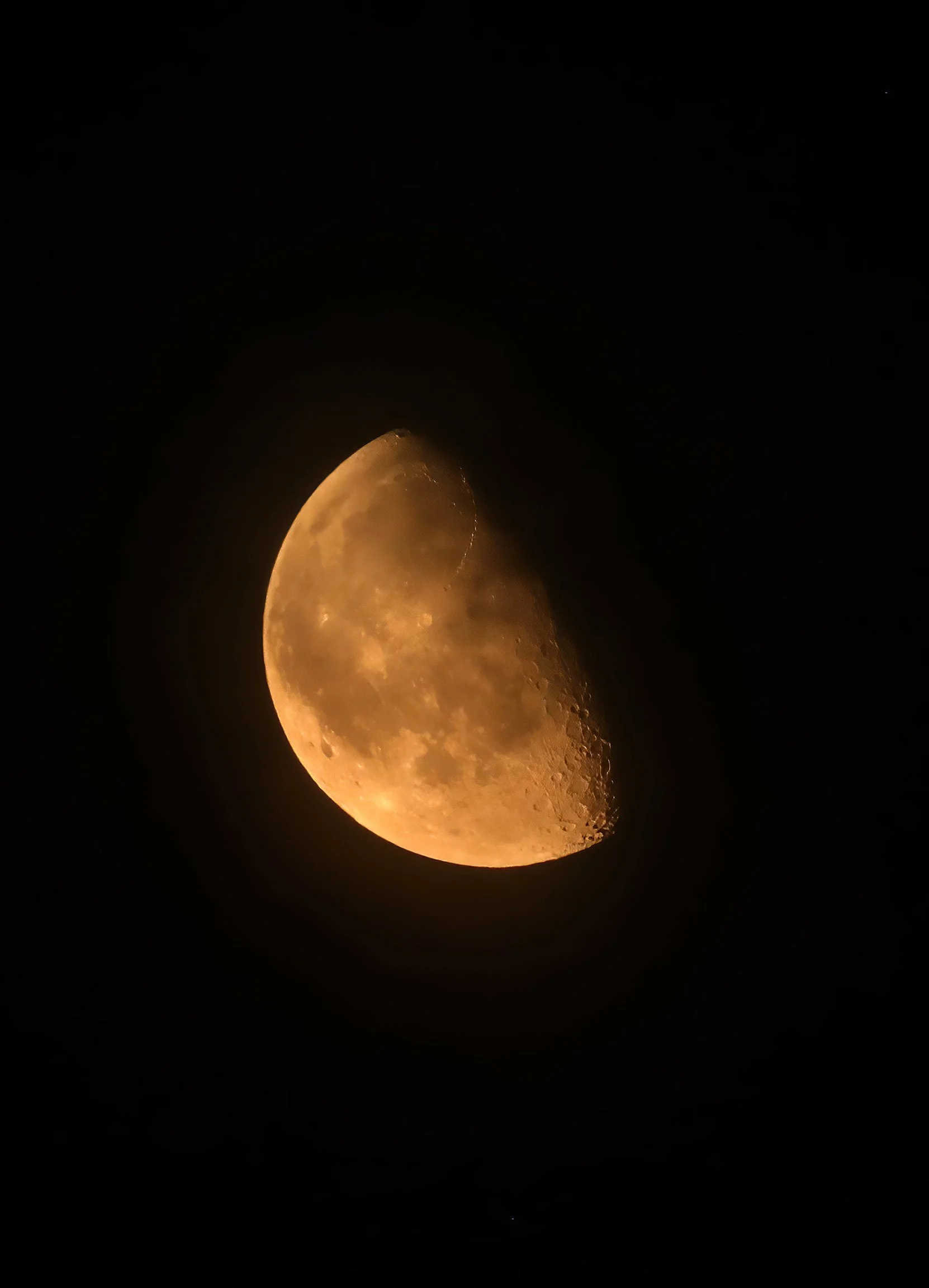
Not Mars! Waning gibbous Moon captured shortly after midnight during “moderate” air quality.
as Castle Valley celebrates the semiquincentennial anniversary of the founding of our great nation on this Independence Day. Community tradition has the volunteer members of the Castle Valley Fire Department hosting a breakfast and parade, seen here featuring Engine 37 leading the way.

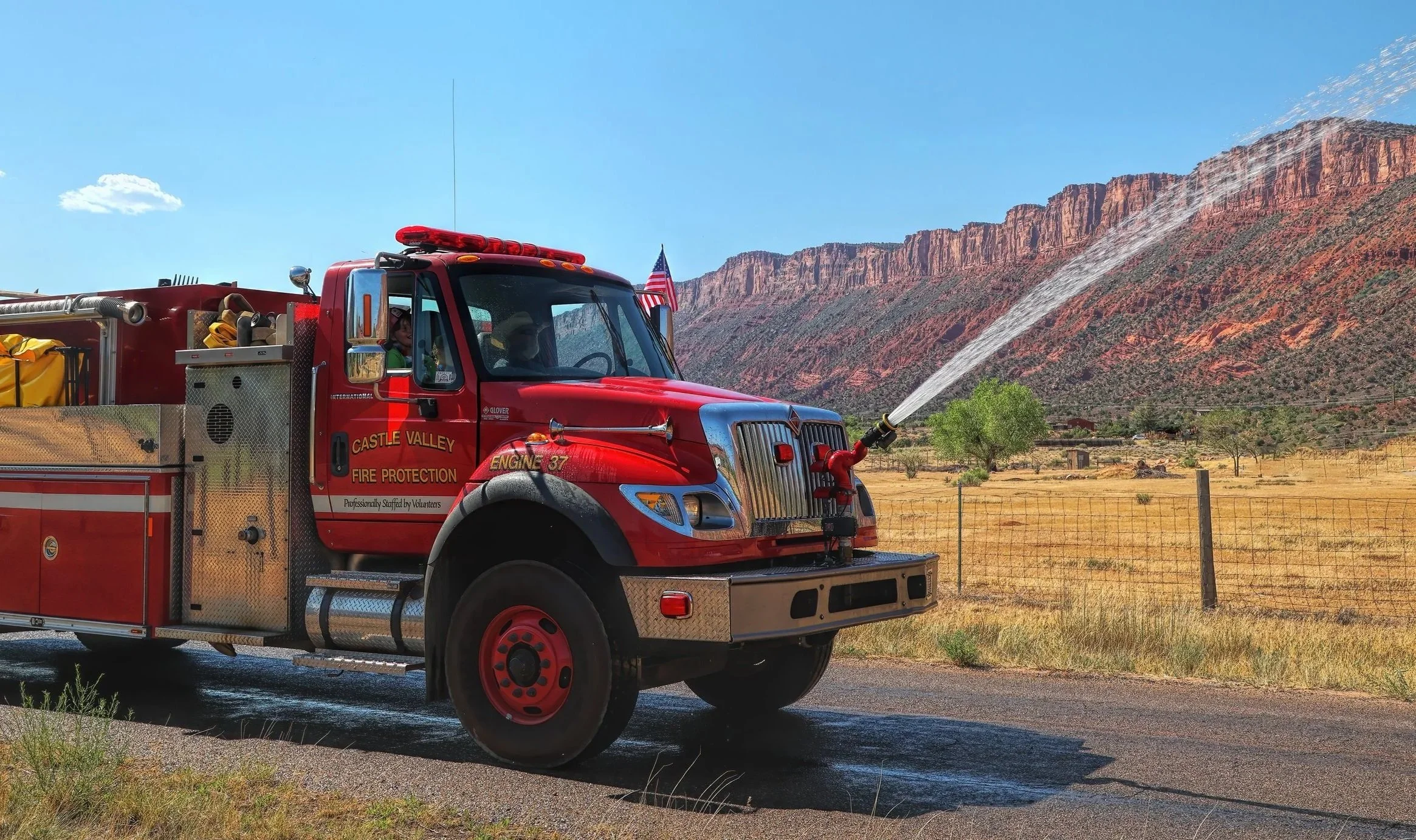

Cherry on top: Air quality this morning is the best since the summer solstice.
Read the Declaration of Independence.
