Analysis of pictographs...

is greatly assisted with DStretch software, allowing researchers to peer through centuries of weathering, fading and vandalism. The program uses a method called decorrelation stretch, which was originally used by NASA to improve remote sensing images of Mars, but DStretch optimizes it for rock art.

Image of a vandalized (chalked) pictograph in Black Dragon Canyon, Utah, taken under ordinary daylight (shaded) conditions.

The false color images below are screenshots from DStretch on my Samsung smartphone, illustrating several of the filters available in the software that are designed to highlight hidden details.

Learn more: DStretch website.

The Great Gallery in Horseshoe Canyon...

is clearly one of the most spectacular displays of Barrier Canyon Style pictographs on the Colorado Plateau. It takes some real effort to get to this special place in an outlying section of Canyonlands National Park but it’s well worth the experience.

The Great Gallery pictograph panel spans about 200 feet (60 meters) in length along a high ledge. (Click on image to enlarge.)

The huge and elaborate Holy Ghost pictograph, more than eight feet (2.4 meters) in height.

Great Gallery detail.

Distinctive trapezoidal Barrier Canyon Style icons in the Great Gallery.

The Alcove in Horseshoe Canyon.

The enigmatic Black Dragon pictograph...

has long been misinterpreted as a depiction of a flying phantasm, however, it actually consists of several individual pictographs as revealed by recent studies utilizing photographic and x-ray fluorescence techniques.

Screenshot of DStretch image of the Black Dragon pictograph captured on my Samsung smartphone that uses a decorrelation algorithm to reveal hidden details. Once the bias of the chalked outline on the pictograph is removed, separate elements are easily recognizable.

National Geographic is coming to town...

late next month to film the industrious globe mallow bee as it goes about its business pollinating the prolific globemallow flower. Documentary film producers caught my previous blog post with images (May 2021) showing their activities in Castle Valley and are sending a crew with a cinemagraphic camera to record their fascinating behaviors as a part of a series on the national parks. Very cool!

Here’s a nice article by local scribe Ron Drake who writes for the Moab Times-Independent that describes the upcoming project in Castle Valley.

The tiny mallow bee (Diadasia diminuta) specifically collects pollen from the desert globemallow plant (Sphaeralcea ambigua).

The mallow bee constructs hives underground, the entrances to which are tiny sedimentary towers, or turrets, only an inch (a couple centimeters) tall.

Mallow bee fully loaded with pollen entering hive through a turret.

The Dark Angel petroglyph panels...

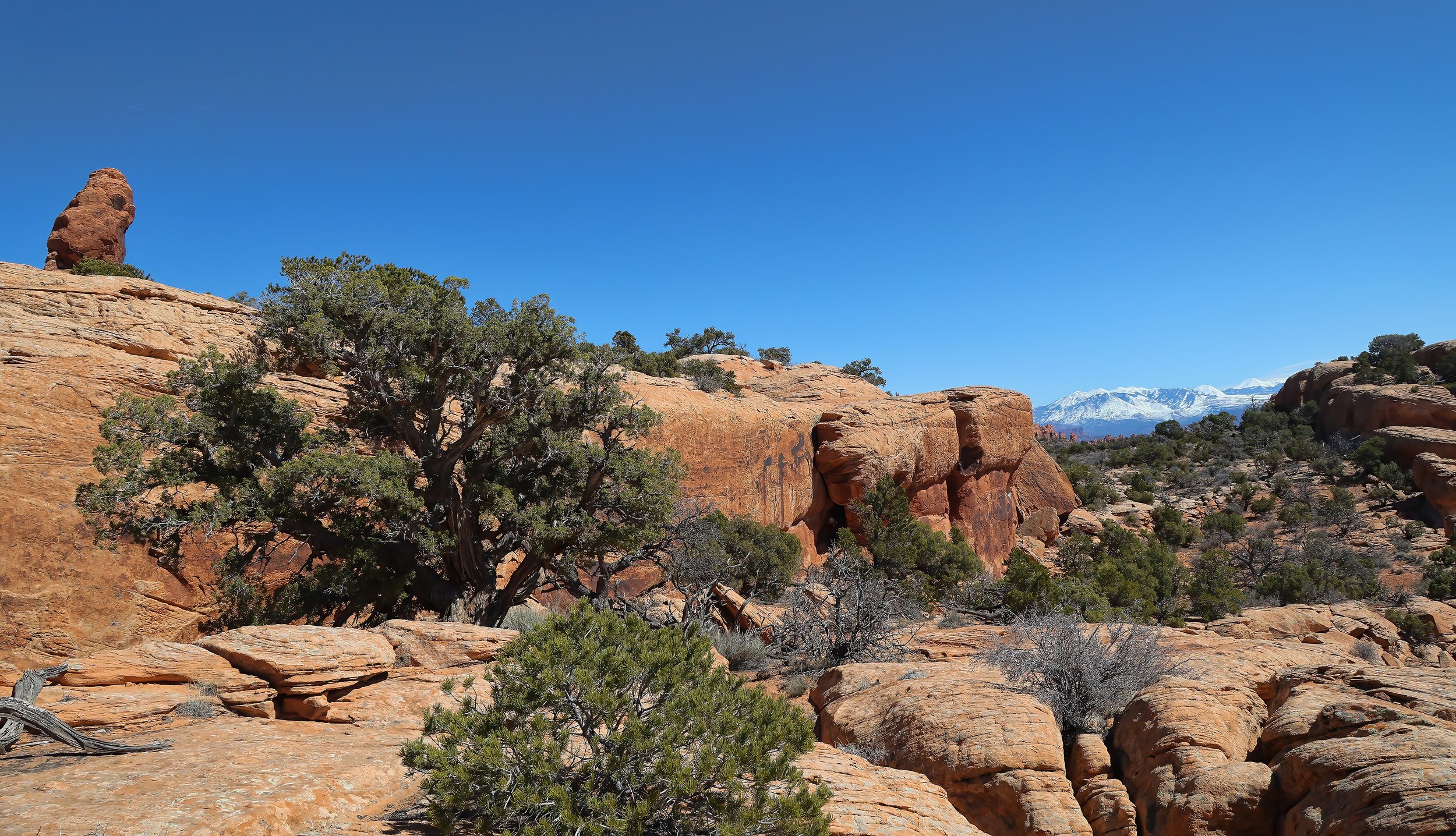
occupy the eastern wall of a sunken graben valley, below and to the west of the sandstone monolith that shares the same name, in the northern part of Arches National Park. This series of about a dozen panels almost certainly depicts hunting scenes involving bighorn sheep and deer in the Salt Valley, spanning both Archaic and Basketmaker cultures.

The top of the Dark Angel spire on the left, with the graben valley framing the distant snow-draped La Sal Mountains on the right.

Small petroglyph showing a human with atlatl aimed at a sheep.

The Dark Angel, my hiking companions and the requisite sun flare. This spire is about 150 feet (46 meters) tall.

View south across Devils Garden and the high La Sal Mountains. Look closely and one can spy Round Mountain in Castle Valley near the center of the image.

Lithic fragments of chert found in the graben show clearly worked edges and must have been carried into the valley.

An expression of the Moab Fault...

showing a textbook example of a fault plane in the Honaker Trail Formation (Pennsylvanian) near the Visitor Center at the entrance to Arches National Park. Note the slickenside banding and related fault gouge features on the near-vertical surface.

Marine fossil assemblage in the Honaker Trail Formation, originally deposited at sea level about 300 million years ago, now lithified and uplifted to 4,100 feet (1,250 meters).

Moab Fault shear zone in the Honaker Trail Formation on road cut on UT 191 across from the Visitor Center at Arches National Park.

Another late season snowfall...

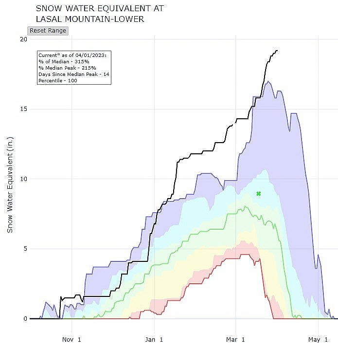
lightly frosted the lower valley, but elevated the snowpack to 271% of median snow water equivalent in the higher mountains, a new record high for this historic water year.

Given the abundant soil moisture, the high desert is likely to pop with wildflowers later this spring.