dramatically illuminates the landscape but, unfortunately, the nearly-full orb brightens the night sky so much that the Milky Way vanishes from view.

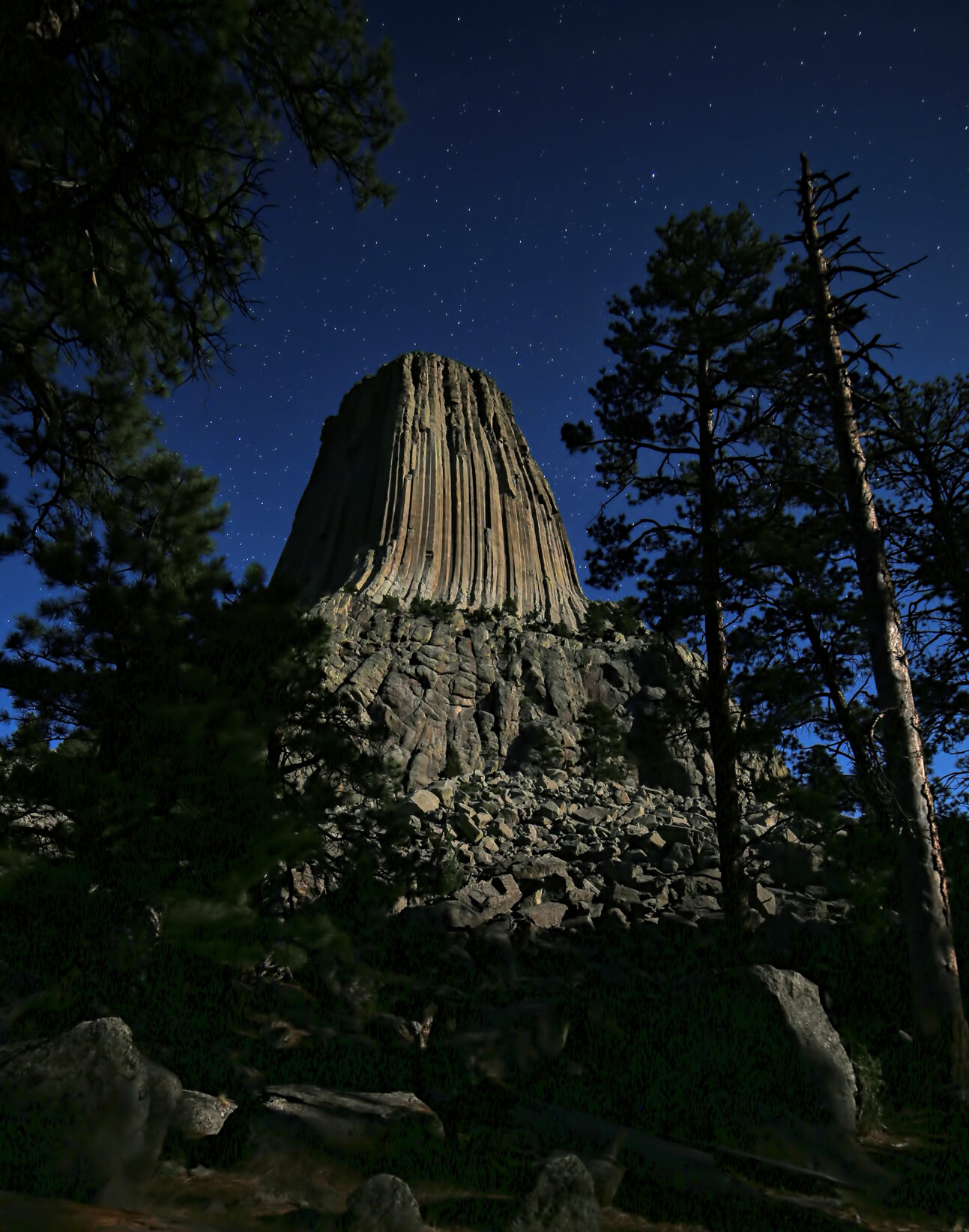
North side of Devils Tower shot at 2 am MDT from the Joyner Ridge trailhead. That’s Jupiter to the left of the Tower and Saturn above and slightly to the right. Ordinarily the Milky Way would appear in this frame to the right of the Tower but the Moon brightens the sky too much for it to be visible.
View of south face from Tower Trail, shot at 11 pm MDT and entirely illuminated by moonlight.

Star trails shot between 10:30-11:00 pm MDT showing the south face of Devils Tower. The white streaks across the lower part of the image were made by late-night hikers and their flashlights. They never knew I was there! Heh.