SpaceX shows NASA how it's done...

in the 21st century with a historic launch and capture of the largest object ever put into space early this morning. It’s unfortunate that this incredible accomplishment isn’t receiving more news coverage.

I’m not so sure that Elon Musk isn’t an alien.

Images below are screenshots from the live stream provided by SpaceX.

One minute before launch the Super Heavy Booster and Starship are fully fueled with liquid oxygen and liquid methane.

Liftoff as 33 Raptor engines on the Super Heavy Booster generate twice the thrust of the Saturn V, capable of placing 150 tons into Earth orbit.

Super Heavy Booster hovering at the launch tower after return from flight. Entirely unprecedented. Wow!

The captured Super Heavy Booster hanging from the “chopsticks” post flight as the vehicle undergoes depressurization.

Glowing plasma during controlled re-entry of Starship during peak heating prior to a successful soft landing on target in the Indian Ocean. Hi-res images provided by Starlink.

Video: Drone’s-eye-view of the liftoff.

Video: The tower catching the returning Booster!

Video: The landing burn and soft touchdown of Starship.

It’s pretty clear that NASA needs SpaceX more than SpaceX needs NASA. Per aspera ad astra.

Terrible air quality...

for the third day is affecting the eastern Utah region due to the Yellow Lake fire in the western Uintah Mountains. It’s going to take a change in wind direction to clear out the smoke and haze.

Link to Fire and Smoke Map 4.0 for latest air quality conditions.

Smoky conditions in Castle Valley obscure the higher La Sal Mountains and Round Mountain shortly after sunrise.

Fire and Smoke Map for Monday morning, 7 October 2024, showing location of Yellow Lake fire and associated smoke plume. Color-coded circles are air quality measurement stations.

Back in the bike saddle...

again in Castle Valley, Utah with the Trek full suspension e-mountain bike turning 3,000 miles on today’s ride. Since September 2020 the cumulative mileage on all my eMTBs comes to 14,357 miles (23,110 kilometers), or 57.6% of the Earth’s circumference at the equator. I’m feeling a bit like Forrest Gump during his running phase.

Sunrise in the Professor Valley...

paints this golden panorama of an amazingly scenic terrain. I was out in the predawn to chase an early morning comet, but having met with no success, I returned with this expansive image. It’s a helluva back yard. You’d think the movie industry would like to film around here.

Click on the annotated image to expandify.

The Thiokol rocket garden...

in remote northern Utah displays all the rocket engines and missiles they manufacture at full scale, now under corporate ownership by Northrop-Grumman. I have an enormous case of rocket envy.

The rocket garden is free and open daily to the public and includes interpretive signs and related displays. Well worth a visit if you’re heading to the Golden Spike National Historical Park which is nearby.

The submarine-launched ballistic Trident (center) with the three-stage land-based Minuteman ICBM (left of center). The enormous solid rocket booster for the Space Shuttle lays in the background.

The business end of the Space Shuttle’s solid rocket booster. When ignited, a pair of these provided 85% of the thrust at liftoff for the first two minutes of ascent. Unfortunately there are no demonstrations.

Location on Google Maps: 41.65892098884914, -112.44084106450782

Re-entering the Colorado Plateau...

after the summer’s absence via the San Rafael Swell. There’s no place like home.

Milky Way galaxy erupting a fountain of stars and nebulae, geyser-like from the rim of the Little Grand Canyon of the San Rafael River.

Sunrise from the Wedge Overlook, northern San Rafael Swell. Click on image to enlarginate.

The magnificent Buckhorn Wash pictograph panel. Click on image to embiggen.

The remote San Rafael River “Swinging Bridge” built 1935-1937 by the Civilian Conservation Corps, listed on the National Register of Historic Places.

Three well-preserved Miocene-age tree molds...

occur in the Wanapum Basalt Formation (Columbia River Basalt Group) along the Fish Lake Trail, exposed in a railroad cut through the volcanic formation within 100 yards (meters) of one another. One can easily imagine a landscape with a stand of large trees being invaded and enveloped by an advancing lava flow around 15 million years ago. I’m certain that 99% of the trail users aren’t aware of these interesting features and the story they tell.

Note the silicified wood that is preserved near the base of this large tree mold.

This tree mold is about 20 inches (0.5 meters) in diameter.

The underlying paleosol (ancient soil horizon) in which the tree were rooted is clearly seen here beneath the overlying basalt formation. This tree mold is about 15 inches (0.4 meters) in diameter and penetrates the interior of the volcanic unit.

An incredibly green and groomed launch site...

serves as the venue for the well-named Sod Blaster VI, an annual event held during Labor Day weekend at a sod farm near Pasco, Washington. More than 100 rocketry nerds gathered to launch low- to high-power model rockets during the four day-long event. It’s fair to say that everybody here has a blast!

An array of launch pads is commanded by the launch control officer (on left) at the well organized event. A high power rocket is heading skyward from a distant pad on the range.

My Nike Smoke Pro ready to go on a mid-power launch rail. It successfully soared to a 617 foot (188 meter) apogee on a “F” rocket engine.

Preparing to attach the electrical igniter to the high power HV Arcas model rocket for my Level 1 certification attempt on a “H” engine.

The HV Arcas zipping off the pad to a 1,719 foot (524 meter) apogee. Unfortunately the rocket separated too energetically when the ejection charge fired but all components were recovered. I'll have to try again for the L1 certification given this failure during flight.

The Arreaux shooting off the pad on a “G” engine to an apogee of 1,826 feet (557 meters).

T-minus five days until Sod Blaster VI...

in southeastern Washington where I hope to earn my Level 1 certification in order to purchase and launch bigger rocket engines in my larger/heavier model rockets. I will fly the 56 inch (142 cm) tall Aerotech HV Arcas for the certification flight, a 60% scale replica of the actual high velocity Arcas sounding rocket historically used for atmospheric research.

The Aerotech HV Arcas and the Aerotech Arreaux model rockets. The smaller and sporty Arreaux should reach 3,000 feet on a "G" engine according to computer simulations.

Based on simulations using OpenRocket software that utilizes basic physics, aerodynamic principles and the standard atmospheric model, the HV Arcas model rocket should soar to a half-mile high apogee in a flight lasting two minutes long on a “H” rocket engine. A Jolly Logic Altimeter Two will be onboard during the cert flight in order to record flight data.

Design rendering of the HV Arcas from OpenRocket software showing internal structure and components, as well as the center of gravity and center of pressure on the airframe.

Simulated flight profile of the HV Arcas flying on a “H” engine from OpenRocket software showing a predicted apogee of 2,456 feet (~750 meters) for a flight lasting 129 seconds.

Links: Sod Blaster VI and OpenRocket software.

This well-adapted beak...

allows this finch to effortlessly pry open conifer seed cones. These chatty and colorful birds are fairly common in the woodlands of eastern Washington.

Adult male Red Crossbill (Loxia curvirostra).

That’s quite the underbite.

The intensity of the iridescence...

of certain bird feathers is governed by the angle of incidence of refracted light as it passes through the micro-structure of the feather barbules. The richness of the glow changes quickly and results in a shimmering effect often seen in hummingbirds. Here’s one at rest at the sugar reservoir giving me the evil eye.

Female or juvenile Black-chinned Hummingbird (Archilochus alexandri).

Following a historic railroad grade...

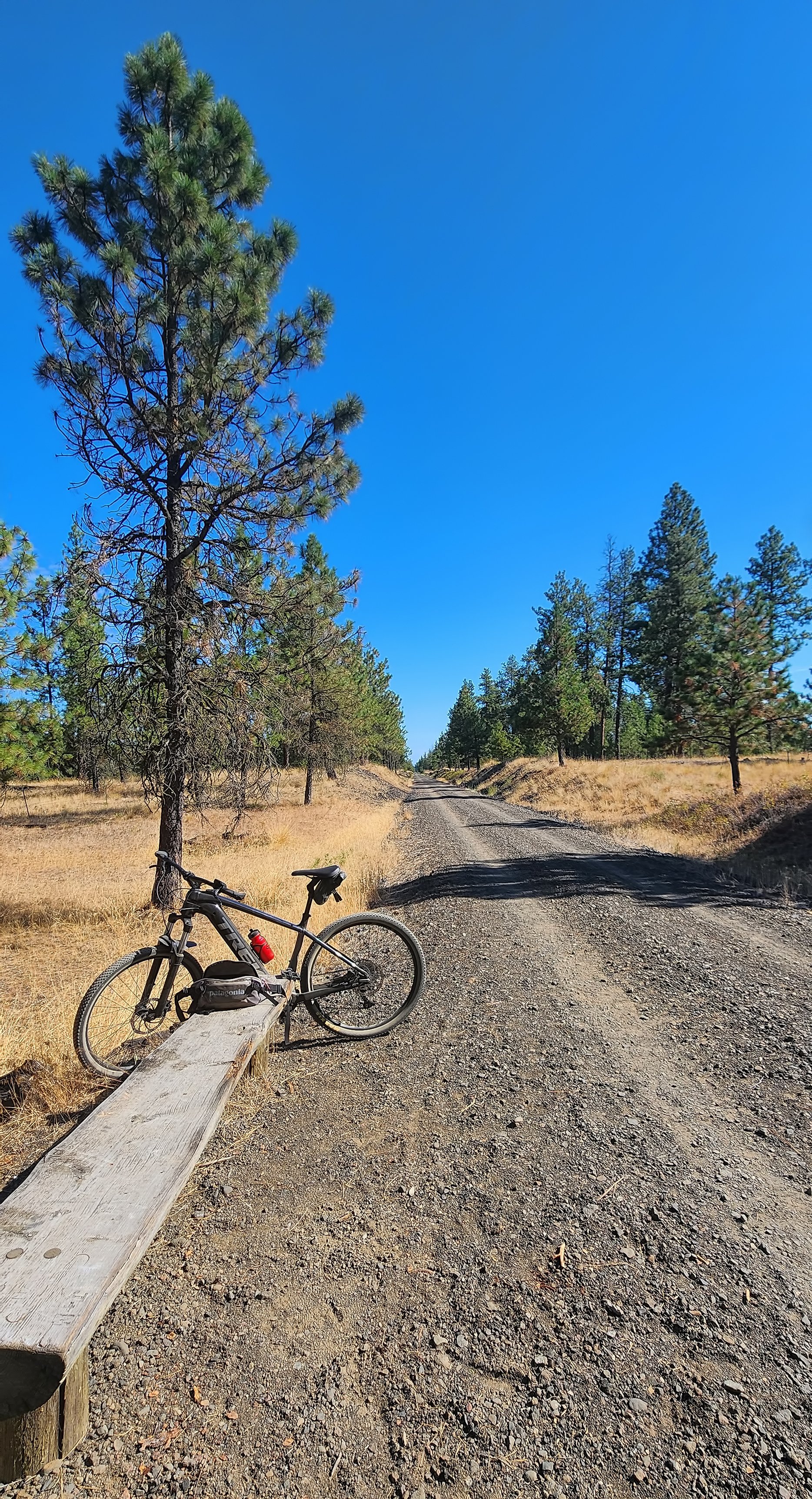
southwest of Spokane, Washington, the Columbia Plateau State Park Trail extends for 130 miles (209 km) across the semi-arid Channeled Scablands. Some portion of this trail system is part of my daily ride, usually a section between Spokane and Amber Lake, at its very northeastern end.

Open ponderosa pine forests and seasonal wetland ponds dominate the flat-lying terrain that traverses the 1908 path of the Spokane, Portland and Seattle Railroad.

A typical crowded day on the trail.