before hitting the local trails again, still a muddy and rutted mess from all the moisture we’ve received this winter.
The RR5 after yesterday’s challenging trail inspection.
before hitting the local trails again, still a muddy and rutted mess from all the moisture we’ve received this winter.

The RR5 after yesterday’s challenging trail inspection.
by the vulgar outdoor lighting at the Red Cliffs Lodge located 14 miles northeast of Moab, Utah. The owners/operators are apparently completely oblivious to the beauty and majesty of the night sky.


Guests staying at that lodge will miss spectacular night skies such as this seen from my desert retreat this evening.
from Castleton, Utah on a lovely mid-winter’s day.


Sharp-shinned Hawk (Accipiter striatus).
of an enormous owl, gazing unblinking for centuries over Kane Creek Canyon.

The owl glyph is about two feet (0.6 meters) tall.
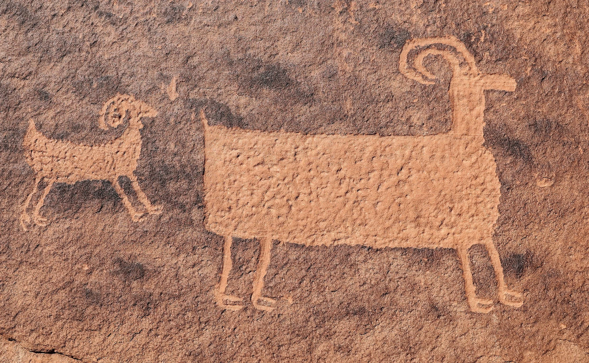
Exquisite detail in a couple of bighorn sheep glyphs.
is forecast by these Wild Turkeys who saw their shadow early this morning in Castle Valley.

Female Wild Turkey (Meleagris gallopavo).

foraging in the underbrush.

Desert cottontail (Sylvilagus audubonii).

on the Moab Uranium Mill Tailings Remedial Action (UMTRA) Project where nearly 80% of contaminated tailings and soils have been removed since 2009, relocated about 30 miles to the north at a disposal site near Crescent Junction, Utah. Here are the numbers and a project overview.


dimly illuminated by the new Moon, with Orion hovering above Castle Valley.
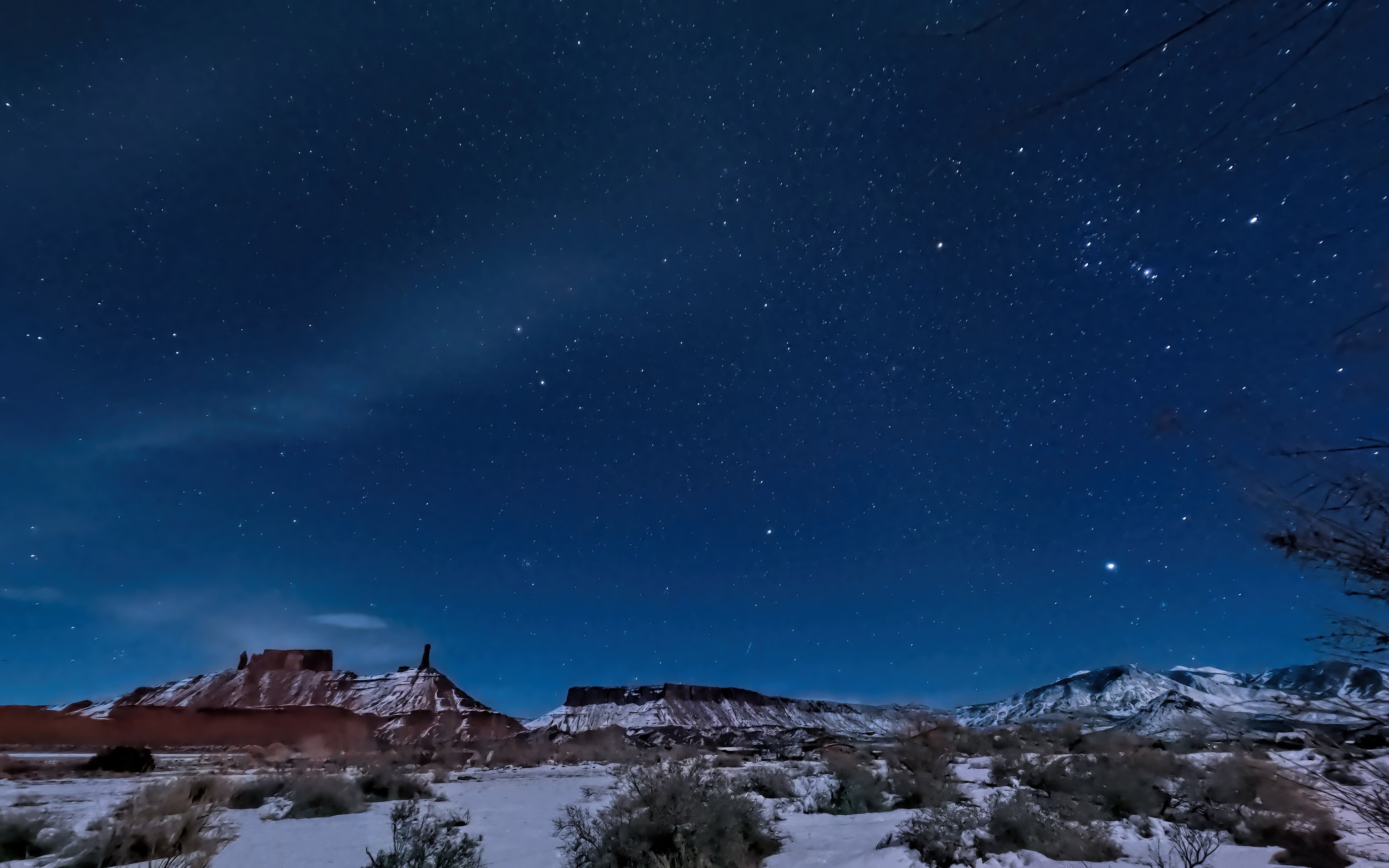
descends upon Castle Valley, Utah, now a third of the way through winter.

One frame of a “nightlapse” shot on my GoPro Hero 9 Black shortly after sundown. Thirty second exposure at ISO 1600.
showing where large cornices have been constructed from the historical record snowpack that has accumulated.

may persist in the canyons in the Moab area for the week ahead, with frigid temperatures but little moisture predicted in the forecast.

the morning after a winter storm, revealing a snowy blanket on the landscape and fully-flocked trees.

The snow water equivalent at the La Sal Mountain SNOTEL site is reporting 228% of the median value on this date based on 41 years of record! (Link to real time data.)

but staying close to the feeding station while fluffy snowflakes fall. This round of moisture puts the La Sal Mountains at well over 200% of the median snow water content for this date.

White-crowned Sparrow (Zonotrichia leucophrys).
at Bryce Canyon National Park, freshly dusted and dressed with snow from a recent winter storm.


The iron oxide-rich Eocene-aged Claron Formation takes on a luminous quality due to the soft reflected light.

Hundreds of hoodoos stand as sentinels on the snowy landscape.


The Henry Mountains and Waterpocket Fold catching the last rays of the day.
on a delightful winter day with two friends in Gold Bar (Culvert) Canyon west of Moab. A continually ascending trail tops out at Gold Bar Arch, also known as Jeep Arch, after two miles with stunning views of the distant snowcapped La Sal Mountains.

Gold Bar Spire is a prominent landmark on the trail.

The opening of Gold Bar or Jeep Arch is about 45 feet (14 meters) high and about 66 feet (20 meters) wide.


marks the first full lunar orb of the new year, as well as one of the smallest, the Wolf Moon.

being literally depicted as a detailed petroglyph at the base of a tall sandstone wall along Potash Road. I think the interpretation of this panel is pretty clear.


The bear glyph itself is enormous, approximately six feet (two meters) across. Note the use of bow and arrows by the several hunters surrounding it, suggesting that this is related to the Fremont culture, placing it over the older bighorn sheep glyphs of Basketmaker origin.
for the first full moonrise of the new year, the so-called Wolf’s Moon, still several days away. Still time to practice my howl.

at sunset on New Year’s Day. A vibrant and welcome relief to an otherwise gray day. It doesn’t suck.
