despite the recent snow and rainstorms that passed through the region.
A view of the high country with its fresh mantle of snow.
We’re only half-way to an “average” snowpack but there are still 46 days until the typical peak.
despite the recent snow and rainstorms that passed through the region.

A view of the high country with its fresh mantle of snow.

We’re only half-way to an “average” snowpack but there are still 46 days until the typical peak.
greets the breakfast visitors at the feeding stations this morning.

Western Meadowlark (Sturnella neglecta).

enjoys a diverse diet during this dry winter, caught here through the front window at dusk.

Mule deer (Odocoileus hemionus) browsing on sagebrush.

Smoking a honey locust seed pod.
herald a big change in the weather pattern for southern Utah the week ahead.
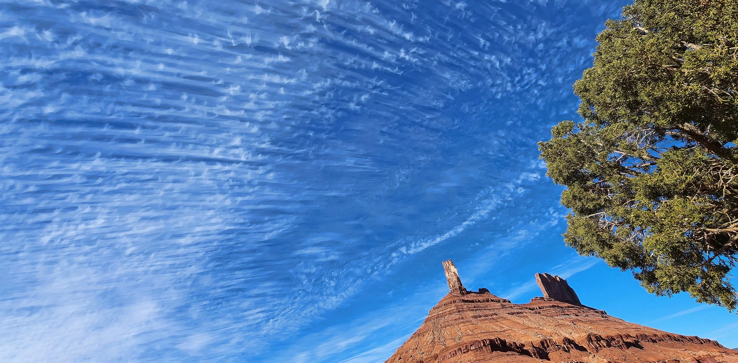
Cirrus uncinus clouds above Castleton Tower.
while its head turns on a swivel, Sharpie visits at dusk.

Sharp-shinned Hawk (Accipiter striatus).
as a small flock of jays noisily announced their presence this morning.

Pinyon Jay (Gymnorhinus cyanocephalus).

at the stratigraphic contact between the Cutler and Moenkopi Formations below Adobe Mesa bears some further examination, but it’s a difficult scramble to its location on steep and unstable slopes. Light-colored mineral deposits, likely either calcium carbonate (calcite) or calcium sulfate (gypsum), occur at the margins of the seep.


to only about 70% of median snow water content in the La Sal Mountains as this very dry winter season continues.

Wind-swept rocky surfaces and large snow cornices reveal a high country that hasn’t seen significant snowfall since around Thanksgiving.

of Sevenmile Canyon north of Moab on a spectacular mid-winter day.

An immense pour-off defines the upstream end of Sevenmile Canyon, west of Arches National Park.

The Slick Rock Member of the Entrada Sandstone comprises the vertical walls of Sevenmile Canyon, capped by the Moab Member of the Curtis Formation (Middle Jurassic (174.1-163.5 Ma)). The Windows Section in Arches National Park on the horizon is eight miles (~13 km) distant.
and in with the new as the seldom-used and decrepit corral along Castleton Road is demolished and replaced with metal fencing.

on the hardtail during today’s gloriously nice ride. This also pushes me past 60% of the distance around the Earth at the equator.

with infinite patience at the feeding station this cold and overcast morning, Sharpie sat nearly motionless for about 45 minutes.

Sharp-shinned Hawk (Accipiter striatus).
covers Castle Creek thanks to the frigid nighttime temperatures, but long crystal-lined canyons in the milky ice open like skylights and reveal the water flowing beneath.


This winter season continues to be cold and very dry. The snowpack in the highcountry is now 80% of the historical median snow water content, but there are still 68 days until the median peak snowpack.
and soft landing of the scale model Patriot rocket this chilly but calm afternoon.

The Patriot model rocket after a successful flight to 425 feet (130 meters). The vent holes allow the parachute to rotate on a swivel during descent. Very entertaining.
on the Colorado River upstream from Moab commemorates a gold placer operation that occurred 130 years ago. High marks to the person that chiseled this historic graffiti into a varnished sandstone boulder above the river. It’s very well done and endures to this day.

Located on the north side of Utah 128 just west of the bouldering area at Big Bend (about 0.6 mi (1 km)).

R.H. is the likely inscriber, but notice the initials JA are faintly pecked in the upper left.

The boulder in 2021 when vandalized with climber’s chalk. Fortunately, several year’s time and rain has washed the chalk away. Image credit: Moab Times-Independent, Sena Hauer.
Learning opportunity: Utah Gold - History, Placers and Recreational Regulations.
this evening and its face is fully illuminated by the Sun, making it larger and brighter than any other time this year. Here Mars is rising above Castleton Tower shortly after sunset.

this evening is this handsome mule deer buck.

Mule deer (Odocoileus hemionus).
in the ephemeral stream channel upstream of the newly installed concrete ford in Placer Creek, rather than being continuously transported across the structure when the stream is flowing. Engineers should have matched the elevation of the stream bed rather than maintain the road grade at the crossing. While this structure isn’t going anywhere in future floods, it will require maintenance after each event in clearing accumulated sediment, in perpetuity. It could have been self-maintaining, so let’s see how it performs over the next decade.

The brand-spanking-new $188,889 mega-concrete stream crossing structure on Placer Creek at the entrance of Round Mountain State Park.
at the rising Full Wolf Moon tonight, but one has to listen closely in the wind.

this afternoon with excellent trail conditions for early winter riding. Cold, though.
