Denying access to public lands...

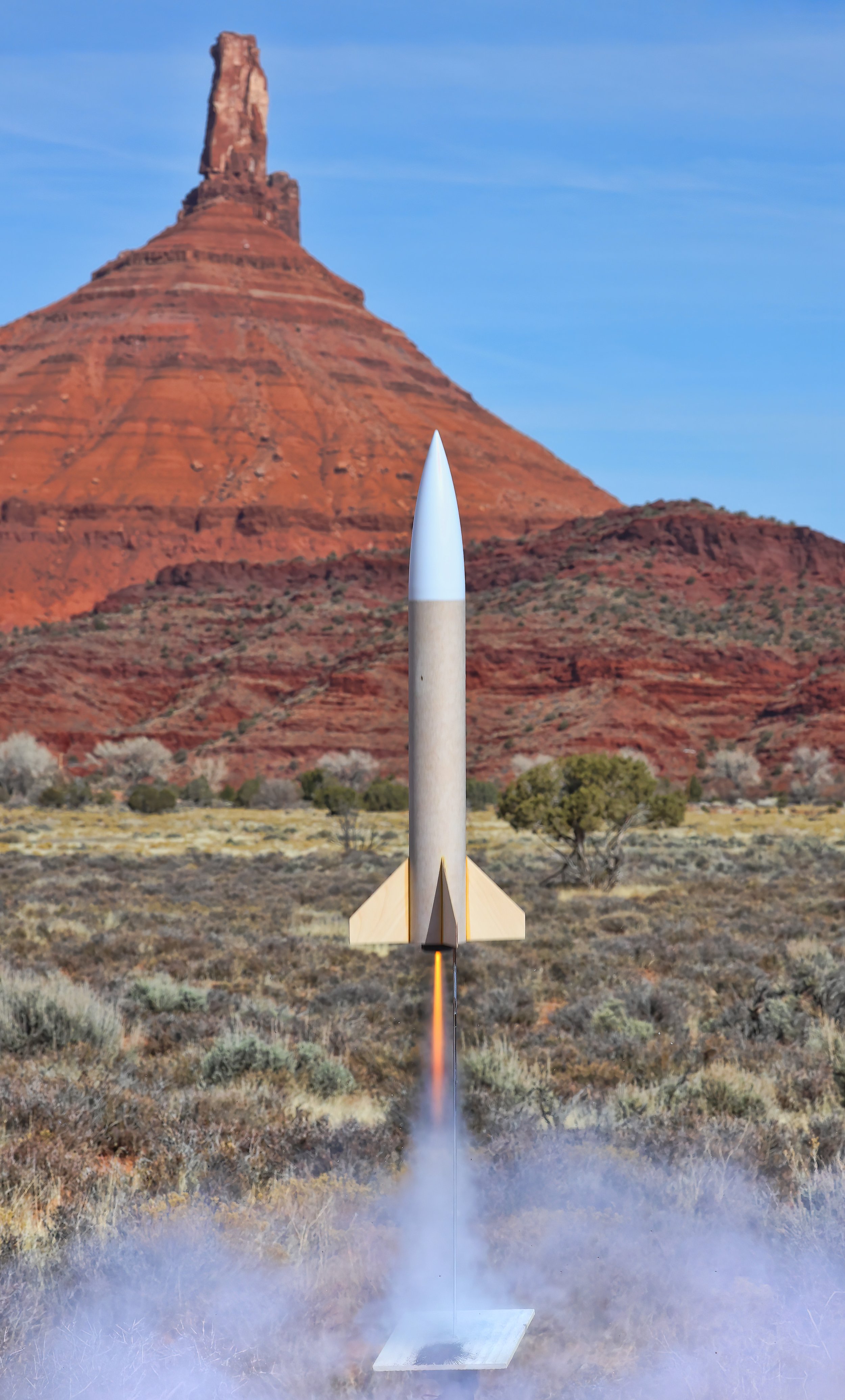
the Bureau of Land Management arbitrarily closes the old Castleton grade, even to bicycles. It’s not a biologically sensitive area. There was no informing discussion with the local community. No comments taken. Screw the staff of the BLM.

UPDATE; Three weeks later someone has ripped down the closure signs. Hayduke lives!

Career Day for Moab middle schoolers...

brought them to the Utah State University campus where one of the activities involved model rocketry. We launched and successfully recovered four rockets in a series of demonstrations as small groups of students rotated through the various activities. It was big and chaotic fun.

Observing the first day of spring...

by lofting a rocket.

Blast off from the driveway with Parriott Mesa in the background.

The Patriot clearing the launch rod and flying to a 486 foot apogee.

Annotated profile of a perfect flight and parachute deployment. The rocket landed softly about 150 feet away from the pad.

It may look menacing...

but it’s just a model rocket, albeit a very big model rocket. The HV Arcas by Aerotech stands 56 inches (142 cm) tall and is mounted on a rigid rail used for launching high powered rockets. I will seek Level 1 certification this coming summer from the National Association of Rocketry in order to fly this impressive projectile on larger engines to several thousand feet in altitude. It’s important to have goals in retirement. Go big or stay home.

Note: The 1010 aluminum launch rail stands 7.5 feet tall (2.3 meters).

A peeping muley...

at the kitchen window last evening with its nose nearly pressed up against the glass. There’s still a small herd hanging out in the valley and several still frequent my bird feeders and bird bath around dusk.

Mule deer (Odocoileus hemionus).

Slow and lingering late winter storms...

maintain the snowpack in the high country at near normal levels while misting the lower valley with light rains. Springtime approaches in the high desert.

A window to the snowy high country opens behind Round Mountain this afternoon.

Lasal Mountain (572) SNOTEL hydrograph: Black line indicates the current water year snow water content, closely following the median value (green line) based on 41 years of record at this station. Last year’s historic snowpack is represented by the purple line for comparison. (Graph from NCRS SNOTEL network.)

17 March 2024 update: This SNOTEL station now reports 119% of median SWE!

"Rocket Men"...

reliving their childhood, featured in this week’s Castle Valley Comments. The young lad pictured below plays a leading role.

Junior rocketeer with Science Fair project, circa 1968.

Richard Codd from Moab (left) supervises as I attach the launch system to the igniter on the unpainted Doorknob model rocket. (Image courtesy Ron Drake.)

The West is best...

for aerial observation of landforms. And remember, geologists always get window seats (except on a Boeing 737 Max 9).

Mancos Shale badlands near Grand Junction, Colorado. The overlying Mesa Verde Group (Cretaceous) crops out in the escarpment.

View towards the northwest. La Sal Mountains and Paradox Valley (a collapsed salt-cored anticline).

Grand Canyon and Colorado River.

With a mighty roar...

on a “F” engine, the unpainted Doorknob model rocket leaps skyward off the pad in a sparkly liftoff. The one minute-long flight reached 832 feet in altitude according to the onboard flight recorder.

Though not a high flyer, the Doorknob drifted about 500 feet from the launch site once the chute deployed.

Launching slightly into the wind on a “E” engine, the sleek and unpainted Frangible Arcas achieved 1,381 feet at apogee, landing softly under chute and drifting about 600 feet down range.

A moody Moon rises...

behind the lower slopes of Castleton Tower this evening. This full Moon is variously known as the Full Snow Moon or the Full Hunger Moon since it appears shortly after the middle of winter.

Frequent guzzlers of water...

from the birdbath at dusk. It seems to be a well known watering hole that is visited nightly, and there are more than 30 muleys grazing out back as this is posted. They’ll be moving up the valley soon as spring approaches.

Mule deer (Odocoileus hemionus).

Model rocket descending under chute...

after an early launch on a calm, clear and sunny morning. This one flew to 501 feet on a “C” engine and pulled 9.4 Gs at peak acceleration, softly landing less than 20 feet from the pad.

Estes Red Max model rocket with a tethered altimeter (black object near nose cone) and Nomex chute protector (orange fabric attached to shock cord).

Still frame from the upward-looking GoPro at the pad.

A snowy surprise...

blankets Castle Valley this morning. But it’s not going to last long.

As a result of this storm, snow depth in the La Sal Mountains ranges from 33 to 59 inches at the SNOTEL sites, with the snow water equivalent rising to 114% of the historic median.

Swept into position by debris flows...

and sitting patiently for millennia, this pair of 1.5+ meter diameter sandstone boulders lie on an old alluvial fan surface below Round Mountain. These enormous clasts were likely entrained in a viscous slurry of water and sediment that moved down the steep topographic gradient, perhaps mobilized by an intense rainfall event, countless centuries ago.

And it was a beautiful - but blustery - day for a ride.