at a turbid but moderate pace, with plenty of channel capacity, all the way to its confluence with Castle Creek. Here’s the view upstream from the arroyo at the end of East Pace Lane.
(Click on image to enlarginate.)
at a turbid but moderate pace, with plenty of channel capacity, all the way to its confluence with Castle Creek. Here’s the view upstream from the arroyo at the end of East Pace Lane.
(Click on image to enlarginate.)
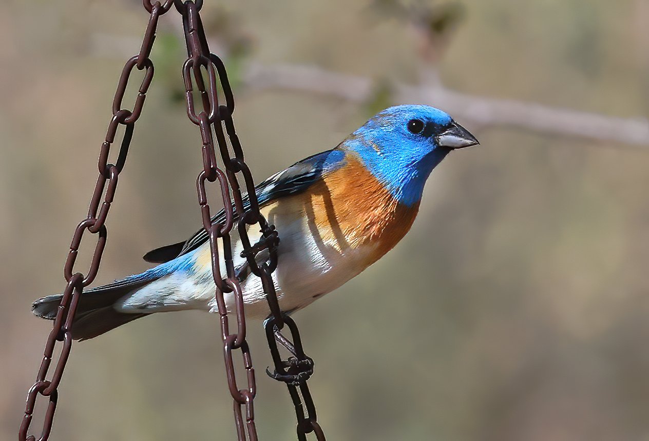
after which it is named, one of my spring favorites joins me for morning coffee.

Adult male Lazuli Bunting (Passerina amoena).
Here are a couple of more shots captured later in the afternoon, under more favorable lighting. Quite the handsome fellow.


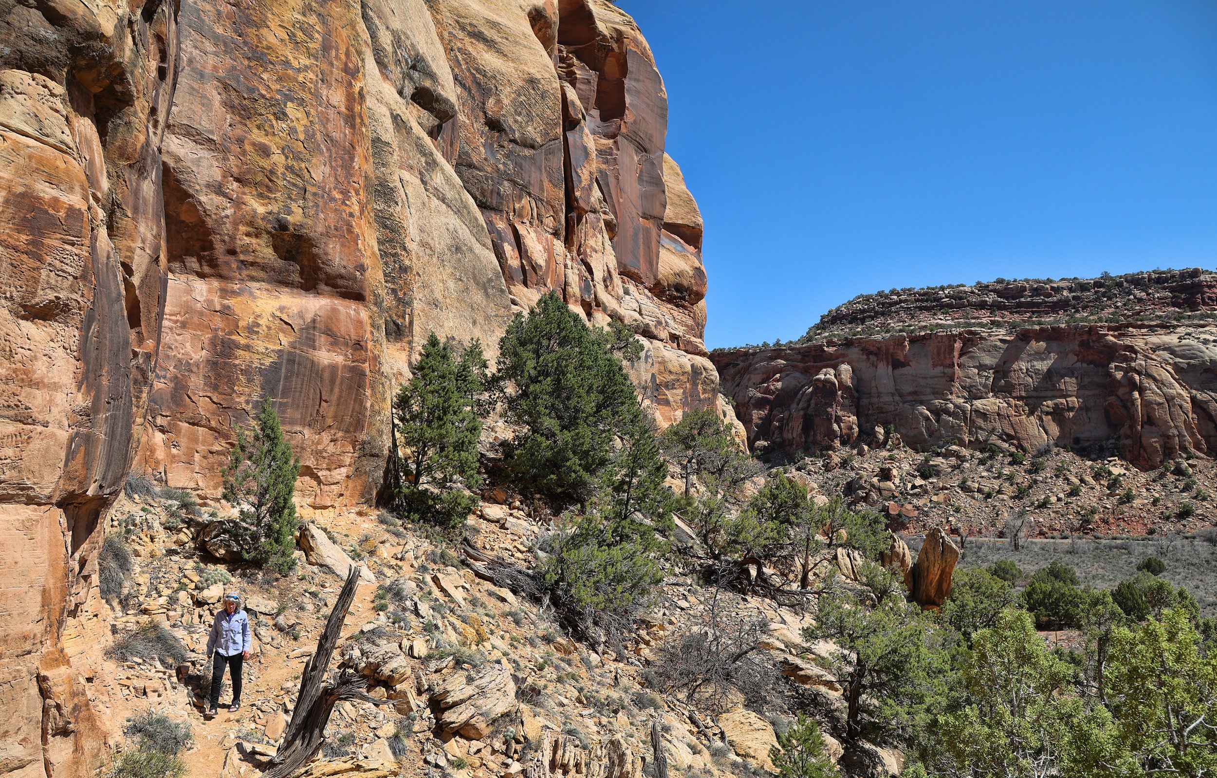
this spring in Castle Valley, Utah. Placer Creek is flowing all the way to its confluence with Castle Creek low in the valley, a once-a-decade occurrence, and in doing so is losing a large amount of its flow into the coarse, gravelly ground.

View upstream of Placer Creek and its distant headwaters in the Pinhook Valley, to the right (west) of Round Mountain.

View downstream of Placer Creek at the Buchanan Lane crossing.
involves this appropriately named - both common and scientific - poisonous beauty, now in full bloom in Castle Valley. In other words, don’t eat it.

Panicled death camas (Toxicoscordion paniculatum) among the blackbrush (Coleogyne ramosissima).

as I sip my coffee, my ever-present companion Bugs Buddy is up early to join me in greeting the day.

this visitor was caught early this morning at the feeding station.

Evening Grosbeak (Coccothraustes vespertinus), either a female or immature male.
is the issue confronting some residents of Castle Valley that live in the so-called Upper 80, where the road crosses Placer Creek. The stream has been running steady for more than a week, eroding the crossing, and the Castle Valley Road Department has used large boulders and concrete in an attempt to limit headward erosion of the nickpoint across the road. This minimal approach is only a band aid solution provided that discharge in the stream does not rapidly increase.

View upstream at road crossing.

View downstream below road crossing.
that collected a specimen on the 1859 exploration of the San Juan River drainage, this lovely early bloomer bears the name of Dr. John S. Newberry, the expedition’s doctor and naturalist.

Newberry’s twinpod (Physaria newberryi).
around the hummingbird feeder, with this little one, no bigger than your little finger, staking out a defensive position in the nearby brush and preventing others from tanking up.

Black-chinned Hummingbird (Archilochus alexandri).


at my feeding station, a large sparrow that spends much of its time scratching at the leaf litter beneath brushy cover.

Green-tailed Towhee (Pipilo chlorurus).
of Castleton, Utah, reciting some of his work as I shoot a test video this morning. I will be working with local poet Rory Tyler, shooting several hours of him reciting his poetry, and posting clips on YouTube. Stay tuned, it's wonderful stuff.

Rory Tyler, rock art guru and cowboy poet.

The view from Rory’s porch. Inspiring.
they will come. Within hours of hanging the hummingbird feeder the air was filled with the high-pitched whirring sounds of the tiny birds zooming off the back deck.

Adult male Broad-tailed Hummingbird (Selasphorus platycercus).

the brilliant Indian paintbrush is the dominant flash of color on the slow-to-awaken high desert this chilly and wet spring.

Vibrant Common Indian paintbrush (Castilleja chromosa) with the greening Round Mountain.

This spark of scarlet beauty is enhanced by the hemiparasitic nature of this perennial plant, robbing water and nutrients from nearby neighbors.
makes an appearance at the feeding stations, especially on the male American Goldfinches. Here’s one with a prized sunflower seed.

American Goldfinch (Spinus tristis).
just a short distance from Newspaper Rock and it contains hundreds upon hundreds of petroglyphs distributed along the base of a varnished cliff for about a quarter mile (~400 meters). All of the glyphs here are heavily varnished, suggesting that they are older than most of the figures carved at Newspaper Rock.


A determined explorer can find this magnificent place quite easily, so I’ll leave it to you.
in the Needles District of Canyonlands National Park lies an amazing pictograph panel and an array of ruins, but one needs a high clearance 4WD vehicle to access a remote campsite and the park boundary.


The stunning Five Faces pictograph panel.

Detailed contrast-enhanced image of two of the figures in the Five Faces panel. Note the smoothed and cleaned rock surface on each face.

This impressive desert varnish-draped alcove is more than 100 yards/meters wide and contains the so-called Log House Ruin high above the canyon bottom. Obvious structures are numbered.

The inaccessible Log House Ruin on a high ledge. Four structures are visible and note Ellen (in green) at the lower right.

Close view of several structures, including the “log house.” Note the hand print pictographs above the structures.
was made this afternoon on the newly acquired Trek Powerfly FS 4 Gen 3 eMTB. Here’s the requisite brochure shot.

Link: Trek Powerfly FS 4 Gen 3
above Potash Road is a stunning petroglyph panel featuring a parade of enormous animals, a walking human figure with a staff and the so-called “Polka Dot Man.” The rock-scrambling route through the maze of sandstone fins to the site is big fun and often used by local canyoneering tours.

View into the intensely jointed Behind the Rocks and the high snow-covered La Sal Mountains. A canyoneering group is preparing to rappel on the left.

Potholes are pregnant with rainwater from the recent deluge. The glyphs are on the high cliff in the distance, to the left of the arch-like alcove.
Scan horizontally across the center of this image to find the somewhat inaccessible glyphs, from the far left to the far right. (Click on image to enlarge.)

That-a-way outa here!
and the Colorado River has already exceeded last year’s peak discharge of 16,400 cfs at the Cisco gage near Dewey Bridge, Utah that occurred in late May 2022. And snowmelt in the high country hasn’t even begun.

Link: Realtime data for the Colorado River near Cisco, UT - 09180500.
is greatly assisted with DStretch software, allowing researchers to peer through centuries of weathering, fading and vandalism. The program uses a method called decorrelation stretch, which was originally used by NASA to improve remote sensing images of Mars, but DStretch optimizes it for rock art.

Image of a vandalized (chalked) pictograph in Black Dragon Canyon, Utah, taken under ordinary daylight (shaded) conditions.
The false color images below are screenshots from DStretch on my Samsung smartphone, illustrating several of the filters available in the software that are designed to highlight hidden details.


Learn more: DStretch website.