as winter wanes and spring approaches. Castle Creek is experiencing pre-runoff base flow and one can feel the energy emanating from Round Mountain! The trails are rideable and in good condition now, with wind and warmer temperatures finally drying out the mud bowl. Here are a couple of shots from my afternoon ride.


An aerial traverse...
across the axis of a collapsed salt-cored anticline structure at the north end of Arches National Park, photographed on final approach to Canyonlands Regional Airport. As always, geologists get window seats!

The sandstone “fins” in the Slickrock Member of the Entrada Sandstone (Middle Jurassic), east of Salt Valley.
North end of Salt Valley showing the plunging end of the collapsed salt-cored anticline structure. The primitive Salt Valley Road follows the spine of the structure towards the northwest, with strata dipping gently outward in opposite directions. Those are the Book Cliffs in the distance composed of the Cretaceous-age Mesa Verde Group. (Click on image to enlarge.)

Densely jointed terrain in the Moab Member of Curtis Formation (Middle Jurassic), west of the Salt Valley.

View showing an escarpment of the variegated Brushy Basin Member of the Morrison Formation (Upper Jurassic) overlain by the Cedar Mountain Formation (Lower Cretaceous).
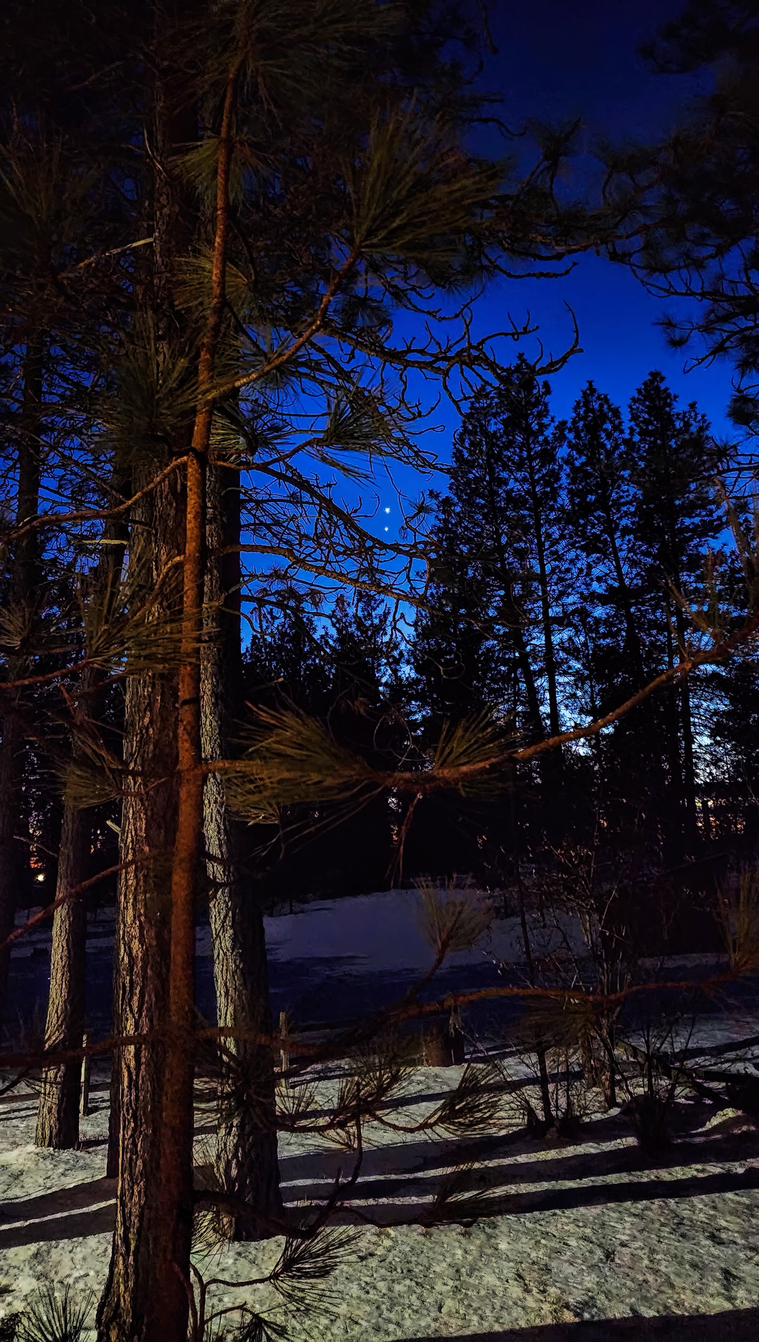
The conjunction of Venus and Jupiter...
make a jewel-like pair of bright evening stars, as seen through the canopy of the ponderosa pine forest in snowy eastern Washington.
Flying out of Canyonlands Regional Airport...
this afternoon and first in line for departure on runway 21. Geologists always get window seats!


View into Mill Canyon and Bartlett Wash area shortly after takeoff.

View of the Cisco reach of the Colorado River. Westwater Canyon can be seen in the upper right.
Moab Man...
waves a friendly hello. Or is this a warning gesture, or a funky dance move?


This portion of the so-called Moab Golf Course Panel measures about 15 feet (4.5 meters) in width. Note the opposing arm positions of the Moab Man (leftmost petroglyph) with the Moab Woman(?) at the far right.
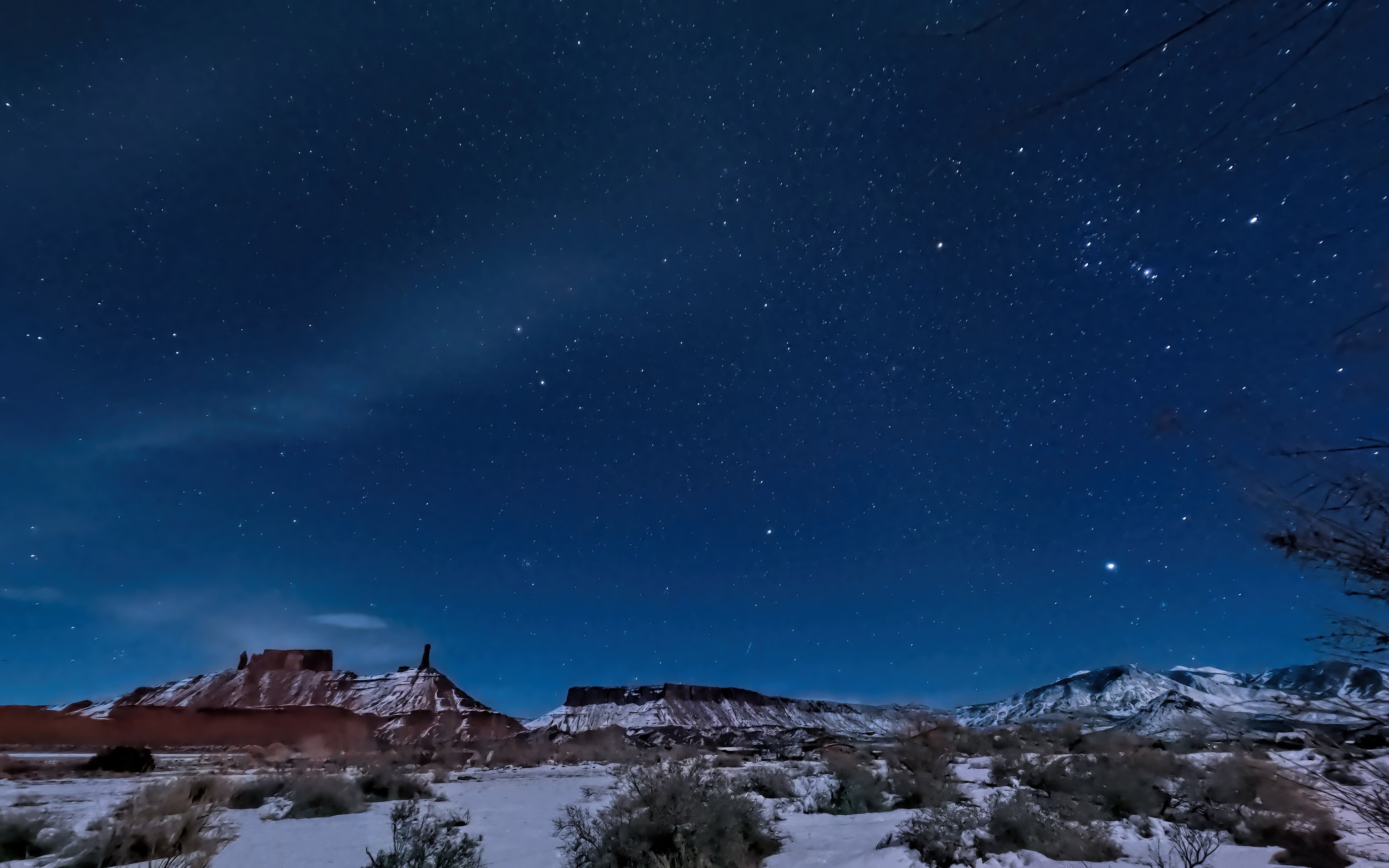
Starry night above Moab, Utah...
with Jupiter and Venus setting in the west.


The view south, toward Spanish Valley, with Orion hovering at top center.
Fossilized crayfish burrow casts...
found in an outcrop of the Triassic-age Chinle Formation near Moab, Utah. Around 200 million years ago this region was a low-gradient alluvial plain, populated by large crayfish belonging to ichnospecies Camborygma eumekenomos based on burrow morphology.

Note the vertical tubular structures cutting across the bedding. Red pen for scale.


Architectural morphologies of different ichnospecies of Camborygma with respect to position on the floodplain and depth to the water table (from Hasiotis and Honey (2000)).
With an eye canted skyward...
toward the gathering storm, this large and flamboyant sparrow is wondering when will winter be over?

Spotted Towhee (Pipilo maculatus).
UPDATE: More than three inches (7.6 cm) of snow fell overnight from another winter storm, confusing more birds at my feeding station.

Frowning Western Meadowlark (Sturnella neglecta), not enjoying the new snow.
It's going to be a while longer...
before hitting the local trails again, still a muddy and rutted mess from all the moisture we’ve received this winter.

The RR5 after yesterday’s challenging trail inspection.
Dark skies shattered...
by the vulgar outdoor lighting at the Red Cliffs Lodge located 14 miles northeast of Moab, Utah. The owners/operators are apparently completely oblivious to the beauty and majesty of the night sky.


Guests staying at that lodge will miss spectacular night skies such as this seen from my desert retreat this evening.
The view down valley...
from Castleton, Utah on a lovely mid-winter’s day.

Considering the choices at the lunch buffet...

Sharp-shinned Hawk (Accipiter striatus).
A perfectly pecked petroglyph...
of an enormous owl, gazing unblinking for centuries over Kane Creek Canyon.

The owl glyph is about two feet (0.6 meters) tall.
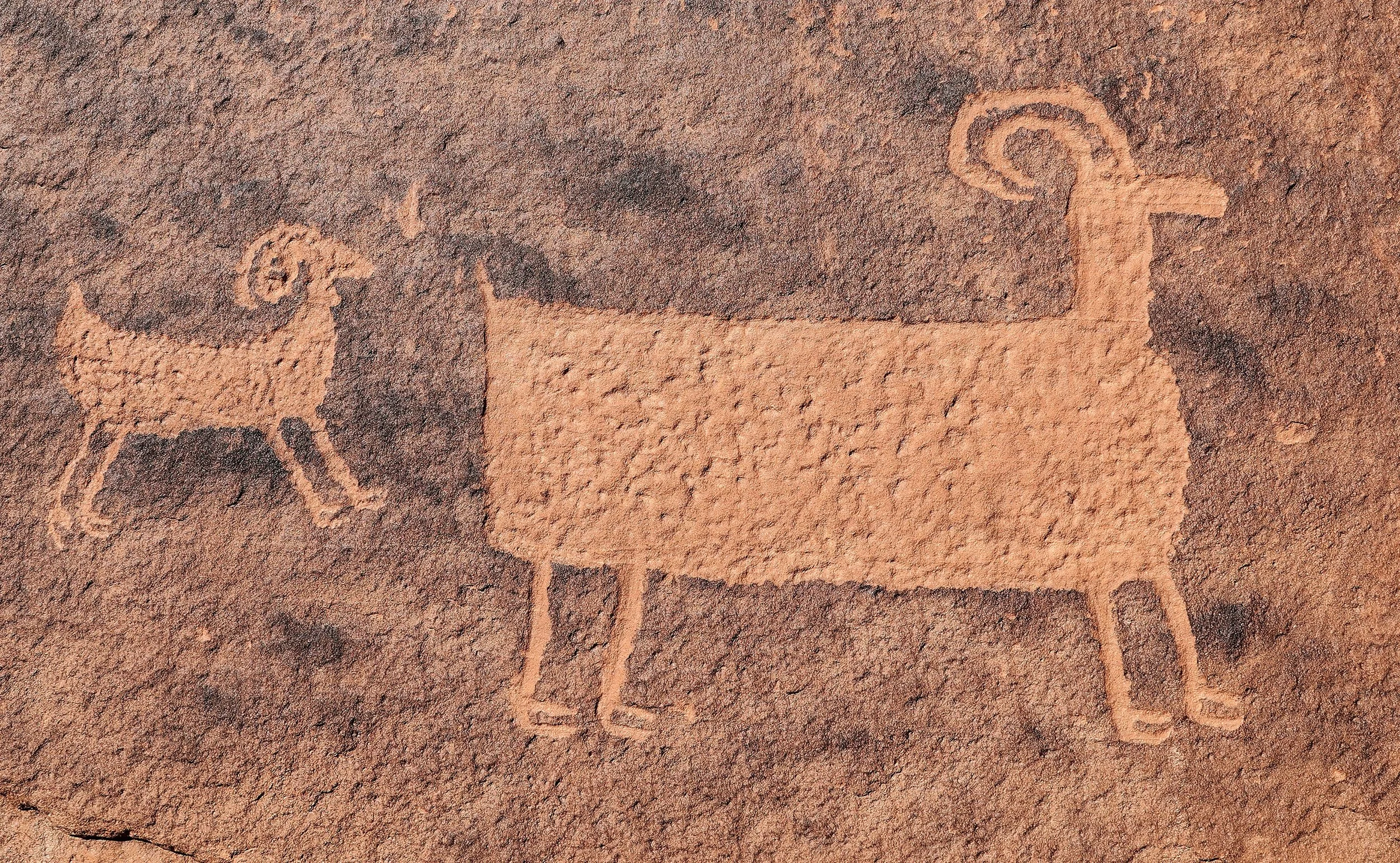
Exquisite detail in a couple of bighorn sheep glyphs.
Six more weeks of winter...
is forecast by these Wild Turkeys who saw their shadow early this morning in Castle Valley.

Female Wild Turkey (Meleagris gallopavo).

A well camouflaged rabbit...
foraging in the underbrush.

Desert cottontail (Sylvilagus audubonii).

Significant progress has been made...
on the Moab Uranium Mill Tailings Remedial Action (UMTRA) Project where nearly 80% of contaminated tailings and soils have been removed since 2009, relocated about 30 miles to the north at a disposal site near Crescent Junction, Utah. Here are the numbers and a project overview.


A glowing snowscape...
dimly illuminated by the new Moon, with Orion hovering above Castle Valley.
A cold and starry night...
descends upon Castle Valley, Utah, now a third of the way through winter.

One frame of a “nightlapse” shot on my GoPro Hero 9 Black shortly after sundown. Thirty second exposure at ISO 1600.
The high country slowly revealed...
showing where large cornices have been constructed from the historical record snowpack that has accumulated.

Scenic snowy landscapes...
may persist in the canyons in the Moab area for the week ahead, with frigid temperatures but little moisture predicted in the forecast.
