of Hidden Valley as the Sun rises two days prior to the winter solstice, captured by a GoPro early this morning. I shot a 90 minute-long time-lapse sequence of images (more than 600 shots) showing the dance of shadows along the sandstone escarpment where numerous petroglyph panels are found.


Near-solstice sunrise flare...
as seen from the White Temple ruin in Hidden Valley early this morning. Absolutely glorious. And quite COLD.
Though it’s not the actual winter solstice (still two days away) there was a weather window of perfect conditions that inspired eight intrepid adventurers to climb into Hidden Valley early this morning. We all scattered to various parts of the valley to make observations of how light played on various petroglyph panels near the shortest day of the year, and I nestled into the White Temple ruin with my camera. And waited. In the cold.

Sunrise is imminent in the deep notch between the two high and distant sandstone fins, or gnomons (the part of a sundial that casts a shadow).

Bang! Sunrise!

Minutes later a brightening landscape. Secret sauce for nice sun flares: f/22 aperture and a clean lens.

Looking back at the shadows cast by the sandstone fins, the gnomons, with the White Temple ruin marked as a O. An additional kiva-like structure sits atop the ridge at the X.

Wide view showing my observational position in the White Temple ruin in Hidden Valley.

Incredibly rare self portrait, with a couple of ancient friends. And an absolutely memorable day, with seven new friends.
Baking brownies and charging batteries...
in anticipation of a frigid ascent into Hidden Valley tomorrow in order to chase the rising Sun as first light falls on an array of petroglyph panels. A small yet determined group is prepared to make observations near the winter solstice while a clear weather window opens tomorrow. My focus is on both still and time-lapse photography, and I need to get an early start at 6 am at the trail head. The first half-mile climbs 660 ft but it will be dark and the predicted temperature is 14° F.


Three-dimensional terrain model showing the position of the rising Sun and the projected shadows on the landscape on the winter solstice. From Photo Ephemeris Web which is a very useful planning tool for astrophotographers.

Closer view at around 9:30 am on the winter solstice. Pin is at west end of Hidden Valley where I generally intend to place a GoPro for time-lapse photography.

Rory Tyler narrates his presentation on Hidden Valley Astronomical Observations.
The annual Audubon Christmas Bird Count...
was to take place today in the Castle Valley - Moab area, but for some reason has been cancelled. It’s an enormously unscientific survey but at least it increases interest and awareness of our feathered friends.

House Sparrow (Passer domesticus) peering in my window.
Here’s the list of frequent flyers around my place this last week, from most to least common:
Dark-eyed Junco
House Finch
House Sparrow
White-crowned Sparrow
Spotted Towhee
American Goldfinch
Common Raven
Collared Dove
American Kestrel
Sharp-shinned Hawk
Common Starling
Pinyon Jay
Western Bluebird
Western Meadowlark
Mars rising in the east...
this evening while the nearby sandstone cliffs catch the alpenglow of the setting Sun. The red planet rising above red rock canyon country. Perfect.

Nothing runs like a Deere...
and this beast still has a new Deere smell. A brand spanking new road grader sits ready and able to keep the Castleton Road open through the coming winter. Here’s some heavy equipment porn:


First tracks are shared...
between myself and the local mule deer on the recently fallen snow that dusts Castle Valley. Sunny and calm but chilly at noon, and sublimely quiet.

There’s a well camouflaged mule deer between my bike and the nearest green juniper.
A steep scramble to two obscure boulders...
on the northwest outskirts of Moab, high above the Kane Creek Road, reveals several interesting petroglyphs inscribed into the deeply varnished sandstone slabs. They’re always in the last place you’d expect.


Is this a map, showing a meandering river course and several tributaries?

Rory Tyler, local rock art whisperer and good friend. His excellent website: moabrockart.org.

View of the snow-draped high La Sal Mountains.
Prior to this mid-day outing, I joined Rory and a small group of devoted friends for breakfast to plan an observation campaign of rock art panels in nearby Hidden Valley on the morning of the upcoming winter solstice. I’ve got a location in mind to capture a time-lapse video of the event and we’re all hoping for good weather.
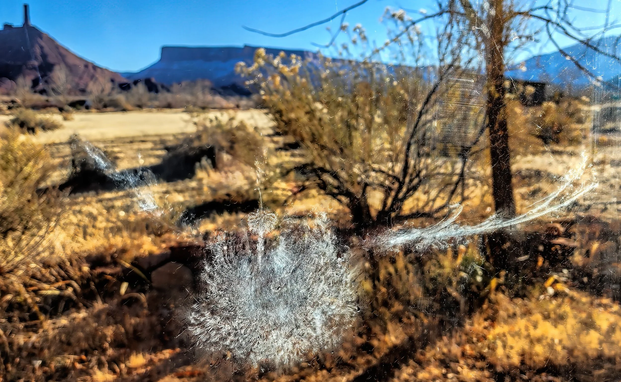
A ghostly impression of a dusty dove...
is preserved on my window, likely spooked and driven to impact the glass by an approaching predator. In this case the prey got away, albeit with a slight headache.
Everybody's gotta eat...
and this sparrow hawk is enjoying a late breakfast. This is the best image I could manage under very difficult lighting conditions, but you get the idea.

American Kestrel (Falco sparverius), also called the sparrow hawk, with prey.
A big gulp...
was taken by this late afternoon visitor to the bird bath. This muley drank down the entire volume in about a minute as I observed from inside the house. I am enjoying this behavior but it makes more work for me, lugging gallons of water each day to replenish the basin.

Thirsty mule deer (Odocoileus hemionus) with broken antler.
Unnecessary harassment of mule deer...
by the Utah Division of Wildlife Resources at Round Mountain this afternoon, where I witnessed a helicopter chasing herds at low altitudes and shooting nets at individuals. This is ostensibly in the name of science, which a conservation officer wouldn’t discuss with me when I raised questions about the activity. Unbelievable and highly aggravating.

Two mule deer slung below a Hughes 500 helicopter.

Two sedated mule deer on field examination tables, being tended to by DWR staff. Nobody would explain their activities.
Follow up: The DWR conservation officer told me that “no deer are ever injured” by the process. While the injury rate is low, it is certainly not zero: Assessing the Helicopter and Net Gun as a Capture Technique for White-Tailed Deer.
Breaking News on 8 December 2022:

From the Moab Times-Independent on 8 December 2022. Karma.
Here’s the full story in the Moab Times-Independent.
Love is in the air...
as a young buck closely follows a doe it has an eye on.

Young mule deer (Odocoileus hemionus) buck.

Mule deer doe.
Waiting in line early...
at the telescope for this evening’s star party. First in the queue, first at the eyepiece. Heh.

Handsome mule deer buck caught early this morning through the door window.
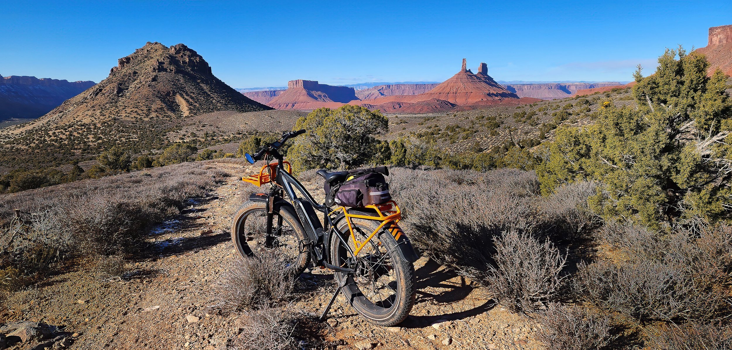
A cloud-free sky on a chilly day...
set the scene for a nice eMTB exploration of the area southeast of Round Mountain in uppermost Castle Valley. Quite the uphill climb (1,945 foot ascent) but the views are stunning, and the downhill run is big fun.

View south-southeast towards the La Sal Mountains, with Willow Basin on the left and Bald Mesa above Porcupine Rim on the right.
View northward, down valley, with Round Mountain on the left.

Portion of GPS track showing the area explored southeast of Round Mountain (lower right in image) on Google Earth.
The loveliest of days...

The circumference of a pumpkin...
divided by its diameter equals pumpkin pi. Happy Thanksgiving!

Occupancy has been exceeded...
in the bird bath this morning by a gang of Starlings working the neighborhood. Many, many dozens of them enjoyed the bath, during several visits throughout the day, requiring repeated refills.

Common Starling or European Starling (Sturnus vulgaris).
The Dewey Bridge area...
north of the Colorado River was explored with my neighbor today on our eMTBs, following a rough jeep track on the edge of the high escarpment. The ~13 mile ride was spectacularly scenic, sunny and comfortably warm. Priceless.
Panorama looking south, with Dewey Bridge on the Colorado River in the center of the image. (Click on image to embiggen.)

Typical southern Utah billboard.

Descending Kokopelli’s Trail above Dewey Bridge near the end of the three hour outing.
Prepping for a star party...
with friends and neighbors during the holiday week ahead. It will be certainly be cold, but the stars shine like bright crystals in the dark skies of southern Utah during the winter months. Jupiter and Saturn are particularly nicely placed for observation now, immediately after dark, so one doesn’t have to stay out late.

Celestron 11-inch Schmidt-Cassegrain telescope on a German equatorial mount.