working the seed heads in the rabbitbrush.
American Goldfinch (Spinus tristis).
working the seed heads in the rabbitbrush.

American Goldfinch (Spinus tristis).

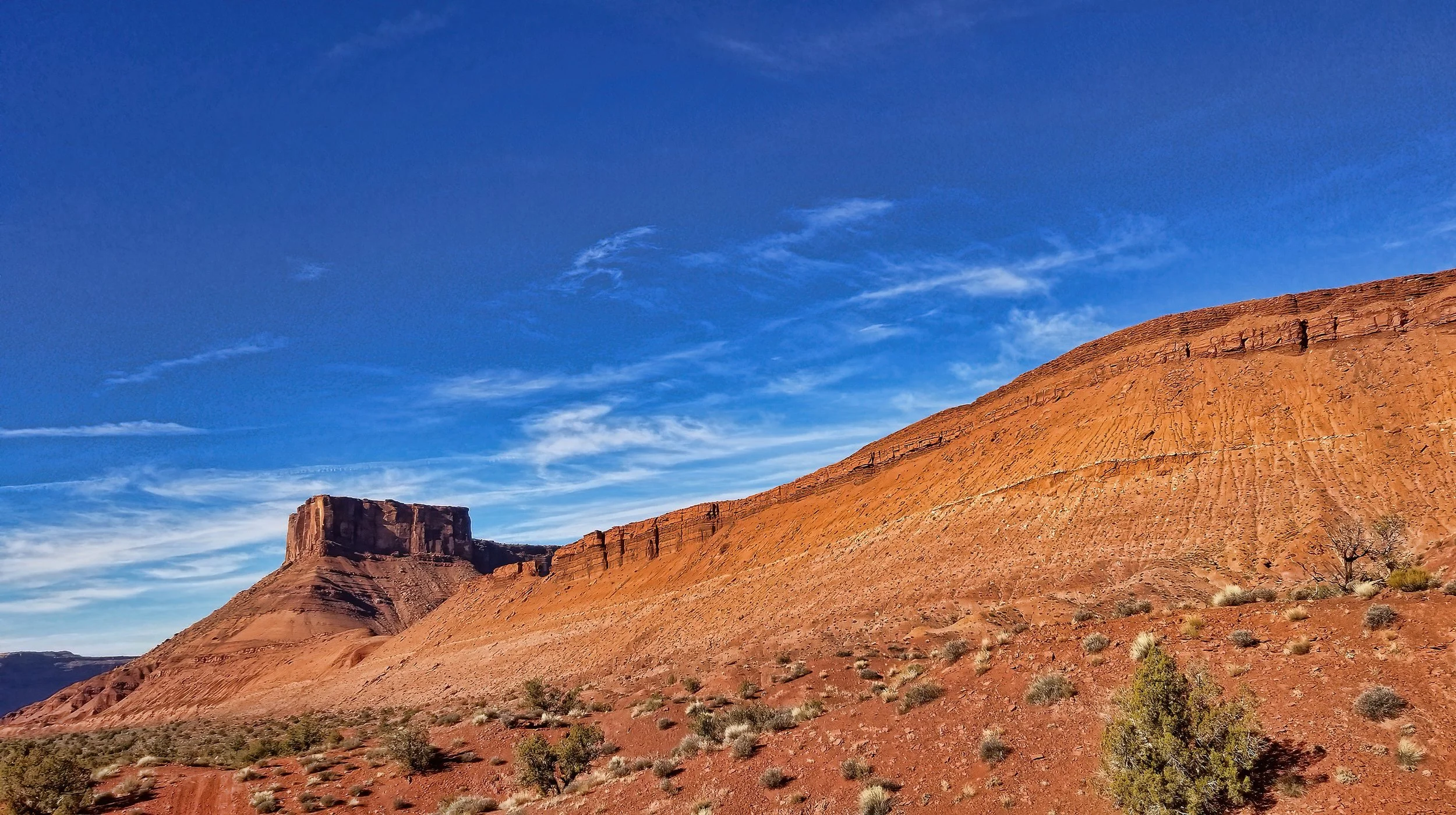
Parriott Mesa on another lousy autumn day in Utah. The winter solstice is still three weeks away.
on the radical RadRover 5 ebike! Still loads of fun.


by W.R. Halliday is the book that changed my life in junior high school, stimulating me to pursue a life of adventure, exploration and geology.

at the bird feeding stations that’s increasingly habituated to my presence, hence I’m able to get some nice close up images. Cool.

Sharp-shinned Hawk (Accipiter striatus).
that today is yet another obscenely gorgeous day in Utah.
Click on image to enlarge.
was discovered on my walkabout today and has been added to my rock garden as a rusty relic from the mining era.

at the bird feeding station to see what’s on the buffet for Thanksgiving dinner.

Sharp-shinned Hawk (Accipiter striatus).

for Thanksgiving. Yum!

from 300 million years of being entombed within the Permian-age Cutler Formation. Now that’s cause for a holiday celebration!

This quartz pebble was buried in the bed of a braided stream during deep geologic time, only to feel the warmth of the Sun’s rays for the last decade or so as erosion slowly lowered the surface, waiting with infinite patience for this day to arrive when I plucked it from its long slumber from the rocky outcrop, setting it free to roam upon the surface of the Earth once again!

Oh, the joy. Be free! Enjoy your travel through the watershed and into the Colorado River. Eventually this grain will abrade and break into smaller particles, only to be buried again centuries from now and incorporated into the rock record once again.
The geologic clock grinds on, whether we are here or not.
on BLM land near Round Mountain, ostensibly in the name of “fire suppression and mitigation,” occurred last week by a contract crew Yet the selection of downed trees is random and indiscriminate, and all the fuel has been left on the ground as seen in the images below. I intend to call the local BLM Field Office to learn more about this tree felling folly.


I estimate this tree is between 65 and 80 years old based on careful examination of the original high-res image. Many of the downed trees are likely more than a century old.
early in the day bring out the base jumpers, and here’s one enjoying a slow ride under canopy with Adobe Mesa in the background.

looms more than 1,700 feet (580 meters) above my vantage point where I captured this image. I’m scouting a scrambling route to access the light-colored spot about mid-slope below the prow, at the base of the Chinle/Moenkopi Formation contact, where I suspect carbonate deposits exist from a former spring.
Side note: I established a geocache at the very tip of the mesa top seen in this image in April 2012. Only two other determined explorers have claimed the cache to date! (Click image to enlarge.)
heralds tomorrow’s partial lunar eclipse where 97% of Luna will be shadowed, turning it a ruddy red. Here’s the technical beta: Partial Lunar Eclipse of 2021 Nov 19

channel has returned, a sign that water diversion for irrigation to a local ranch has ended for the season.

fabulously terrific autumn days. But it gets too dark too early.

is a fallen megachunk of the Wingate Sandstone (or Kayenta Formation), stranded by progressive erosion of the Cutler Formation bedrock base, now delicately balanced on the shrinking pedestal. Don’t sneeze when you’re near this thing.


Two good friends from Castle Valley provide a sense of scale of the balanced rock.
discharges from the basal contact of the Moenkopi Formation with the underlying Cutler Formation somewhere within this rockfall at the head of the drainage that I am exploring today.

Within this brushy thicket and rockfall at the base of Adobe Mesa, alkaline groundwater surfaces from the Moenkopi Formation. Note the white soils on the left foreground.

About 10 liters per minute flows in the main channel below the discharge point, incised about three to four meters below the alluvial terrace.

Carbonate precipitate on vegetation and soil surfaces in the area are also evidence of the alkaline nature of the spring.

My GPS track superimposed on Google Earth imagery. The spring is located at the highest point in the drainage, in the area of brighter vegetation.
has its headwaters in the La Sal Mountains but only flows during spring snowmelt and flash flood events. But when it contains water it is very capable of moving large clasts down the steep channel gradient.

View upstream in the Castle Creek channel showing a mix of sedimentary and igneous plutonic clasts.

View of alluvial deposits in the bank of Castle Creek below Adobe Mesa. My black bike helmet is near the center of the image for scale. Note the imbrication of many of the larger clasts, with a distinct upstream-dipping direction to the right.
of the trail on my ride today.
