Various vistas...

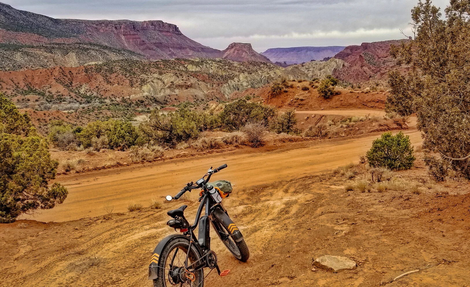
from my ride early this afternoon around Castle Valley, Utah. It’s like having a mountain bike park in your backyard!

The gate at the southern city limits, with the Round Mountain plagioclase-rich trachyte porphyry stock in the background.  It’s the cathode to Devils Tower’s anode.

The gate at the southern city limits, with the Round Mountain plagioclase-rich trachyte porphyry stock in the background. It’s the cathode to Devils Tower’s anode.

Panorama showing Adobe Mesa (left) to Castleton Tower (right). Here the track is within the strike valley consisting of Moenkopi Formation (Triassic) sandstone and mudstone red beds. (Click image to enlarge.)

Old jeep track with a commanding view of Castleton Tower, which consists of the Wingate Sandstone (Triassic-Jurassic) sitting atop the Chinle Formation (Triassic).

Old jeep track with a commanding view of Castleton Tower, which consists of the Wingate Sandstone (Triassic-Jurassic) sitting atop the Chinle Formation (Triassic).

Panorama showing Castleton Tower and the Rectory (left) to Adobe Mesa (right). My shadow in this image absolutely proves that I was there! (Click image to enlarge.)

I always appreciate a charming ranch gate.

I always appreciate a charming ranch gate.

For the nerds:  Here’s the GPS track recorded by my Garmin Fenix 6X Pro watch, superimposed on Google Earth, covering 17 miles and 1,600 feet elevation gain.

For the nerds: Here’s the GPS track recorded by my Garmin Fenix 6X Pro watch, superimposed on Google Earth, covering 17 miles and 1,600 feet elevation gain.

About that radical bike...

you’ve seen in a couple of recent posts: RadRover 5 by Rad Power Bikes.

The brochure shot. (Click image to enlarge.)

Built like a tank, drives like a sports car. Word of advice: Do not ride an electric bicycle of any kind unless you are ready to buy it.

DECEMBER UPDATE: While I very much like the bike, the customer service at Rad Power Bikes leaves a lot to be desired. Buyer beware.

An eMTB exploration of Onion Creek...

was huge fun, especially because of the interesting geology exposed along the way. Read more here:

GEOSIGHTS: THE ONION CREEK SALT DIAPIR, GRAND COUNTY.

Although the sky looks threatening, it was a pleasant and warm day for riding the 10 mile-long road with 1,600 feet of elevation gain. This panoramic image caught where Onion Creek is incising through sandstone beds of the Cutler Formation. (Click image to enlarge.)

Stinking Spring emerging from the gypsum caprock of the Paradox Formation (Pennsylvanian) that constitutes the body of the salt diapir.  Note the white bacteria in the spring water.

Stinking Spring emerging from the gypsum caprock of the Paradox Formation (Pennsylvanian) that constitutes the body of the salt diapir. Note the white bacteria in the spring water.

Filamentous sulfur-reducing bacteria living in the discharge of appropriately-named Stinking Spring.

Filamentous sulfur-reducing bacteria living in the discharge of appropriately-named Stinking Spring.

At the head of Onion Creek looking north across the olive-colored gypsum caprock of the Paradox Formation diapir. Red beds in near-right foreground are part of the Cutler Formation (Permian).

At the head of Onion Creek looking north across the olive-colored gypsum caprock of the Paradox Formation diapir. Red beds in near-right foreground are part of the Cutler Formation (Permian).

My road to recovery...

from my full hip replacement surgery just seven weeks ago continues strong! I’ve been out on my bike each of the last four days on various terrains and the pedaling is very therapeutic, but the several falls not so much (the doc doesn’t need to know about that).

Track map from my Garmin Fenix 6x Pro watch for Friday’s ride.

Track map from my Garmin Fenix 6x Pro watch for Friday’s ride.

One of my groundwater monitoring wells in Castle Valley, and my bad ass RadRover 5 eMTB.

One of my groundwater monitoring wells in Castle Valley, and my bad ass RadRover 5 eMTB.

round mtn stock.JPG

Yellowstone National Park...

early last week, during my travels south to Utah.

Geothermal steam during a chilly early morning at Norris Geyser Basin, the hottest part of the caldera.

Geothermal steam during a chilly early morning at Norris Geyser Basin, the hottest part of the caldera.

Norris Geyser Basin painted with various colorful heat-tolerant bacteria.

Gibbon Falls (84 feet (26 m) tall).

Gibbon Falls (84 feet (26 m) tall).

So-called Black Pool at West Thumb.

So-called Black Pool at West Thumb.

Fishing Cone on the shore of Yellowstone Lake at West Thumb.  Jim Bridger tells a tall tale here:  “When he needed a quick meal, Bridger would catch a trout and reel it in slowly, allowing time for it to cook on the line as it passed through the hot…

Fishing Cone on the shore of Yellowstone Lake at West Thumb. Jim Bridger tells a tall tale here: “When he needed a quick meal, Bridger would catch a trout and reel it in slowly, allowing time for it to cook on the line as it passed through the hot water.”

Grand Prismatic Spring at Midway Geyser Basin. (Click image to enlarge.)

Elk calf slowly nodding off on the warm ground near a geothermal vent.

Elk calf slowly nodding off on the warm ground near a geothermal vent.

YNP-elk.jpg
YNP-two-elk.jpg
Grand Geyser, in the Upper Geyser Basin, fountaining as high as 200 ft (60 m).

Grand Geyser, in the Upper Geyser Basin, fountaining as high as 200 ft (60 m).

Last but not least, Old Faithful.

Last but not least, Old Faithful.

Missing in action...

due to a fractured femoral neck and total hip replacement surgery! I was getting a little too rascally on my new electric mountain bike in early September! Paramedics had to come to my aid and scrape me up off the rocks. Doh.

BEFORE: Finger is pointing to fractured femoral neck on my right hip. Ouch.

BEFORE: Finger is pointing to fractured femoral neck on my right hip. Ouch.

AFTER: Installed titanium prosthetic.  Recovery is proceeding exceptionally well!

AFTER: Installed titanium prosthetic. Recovery is proceeding exceptionally well!

UPDATE: My recovery is strong now 28 days post-surgery. I’m more than a bit frustrated by the doc’s limitations but I am taking it slowly and cautiously and doing my own physical therapy. I’ll be back!

Breaking news as wildfire burns...

just one mile west of my residence in the Scabland pines, near Cheney, Washington. Local police knocked on my door around 1:30 pm PDT and ordered my evacuation, so I grabbed my camera gear and chased the story.

Tinder dry conditions in the rangelands and ponderosa pine forests in rural eastern Washington are easily ignited mid-summer, but the cause of this fire remains unknown at this time.

Tinder dry conditions in the rangelands and ponderosa pine forests in rural eastern Washington are easily ignited mid-summer, but the cause of this fire remains unknown at this time.

The Air Tractor AT-802 in the Fire Boss configuration with pontoons, capable of carrying 820 US gallons of water.

The Air Tractor AT-802 in the Fire Boss configuration with pontoons, capable of carrying 820 US gallons of water.

Water drop underway with nearly 7,000 pounds of weight loss on the airframe.

Water drop underway with nearly 7,000 pounds of weight loss on the airframe.

904-fire-water-drop-2.jpg
Mopping up hot spots after the air drops.

Mopping up hot spots after the air drops.

904-fire-plume-sun-flare.jpg

RE-POST: Mars 2020 mission is ready to launch...

atop an Atlas V-541 rocket from Cape Canaveral, carrying the next-generation scientific rover, named Perseverance, this Thursday, 30 July 2020 at 7:50 am EDT. Link to more information about this extraordinary machine: Mars 2020 Perseverance Rover. Landing on the red planet will occur in late February 2021.

What fascinates me, though, is that this robotic geologist will land on/near an ancient deltaic system that enters the crater from the west. I have lectured about this landform and depositional system in various courses from physical geology, fluvial geomorphology, sedimentology and stratigraphy, and more.

Image of fluvial-deltaic system on west side of Jezero Crater. False color image from NASA.

Image of fluvial-deltaic system on west side of Jezero Crater. False color image from NASA.

Photo-geologic map of Jezero crater quads showing exposed bedrock and surficial units. Blue circle indicates the landing ellipse. From Williams et al., 2020 (pdf). Related on-line article: Here’s How Scientists Mapped the Perseverance Rover’s Landin…

Photo-geologic map of Jezero crater quads showing exposed bedrock and surficial units. Blue circle indicates the landing ellipse. From Williams et al., 2020 (pdf). Related on-line article: Here’s How Scientists Mapped the Perseverance Rover’s Landing Site.

Another night under the stars...

in eastern Washington. Wonderful.

Once again the ISS zooms by overhead shortly after sunset in this minute-long exposure.

Once again the ISS zooms by overhead shortly after sunset in this minute-long exposure.

Another satellite trail above the Milky Way, plus Jupiter and Saturn, and Antares.

Another satellite trail above the Milky Way, plus Jupiter and Saturn, and Antares.

Comet NEOWISE in the ponderosa pine trees. Look closely and you can spy the very faint ion tail (rising nearly vertically from the comet nucleus) in addition to the brighter dust tail (that broadens and angles to the right). Learn more here: Why Doe…

Comet NEOWISE in the ponderosa pine trees. Look closely and you can spy the very faint ion tail (rising nearly vertically from the comet nucleus) in addition to the brighter dust tail (that broadens and angles to the right). Learn more here: Why Does Comet NEOWISE Have Two Tails?