back in southeastern Utah.
Winter storm blankets Castle Valley the day after my arrival!
back in southeastern Utah.


Winter storm blankets Castle Valley the day after my arrival!
Early morning at the Snake River Overlook. This view was made famous by Ansel Adams in 1941, but today, there are too damn many trees for a similar photograph. (Click image to enlarge.)

Ranch site at Mormon Row with the Grand Teton and Mount Owen looming in the distance.
early last week, during my travels south to Utah.

Geothermal steam during a chilly early morning at Norris Geyser Basin, the hottest part of the caldera.
Norris Geyser Basin painted with various colorful heat-tolerant bacteria.

Gibbon Falls (84 feet (26 m) tall).

So-called Black Pool at West Thumb.

Fishing Cone on the shore of Yellowstone Lake at West Thumb. Jim Bridger tells a tall tale here: “When he needed a quick meal, Bridger would catch a trout and reel it in slowly, allowing time for it to cook on the line as it passed through the hot water.”
Grand Prismatic Spring at Midway Geyser Basin. (Click image to enlarge.)

Elk calf slowly nodding off on the warm ground near a geothermal vent.


Grand Geyser, in the Upper Geyser Basin, fountaining as high as 200 ft (60 m).

Last but not least, Old Faithful.
due to a fractured femoral neck and total hip replacement surgery! I was getting a little too rascally on my new electric mountain bike in early September! Paramedics had to come to my aid and scrape me up off the rocks. Doh.

BEFORE: Finger is pointing to fractured femoral neck on my right hip. Ouch.

AFTER: Installed titanium prosthetic. Recovery is proceeding exceptionally well!
UPDATE: My recovery is strong now 28 days post-surgery. I’m more than a bit frustrated by the doc’s limitations but I am taking it slowly and cautiously and doing my own physical therapy. I’ll be back!
on a hot summer morning, especially by these Western Bluebirds.


shot this morning at 5:45 am PDT.

from images shot today on the lake.


NOTE: Images were processed with Topaz Lab’s “Glow” plugin for Adobe Photoshop/Lightroom.
caught at 2:30 am PDT this morning.

Handheld Canon 5Div with 500 mm prime lens, ISO 100, 1/100th sec at f/4.5.
allow for easier photography and a less turbid water column.

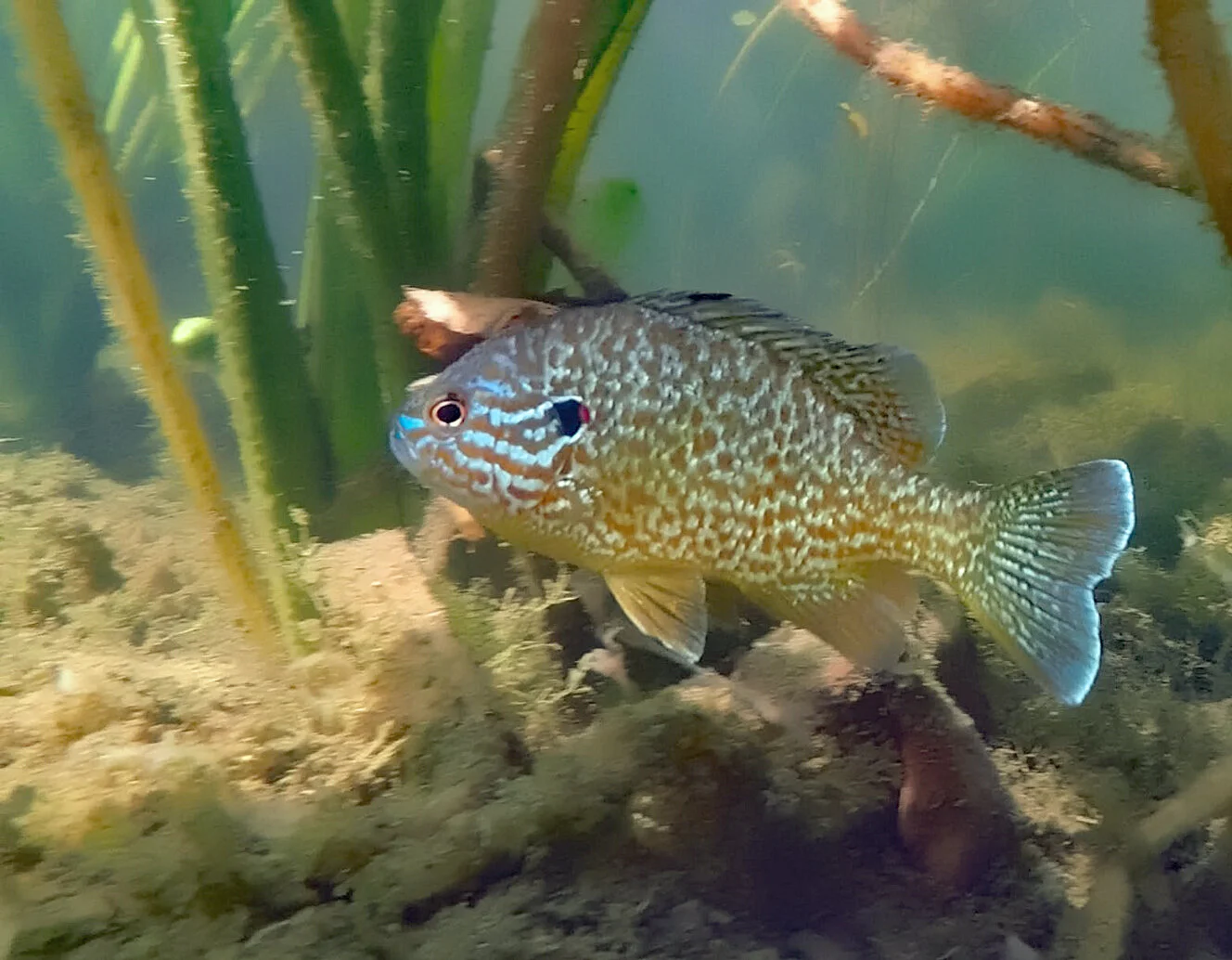
Pumpkinseed sunfish (Lepomis gibbosus).

GPS track of my paddling route, sticking close to the lily pads around the perimeter of the water body.
just one mile west of my residence in the Scabland pines, near Cheney, Washington. Local police knocked on my door around 1:30 pm PDT and ordered my evacuation, so I grabbed my camera gear and chased the story.

Tinder dry conditions in the rangelands and ponderosa pine forests in rural eastern Washington are easily ignited mid-summer, but the cause of this fire remains unknown at this time.

The Air Tractor AT-802 in the Fire Boss configuration with pontoons, capable of carrying 820 US gallons of water.

Water drop underway with nearly 7,000 pounds of weight loss on the airframe.


Mopping up hot spots after the air drops.

where there’s a fascinating universe just below the water surface.


atop an Atlas V-541 rocket from Cape Canaveral, carrying the next-generation scientific rover, named Perseverance, this Thursday, 30 July 2020 at 7:50 am EDT. Link to more information about this extraordinary machine: Mars 2020 Perseverance Rover. Landing on the red planet will occur in late February 2021.
What fascinates me, though, is that this robotic geologist will land on/near an ancient deltaic system that enters the crater from the west. I have lectured about this landform and depositional system in various courses from physical geology, fluvial geomorphology, sedimentology and stratigraphy, and more.

Image of fluvial-deltaic system on west side of Jezero Crater. False color image from NASA.

Photo-geologic map of Jezero crater quads showing exposed bedrock and surficial units. Blue circle indicates the landing ellipse. From Williams et al., 2020 (pdf). Related on-line article: Here’s How Scientists Mapped the Perseverance Rover’s Landing Site.
the water surface in nearby Fish Lake.

Frame grab from a 1080p video shot on my GoPro Hero 5 Black as I experiment with various settings and sun angles.


in eastern Washington. Wonderful.

Once again the ISS zooms by overhead shortly after sunset in this minute-long exposure.

Another satellite trail above the Milky Way, plus Jupiter and Saturn, and Antares.

Comet NEOWISE in the ponderosa pine trees. Look closely and you can spy the very faint ion tail (rising nearly vertically from the comet nucleus) in addition to the brighter dust tail (that broadens and angles to the right). Learn more here: Why Does Comet NEOWISE Have Two Tails?
in eastern Washington, just west of Cheney, America. Hands down this is the best naked-eye comet since Hale-Bopp in 1997.


Bonus shot: That’s the International Space Station streaking over the comet in a 30 second-long image.
and my paddleboard is my desk this summer in eastern Washington. The tyrant governor can’t make me wear a mask out here!

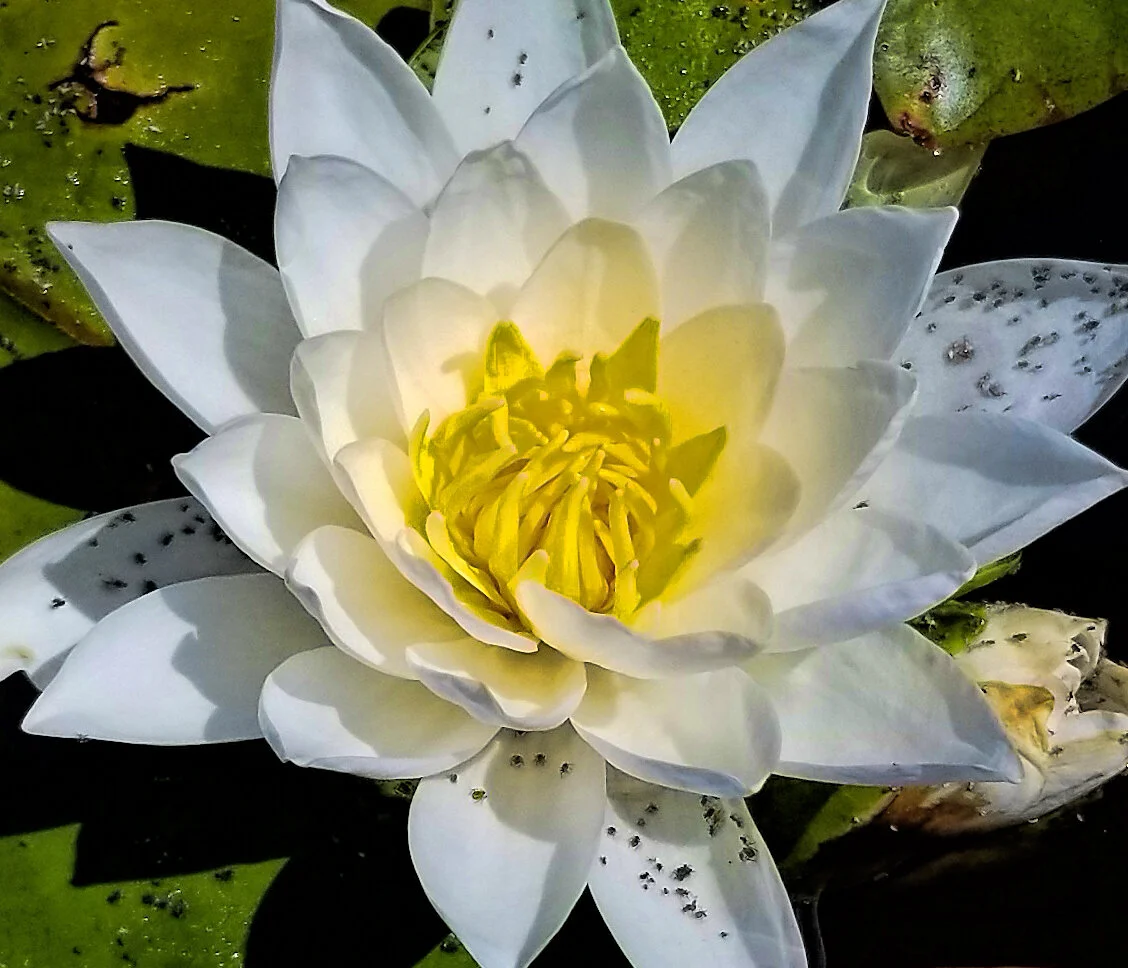
The beautiful blossom of the introduced fragrant or white waterlily (Nymphaea odorata).


The flower of the native great yellow pond-lily (Nuphar polysepala).
is now a spectacular naked-eye object. Get up at least an hour before sunrise and cast your gaze toward the north-northeast, low above the horizon, to spy this fleeting visitor to the inner solar system. You can’t miss it.

Shot with tripod-mounted Canon 5Div and 500 mm prime lens, ISO 3200, 1 sec at f/4.0.
UPDATE: This comet is now an easy evening object to see toward the north-northwest, a little more than an hour after sunset: How to See Comet NEOWISE in the Night Sky This Month. Super in binoculars! Get out and take a look… you can sleep when you’re dead.
Click image to enlarge finder chart.

Shot at around 10:30 pm PDT on Monday, 13 July.
in the Wind River range near Pinedale, Wyoming.


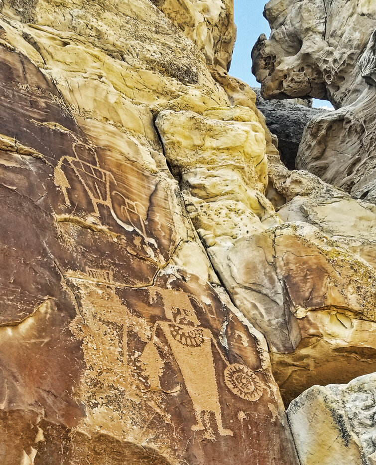
in the form of Fremont-style petroglyphs at McKee Springs.


as I embark on a northward-bound road trip. First stop, Dinosaur National Monument.
