to keep him/her company in the nest, and I’ve given the name Racket to the second chick for obvious reasons.
Look carefully and you can spot the second chick in the nest.
to keep him/her company in the nest, and I’ve given the name Racket to the second chick for obvious reasons.


Look carefully and you can spot the second chick in the nest.
at Corona Arch, above the Potash Road near Moab, Utah. Just another night at the office.

The underside of the arch was dimly illuminated with two small LED panels, while Saturn and Jupiter dominate the center of the image, captured about 3 am MDT.

last night in Arches National Park yielded the following results.

This 20 second-long image was not light-painted, but rather illuminated by the diffuse glow from vehicle headlights on the park road. That’s the glow of Moab in the far right.

This star trail image consists of 42 images for 21 minutes total duration. I dimly lit the monolith with a small LED panel for the last of the 30 second-long shots in the sequence.
above Castleton Tower on the evening of the 17th of June.


This image was captured the evening of the 19th of June, beginning near the end of nautical twilight in order to capture the beautiful blue hues after sunset.
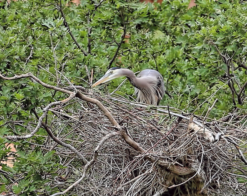
the heron chick (that’s what I’m calling it) that finally popped up in the nest this morning.


A turkey vulture (Cathartes aura) swoops by and clearly spies the chick in the nest.

A Yellow-Breasted Chat (Icteria virens) along the river.
atop an Atlas 5 rocket from Cape Canaveral, carrying the next-generation scientific rover, named Perseverance, Monday, 20 July 2020 at 9:15-11:15 am EDT. Link to more information about this extraordinary machine: Mars 2020 Perseverance Rover. Landing on the red planet will occur in February 2021.
What fascinates me, though, is that this robotic geologist will land on/near an ancient deltaic system that enters the crater from the west. I have lectured about this landform and depositional system in various courses from physical geology, fluvial geomorphology, sedimentology and stratigraphy, and more.

Image of fluvial-deltaic system on west side of Jezero Crater. False color image from NASA.

Photo-geologic map of Jezero crater quads showing exposed bedrock and surficial units. Blue circle indicates the landing ellipse. From Williams et al., 2020 (pdf). Related on-line article: Here’s How Scientists Mapped the Perseverance Rover’s Landing Site.
is my hero. The Mediterranean tamarisk beetle (Diorhabda elongata) was introduced along the Colorado River about ten years ago in an effort to biocontrol the spread of saltcedar in the riparian zone.

Macro shot of adult beetle, about 5 mm long.
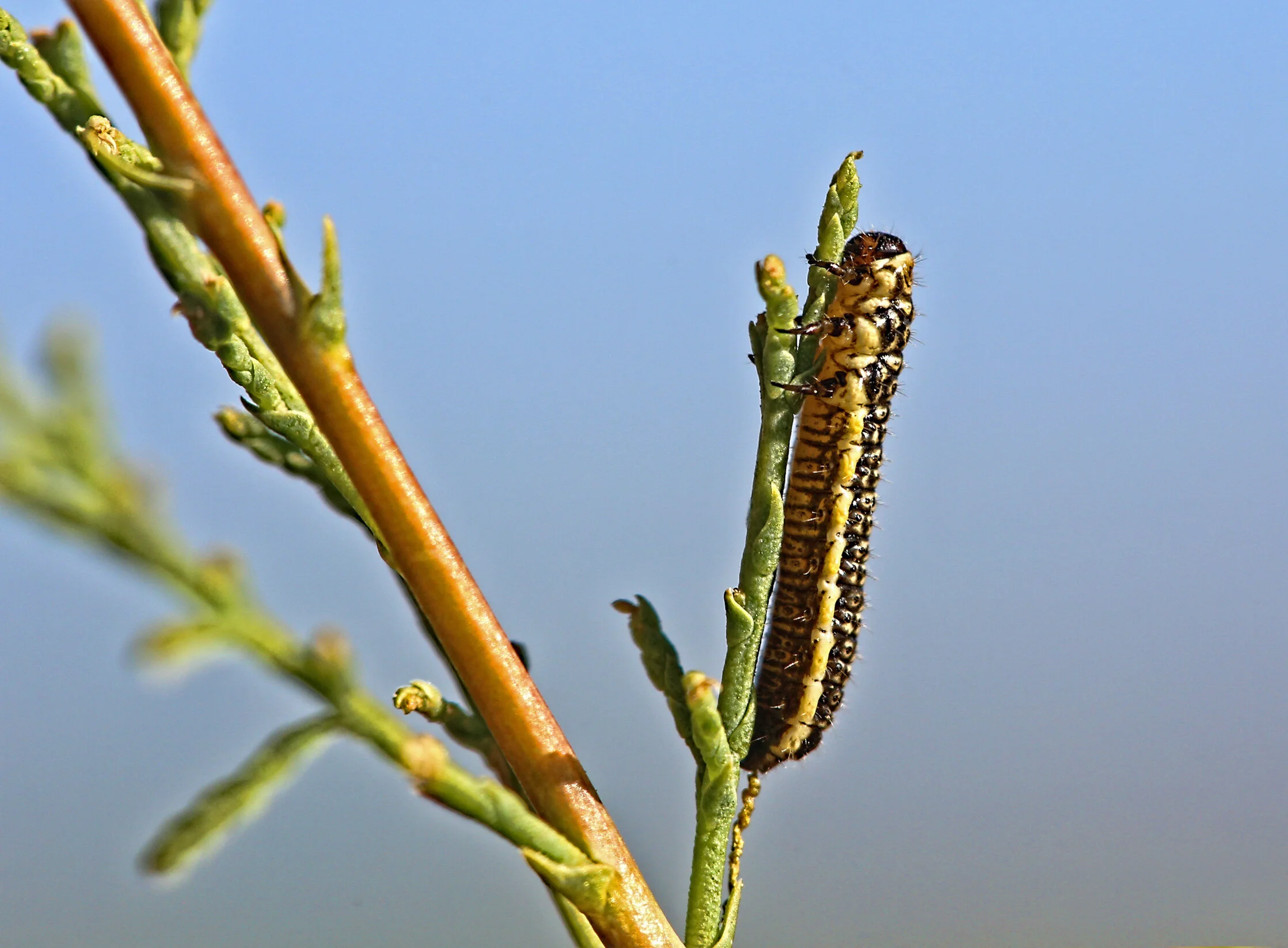
Macro image of one of three larval stages munching away on a tamarisk stem. Body length approximately 6-7 mm.
as I sip my second cup of coffee. These guys scoot all over this place and are quite fascinating and it’s entertaining to watch their stalking behavior.

The northern whiptail lizard (Cnemidophorus tigris septentrionalis) can grow to nearly 4.5 inches (~ 11 cm) in length.


That gnat is history.
on the Colorado River.


near the base of Castleton Tower. Just need to wait another week for the night skies to darken during the upcoming new Moon.

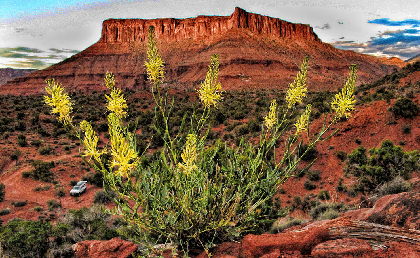
Prince’s Plume (Stanleya pinnata) in bloom below Adobe Mesa.
of the San Rafael River as seen from the Wedge Overlook. Here are several various views under different lighting conditions.
Long shadows begin to creep into the deep canyon late in the day. (Click image to enlarge.)


The rim consists of the Middle Jurassic Carmel Formation while the bottom of the canyon exposes the Upper Triassic Chinle Formation.
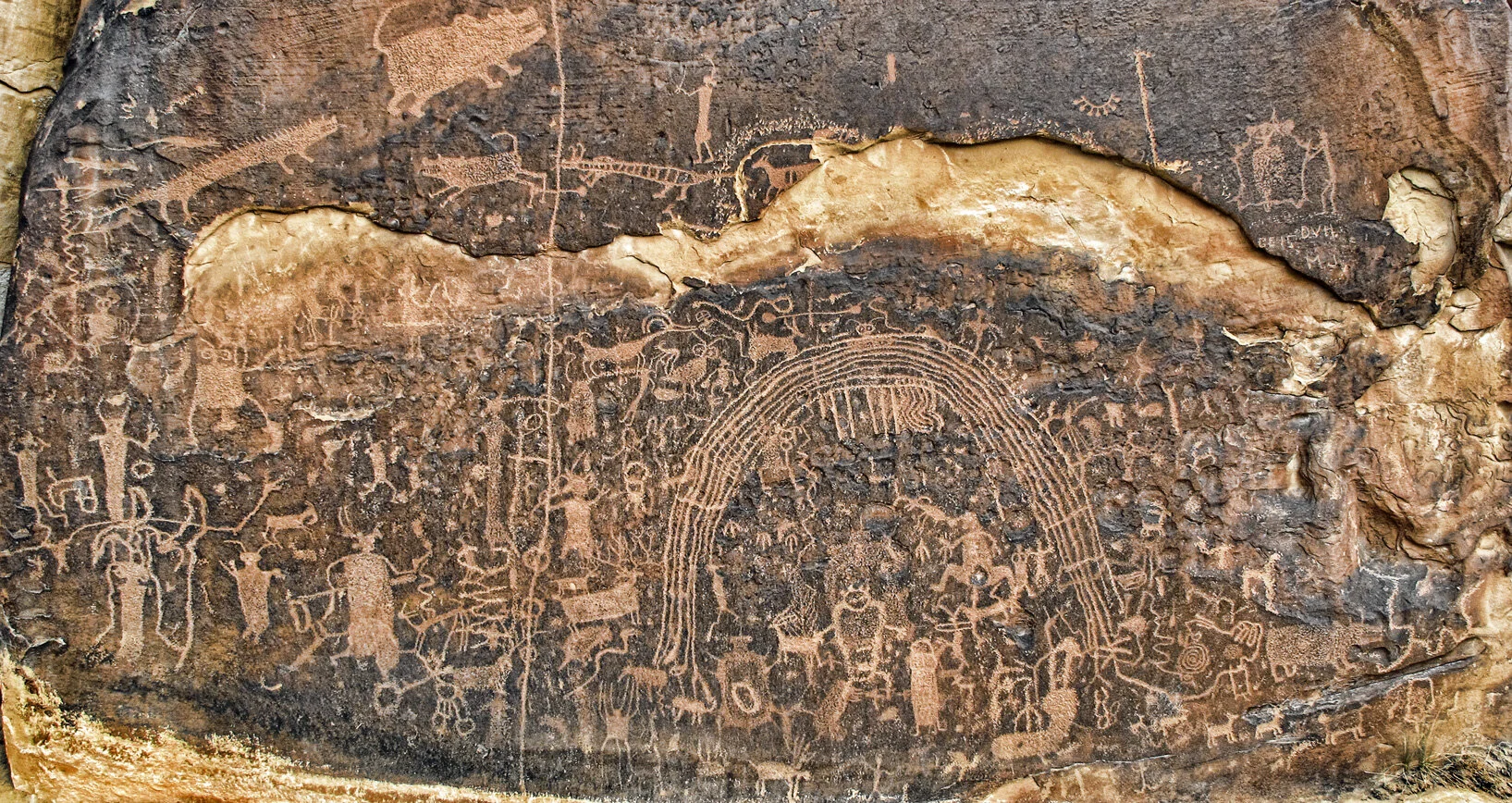
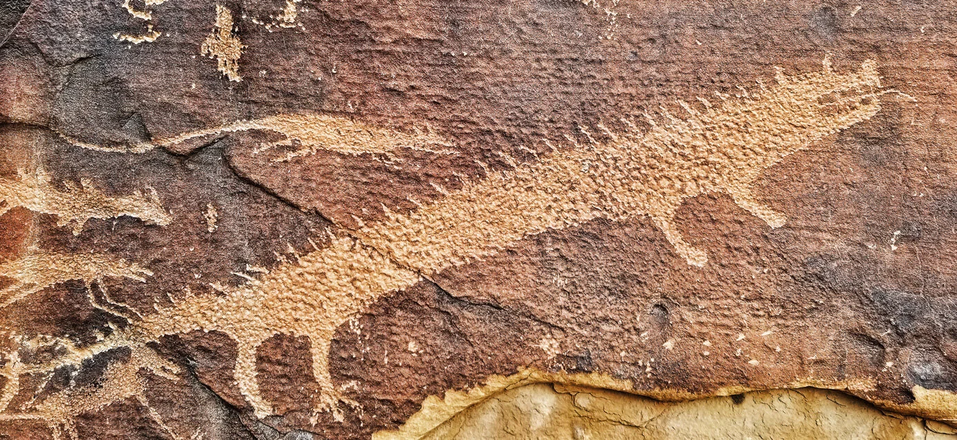
near Emory, Utah has the most fascinating zodiac-like arch as the focal point of the darkly varnished sandstone wall. This site is also included in my top five Colorado Plateau rock art localities.
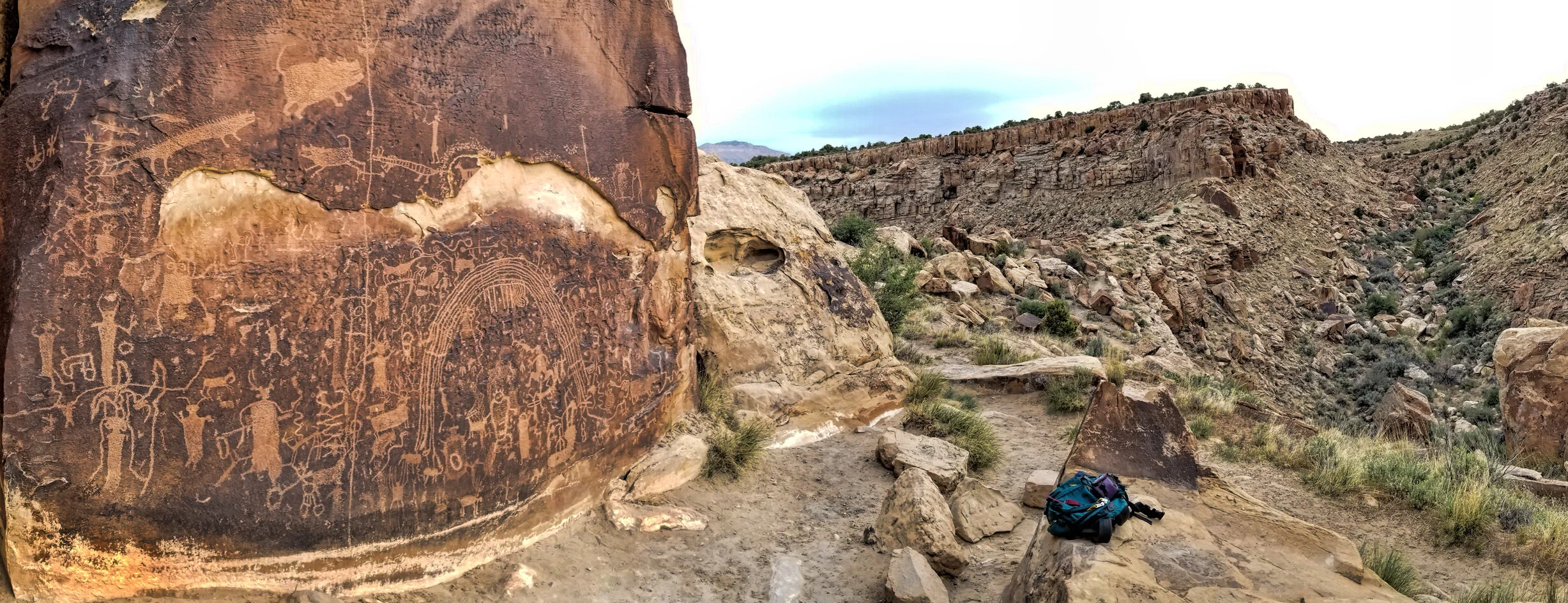
The trailhead to this site is on the plateau, a half-mile in the distance. This panel stands out as a “billboard” immediately above a stream confluence.

near Clawson, Utah, at a claim known as “Septarianville.” This gray and dreary landscape is dominated by the presence of the Mancos Shale (Cretaceous), and the nodules are found in the lowermost member.


Large nodules exposed along the bedding plane. One needs to work slowly with chisels and crack hammers in order to extract one of these monsters.

Small, whole nodule on left, with a cracked specimen showing interior filled with calcite and aragonite.

This large nodule broke into three beautiful parts.

Close-up of nodule interior filled with amber or white/clear calcite surrounded by dark, blackish to red bands of aragonite and also filled with sharp rhombohedral calcite crystals.
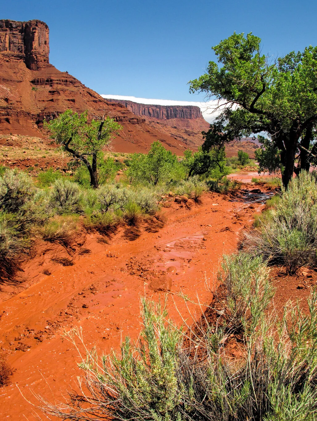
occurred in Castle Valley this morning where about one-half inch of rain fell, accompanied by high winds and countless lightning strikes.

The ditch running in front of my property - an uncommon occurrence.
Unnamed arroyo at Peach Beach, where it enters the Colorado River.

The Colorado River running about 15,000 cfs. Now do you understand where it gets its name?

Flowing pour-off across from Sandy Beach on the Colorado River, between Moab and Castle Valley.
a little after 10 pm MDT this evening, 254 miles above my red rock hacienda, zooming by at 16,000+ mph. I offer this image as a salute to the SpaceX team that docked the first crewed Dragon capsule with the station earlier in the day, ending a nine year long hiatus of the ability of the US to launch astronauts since the abandonment of the space shuttle program a decade earlier. Kudos, SpaceX!!

Tripod-mounted Canon 6D with 14 mm Rokinon lens at f/2.8, ISO 100, 180 second exposure. The foreground was illuminated by the ambient light of the waxing Moon.
in the northern San Rafael Swell is among my top five favorites.


on the Colorado River, just a few miles upstream from Castle Valley, Utah, during the last new Moon. I wandered a short distance up the Amphitheater Trail to set up behind these conglomeratic hoodoos in the Cutler Formation.


Bottleneck Peak (6,403 ft) in the San Rafael Swell. Couldn’t resist this shot! Cheers!
above Parriott Mesa and Castleton Tower.
Click image to enlarge.
This star trail image was assembled from 120 shots made around 2 am this morning, each 30 seconds in duration. Tripod-mounted Canon 6D with 14 mm Rokinon lens at f/2.8, ISO 400. Stacked and blended with StarStaX.
on a mini-expedition to dig septarian nodules, explore the endless canyons and old copper and uranium mine sites, examine and photograph interesting petroglyph and pictograph panels, and generally knock around and have a good time. Several friends from Colorado will join in the big fun, taking about a week, and the weather forecast looks fabulous.

Sunset captured from the Wedge Overlook of the Little Grand Canyon of the San Rafael River, elevation around 6,300 feet. View is directly east, and the river is about 1,200 feet below the rim. I shot this several years ago during spring, immediately after an intense thunderstorm. I also recall that great numbers of spadefoot toads emerged and made quite a racket with their croaking.