at Kötlujökull Mýrdalsjökull, the fourth largest glacier in Iceland.
The dark material incorporated into and on the glacial ice is ash and cinder from countless volcanic eruptions.
The interior of a natural tunnel in the glacial ice.
at Kötlujökull Mýrdalsjökull, the fourth largest glacier in Iceland.

The dark material incorporated into and on the glacial ice is ash and cinder from countless volcanic eruptions.

The interior of a natural tunnel in the glacial ice.
drops 60 meters (197 feet) and one can explore behind the enormous curtain of water.


Skógafoss, a short distance from Seljalandsfoss, is one of the biggest waterfalls in Iceland, with a width of 25 meters (82 feet) and a drop of 60 meters (200 feet).
last erupted in April 2010 and disrupted air traffic over northern Europe for more than a week.

The volcanic edifice illuminated by the morning light.

NASA image of eruption plume emanating from the southern tip of the island.
rises to 1,450 meters (4,756 feet) and today we drove to the summit of the second largest ice cap in Iceland in two “super jeeps.”

View of the ice cap from the lower outwash plain.


View southeastward from the summit of Langjokull glacier across the rift valley (mid-ocean ridge) toward Hekla volcano, approximately 50 km (30 miles) distant.
were the highlights of our first full day of exploration east of Reykjavik, Iceland. An outstanding day!

Steam column from Strokkur geyser following an eruption.

Water mound signaling the beginning of an eruption.

Eruption underway!

Strokkur Geyser in full eruption, with column height approaching 35 meters (115 feet).

Gullfoss waterfall on the Hvíta River, plunging 32 meters (105 feet) in two steps.

Lower waterfall at Gullfoss with glacially scoured columnar basalt in the foreground.

Rift valley at Þingvellir National Park, a sub-aerial portion of the northern Mid-Atlantic Ridge divergent margin. In this view towards the southwest, rocks to the right side of the path belong to the North American plate while those on the left are part of the Eurasian plate.
of the island nation of Iceland where more than half the country’s population is concentrated in this urban center.
Panorama of Reykjavik (click image to enlarge).

The 240 ft (73 m) high tower of Hallgrimskirkja cathedral, the architecture of which is inspired by columnar jointed basalt.
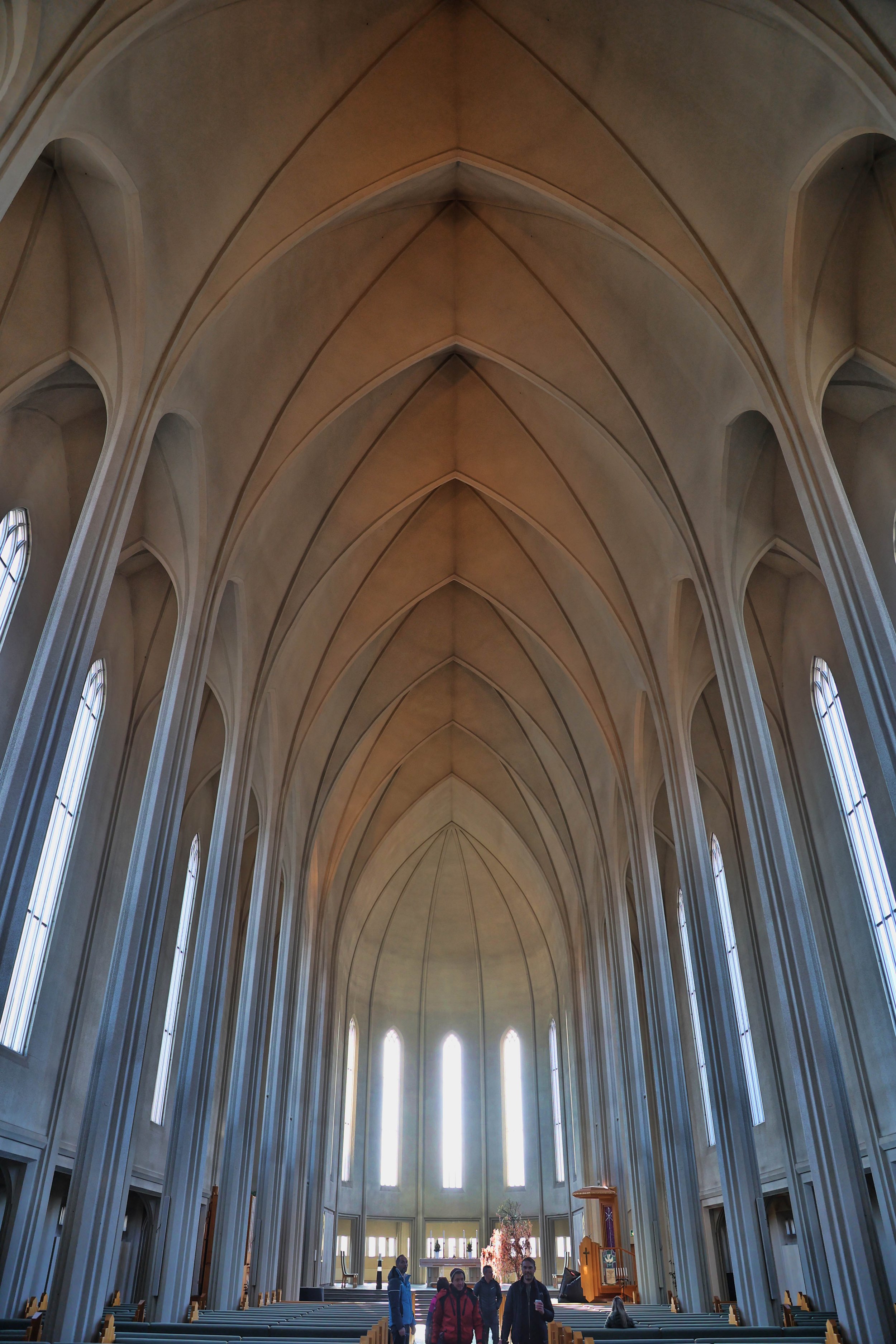
The spartan interior of Hallgrimskirkja cathedral.
between Seattle, Washington and Keflavík, Iceland that I’ll be flying today, visualized in the graphics below. Remember, geologists always get window seats!

The straight-line air route appears to follow an arc of a circle when visualized on a Mercator projection of the globe.
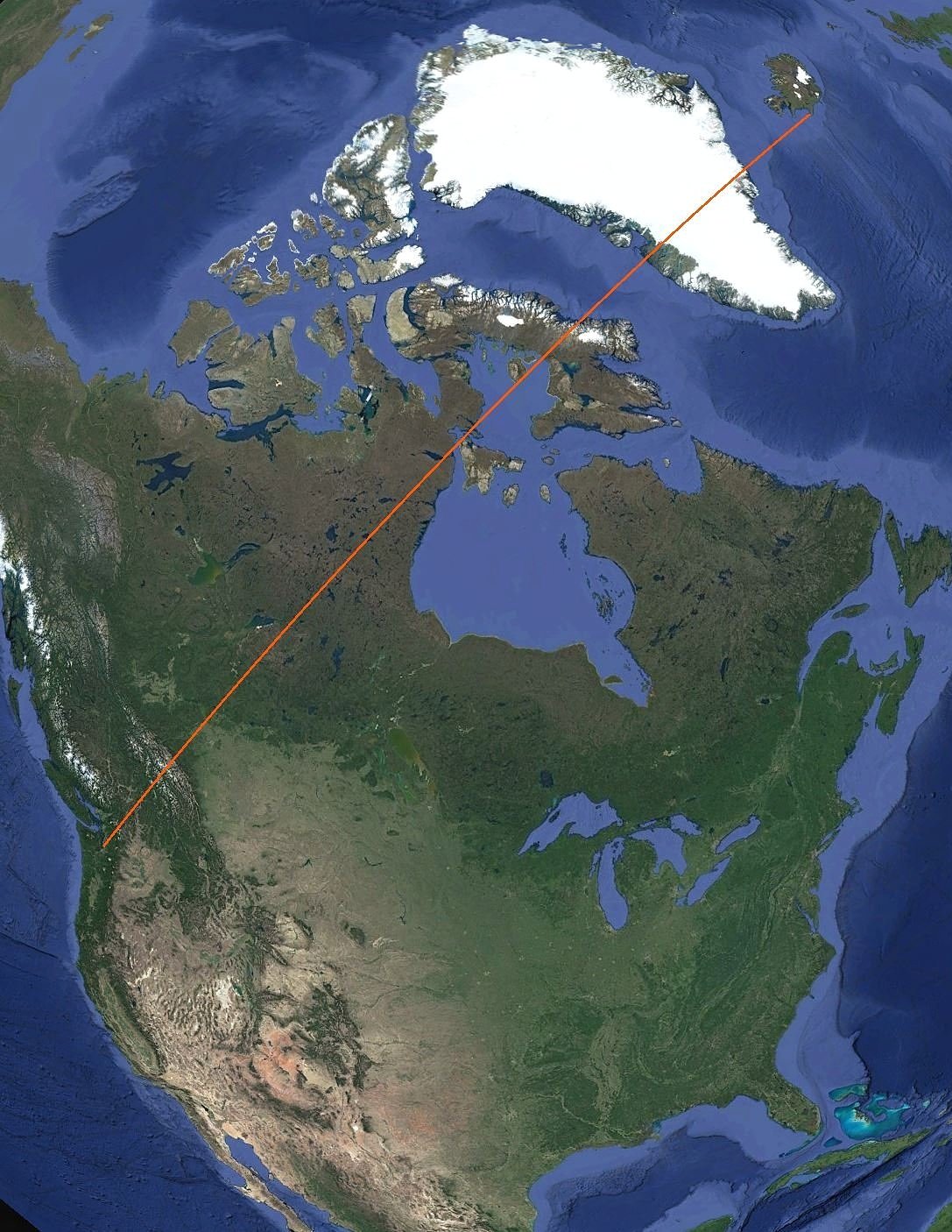
The air route from SEA to KEF is 3,622 miles (5,830 km) and takes about 7.5 hours flight time.
for the upcoming trip to Iceland. Here’s my camera kit that I’ll carry that consists of two camera bodies and three lenses:
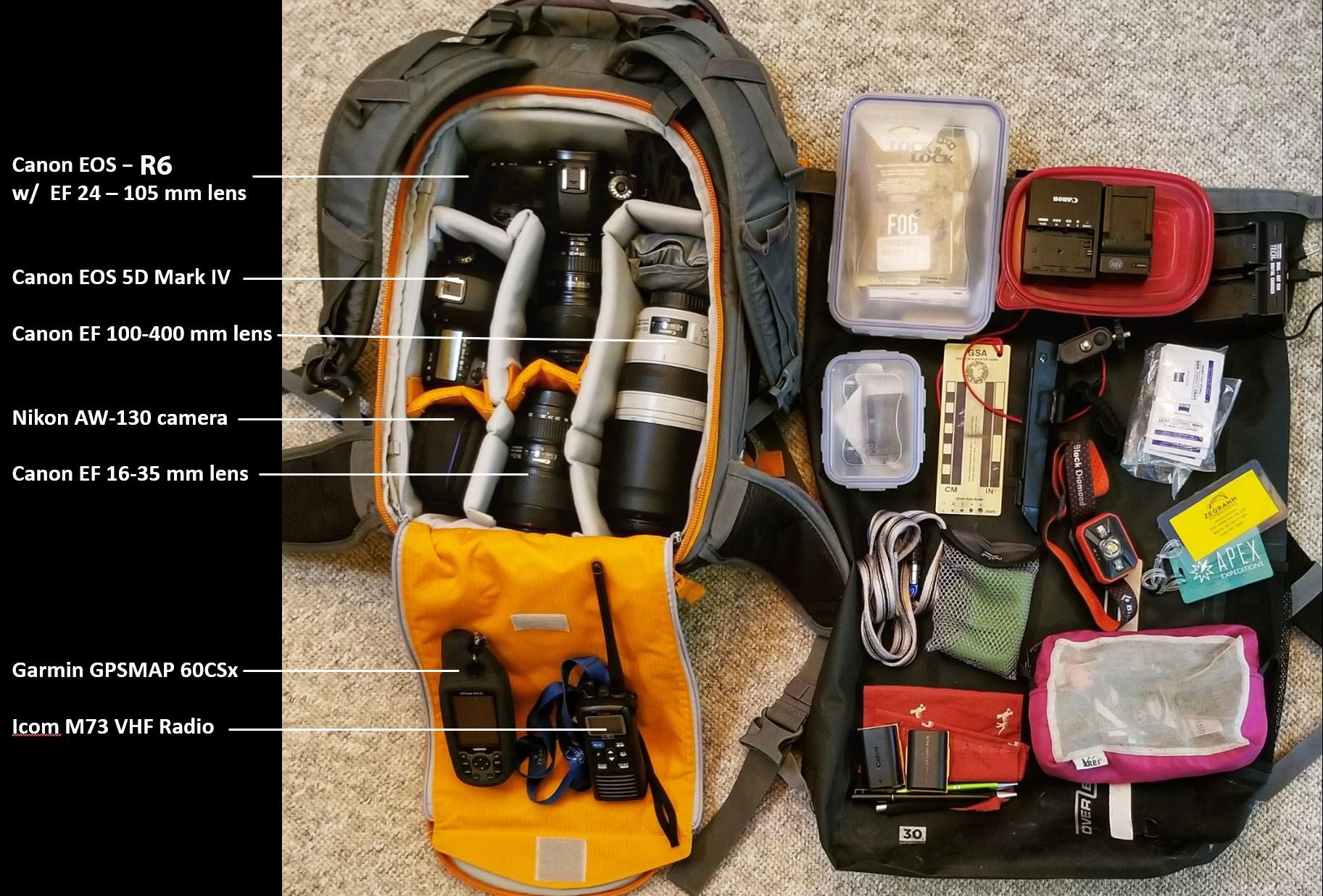
Not shown here is a small carbon-fiber tripod suitable for travel. I’m also taking several neutral density and polarizing filters, and an intervalometer/cabled remote for aurora photography.
along the Fish Lake Trail occurred during the past winter, but it doesn’t appear to represent a hazard to trail users. I am concerned, however, about the undermining of the adjacent columns, which if left unsupported, could topple onto the trail.

I estimate the weight of the dropped column to be at least 7 tons (6,350 kg). That’s my green RR5 for scale, the northern variant of my bike in Utah.

Note the erosion of the lower sedimentary contact beneath the basalt columns on the left of this image.
in great numbers from the pine forest floor, indicating the arrival of spring in eastern Washington.
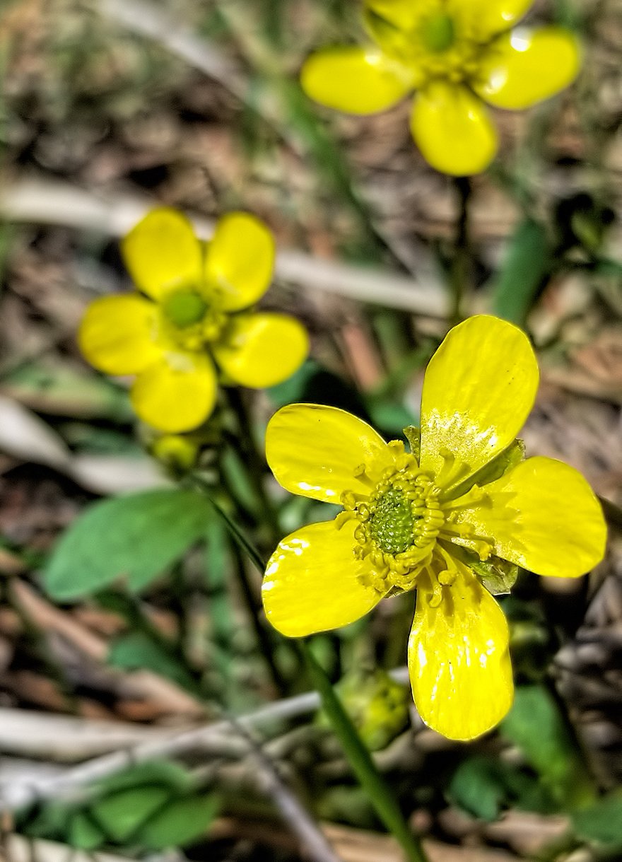
Buttercup (Ranunculus sp.).
of my typical bike rides, in Utah and in Washington state. Both maps shown below are represented at nearly the same scaling.

Track for a 25 mile ride with 1,700 foot vertical ascent in Castle Valley, Utah.

Track for a 21 mile ride with 460 foot vertical ascent in Cheney, Washington.
I was caught out on a plague ship at the leading edge of the Covid crisis and this is the epic story of my repatriation.

The Silver Explorer expedition ship, operating in the icy fjords of southern Chile, March 2020, the day before the lockdown.

Me in a N95 mask driving a Zodiac from the Silver Explorer to an awaiting ferry at the beginning of our dramatic escape under the cover of darkness. Read the linked story! Image credit: Ross McDonald.
could be a title for a captivating murder mystery but it perfectly describes the semi-bloody scene on the back deck early this morning.

on the trail with beautiful spring-like weather and near perfect trail conditions before heading north to prep for travel to Iceland.

UPDATE 15 March 2022: Rode my final ride today, at least for a short while. Twenty-five joyful miles. It’s that fun and conditions are that good. I will miss this place for the next month.
was had in Hellroaring Canyon today with a group of about a dozen intrepid explorers seeking an audience with the Comet Thrower. The short hike involves a very sporting and exposed downclimb into the canyon via a series of ledges in the canyon wall.


View westward into Hellroaring Canyon, with the Kachina Towers on the left.

The magnificent Comet Thrower pictograph.

View eastward towards the Kachina Towers. The red circle marks the location of the Comet Thrower on the enormous Wingate Sandstone wall.

Rock art savant Rory Tyler mind-melding with a spooky anthropomorphic equinox marker.
from an earlier uranium mining era, slowly rusting away below the rim of Rill Creek Canyon.


Rill Creek Canyon, tributary to the North Fork of Mill Creek.
sits in a remote corner of Arches National Park and was the focus of a long hike today in search of hidden pictographs somewhere in the complexly jointed terrain.

View south towards the La Sal Mountains.

Stratiform malachite mineralization (Cu₂CO₃₂) in the Salt Wash Member of the Morrison Formation (Upper Jurassic).

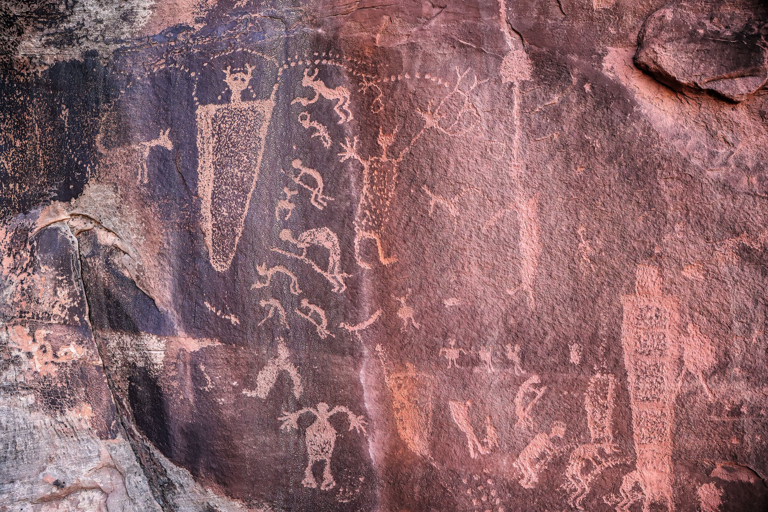
Look closely at this image to see petroglyphs carved over the older pictographs.

GPS track overlain on Google Earth for the 9.3 mile (1,300 foot vertical) exploration.
in an obscure part of Arches National Park took a small group of us to the compelling and relatively unknown Goose Panel, depicting a variety of bighorn sheep and geese and goslings.
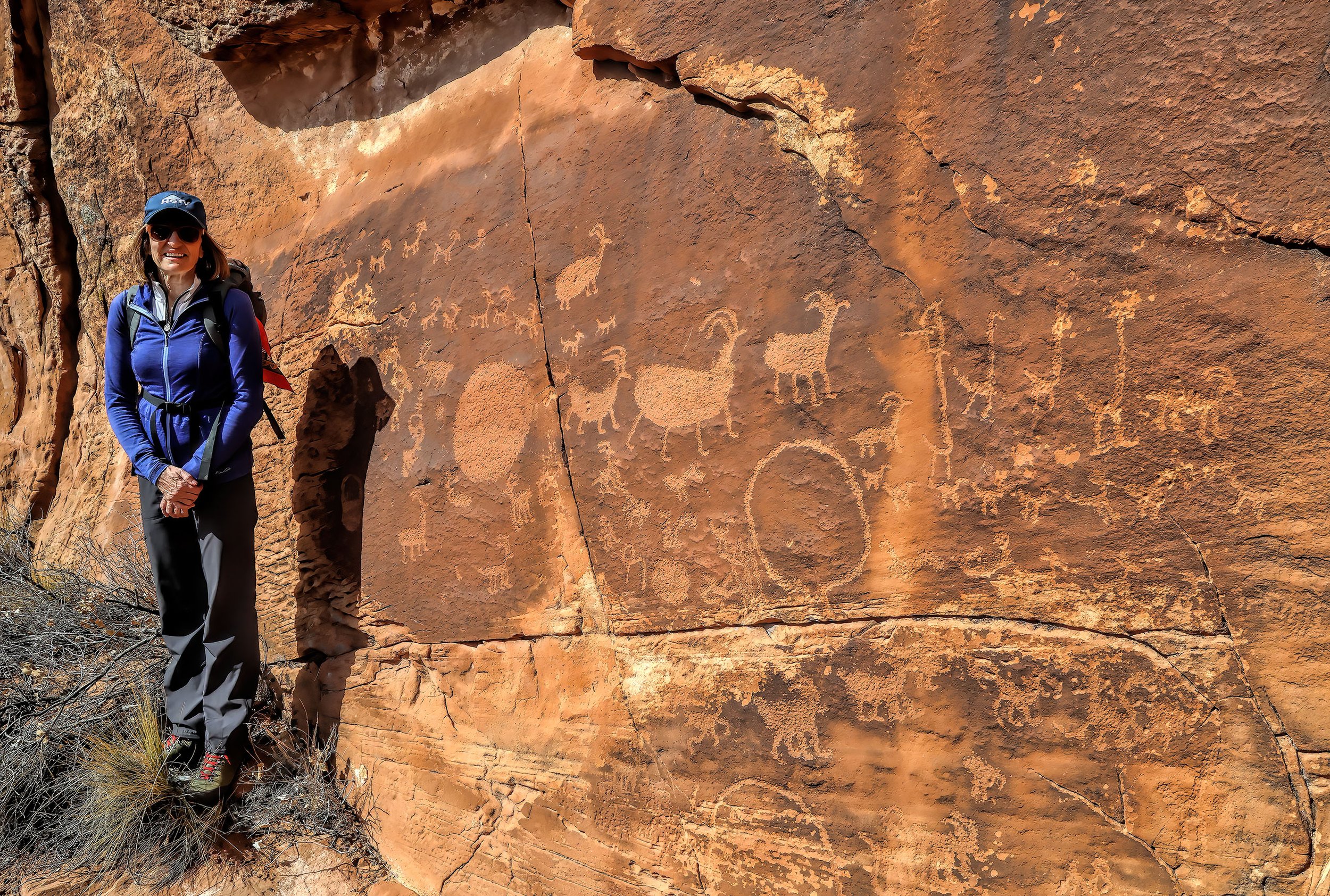
The Goose Panel.

An abundance of chert in the area was likely a large draw for the ancients to this location.

The four, tall, long-necked figures to the right are interpreted to be geese, with the smaller glyphs beneath them thought to be goslings.
was the primary objective of a 20 mile ride today on Willow Springs Road, one of the back roads into Arches National Park. It was the second ride by my neighbor, BH, on his new eMTB, a RadRover 6, the successor to my RadRover 5. It was big fun and he was ecstatic.

View through the Eye of the Whale.

View towards Balanced Rock, The Windows and the high La Sal Mountains from Willow Springs Road.

Balanced Rock.

RadRover 6 (left) and RadRover 5 (right) at the unattended back door entry station to the park.
north of Moab, Utah was the location of a walkabout today in order to examine petroglyphs with local rock art expert Rory Tyler.

“Supplication Panel” detail.

Local rock art whisperer Rory Tyler and a bighorn sheep petroglyph.
Here’s a link to Rory’s new website, under development: moabrockart.org