on our first approach to South Georgia.
The Allardyce Range, draped in glacial ice and snow, rises to nearly 10,000 ft above sea level.
Folded turbidite sequences in the Cumberland Bay Formation, with Lyell Glacier in foreground.
on our first approach to South Georgia.

The Allardyce Range, draped in glacial ice and snow, rises to nearly 10,000 ft above sea level.

Folded turbidite sequences in the Cumberland Bay Formation, with Lyell Glacier in foreground.
following the ship this afternoon between the Falklands and South Georgia.
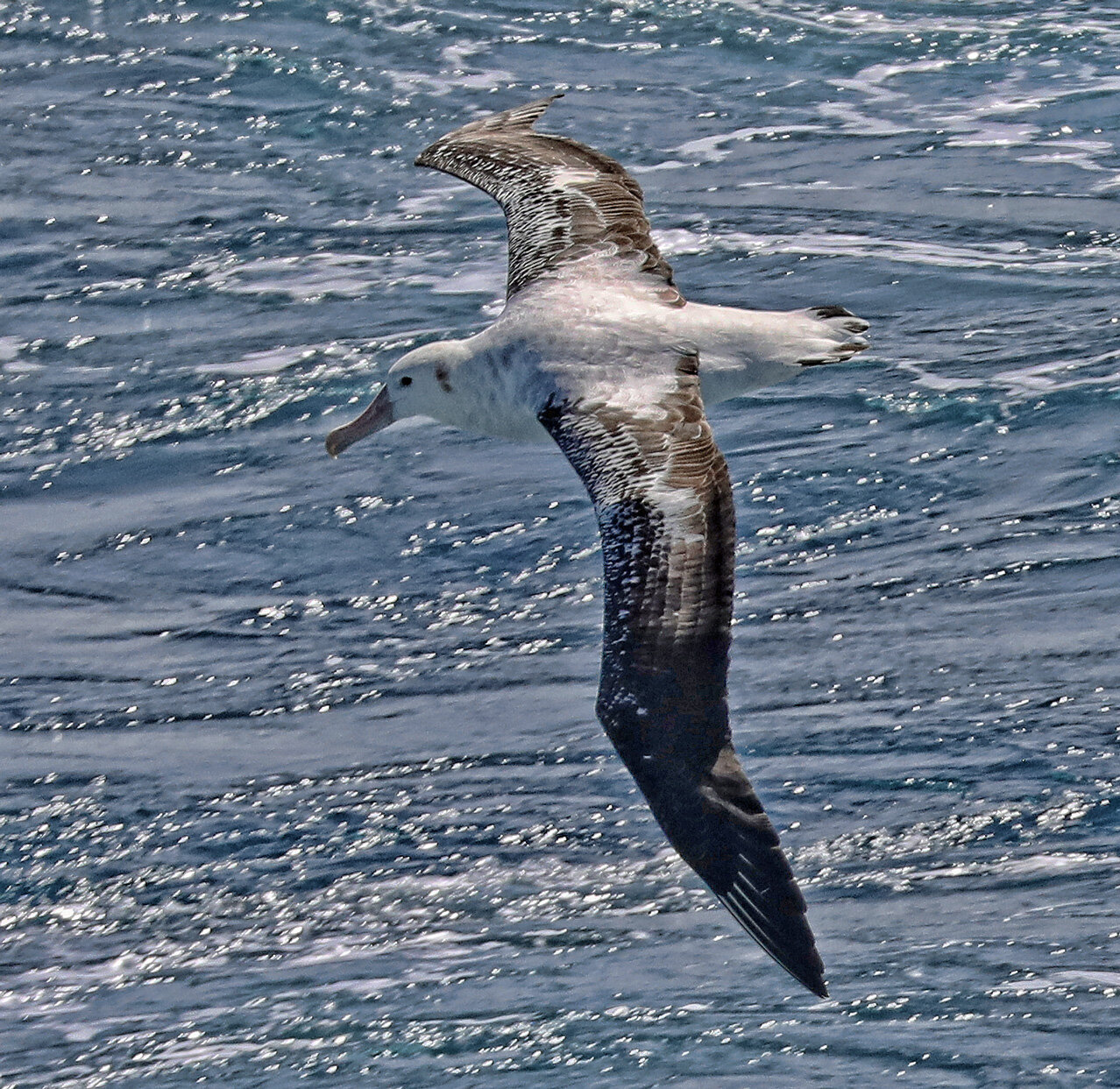
Wandering Albatross, wingspan nearly eleven (11) feet!
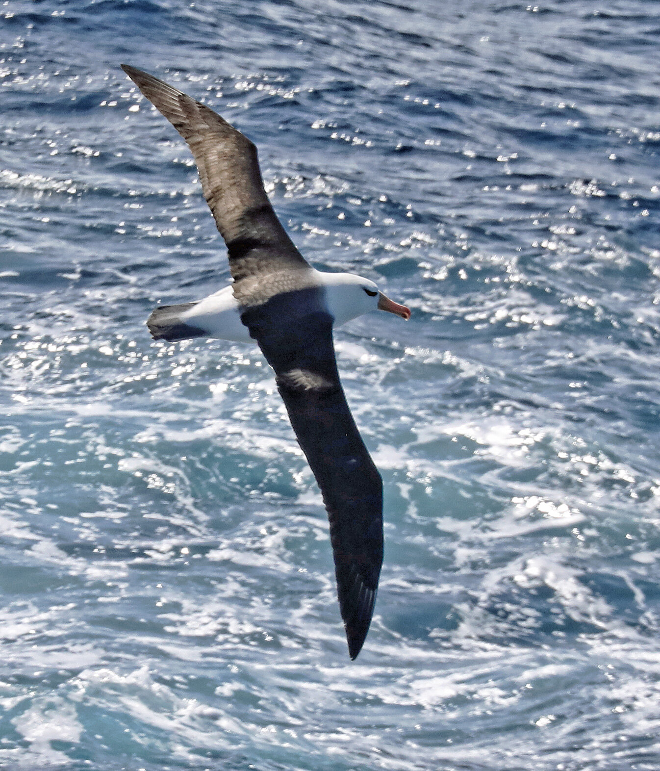
Black-Browed Albatross, wingspan approximately eight (8) feet.
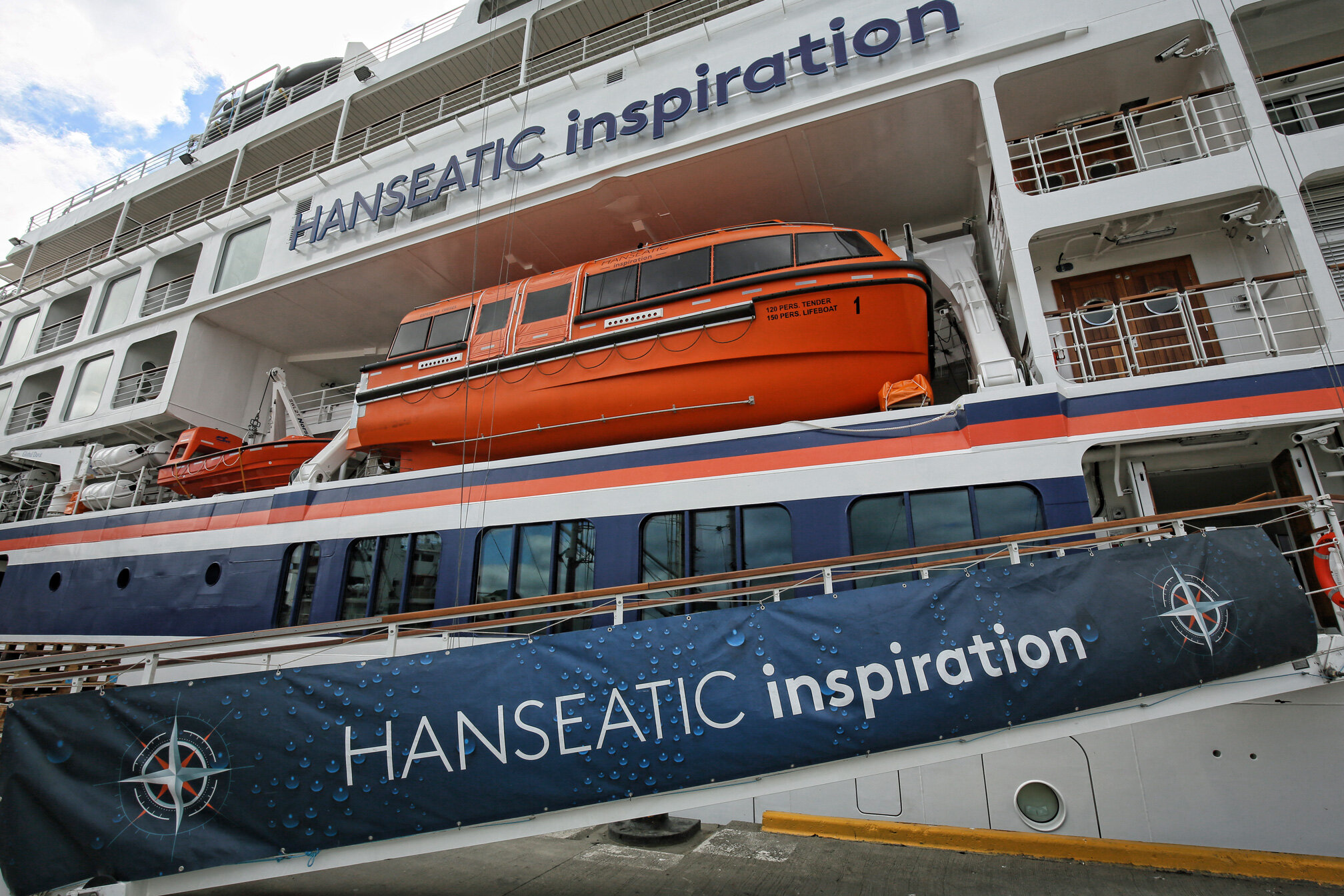
for the next three weeks aboard the brand new expedition ship Hanseatic Inspiration.

The lecture theater with floor-to-ceiling high resolution panels. There’s even a bar, something not found in most university lecture halls!

The “Ocean Academy” where lecturers can engage in hands-on activities.

My home office, with my own balcony!
in the northwestern part of the Falkland Island group is our first expedition landing.
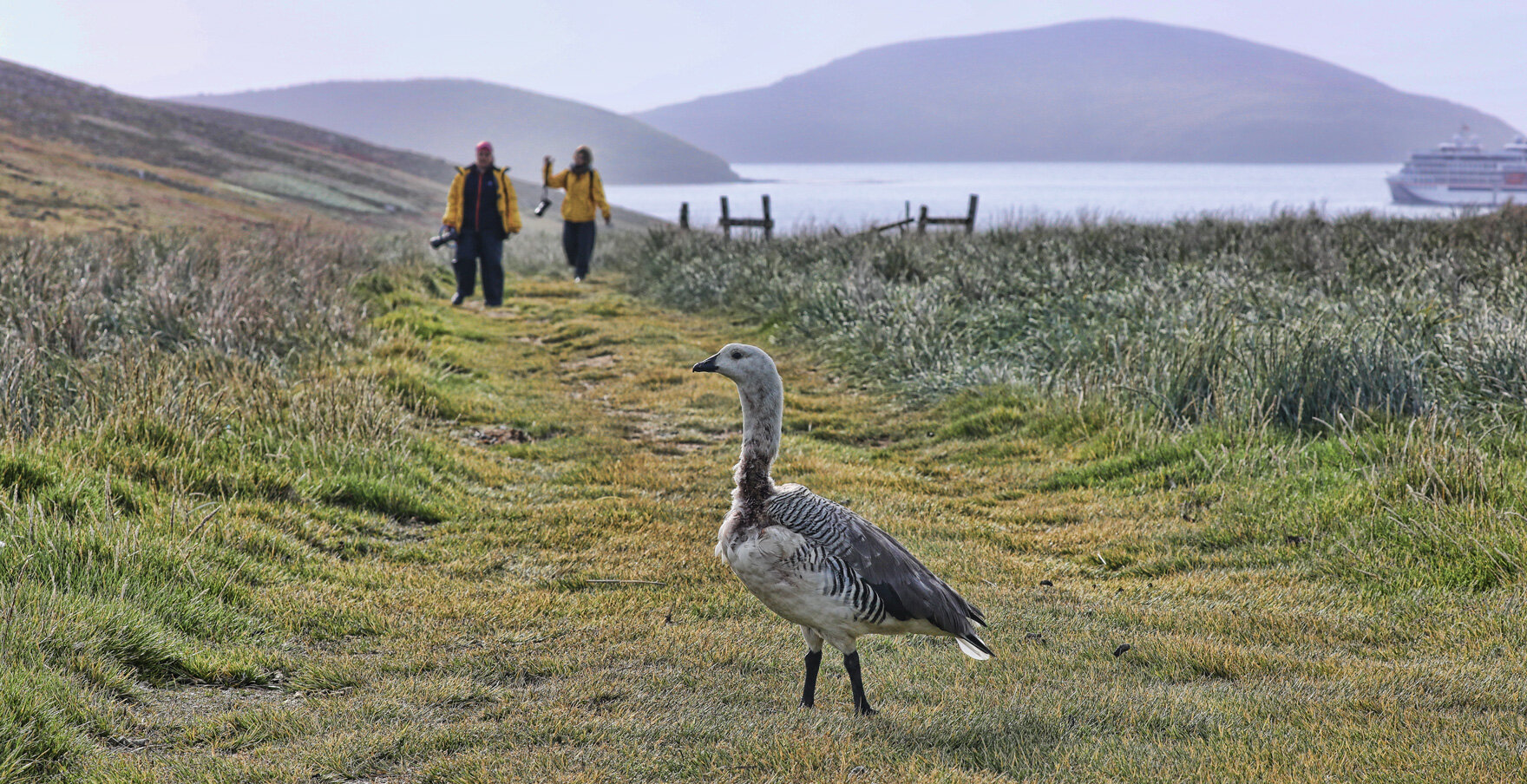
Upland Goose welcoming our first guests ashore.
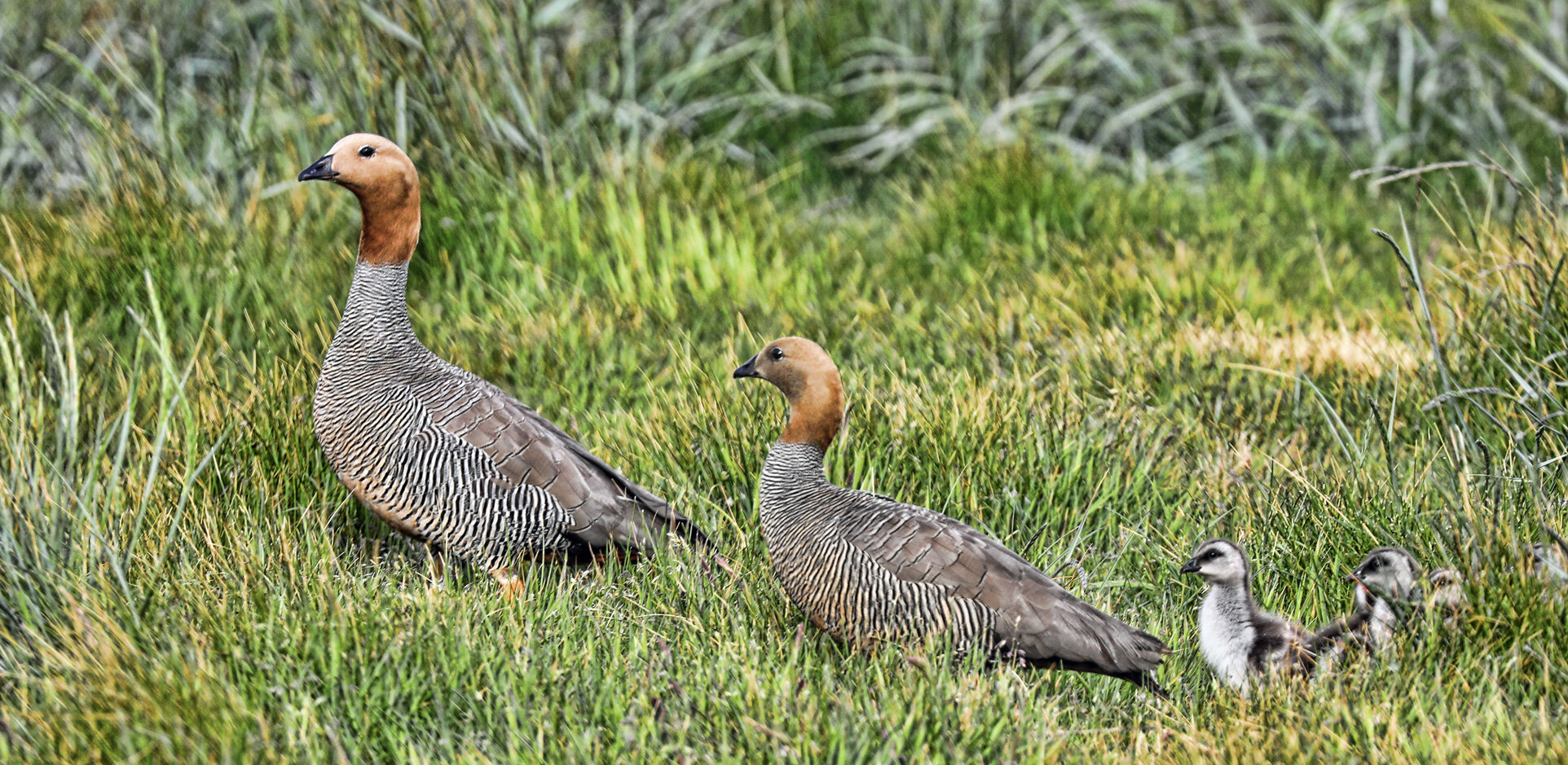
Ruddy-Headed Geese.
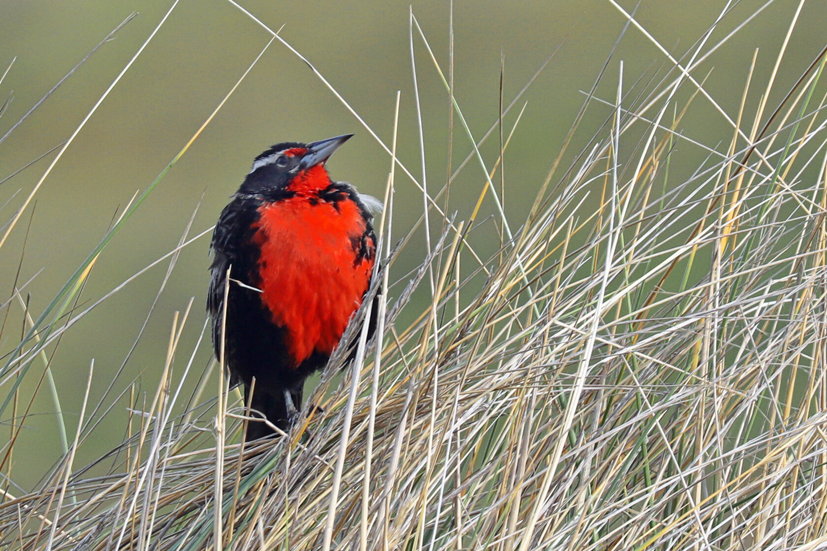
Red-Breasted Meadowlark.

Black-Browed Albatross sitting on nest.

Blue-Eyed Cormorant.

Kelp Goose having breakfast.

Southern Rockhopper Penguin.
and heading to the Falkland Islands.

Leaving the port of Ushuaia, Tierra del Fuego, Argentina.

Southern Giant Petrels commonly follow the ship, playing in the draft.

The SGP bony beak, consisting of nine plates. The upper tube is a saltwater excreting structure.

Sunset at the end of our first day at sea.

On the aircraft, window seat (of course) taxiing at Spokane International Airport. Location is indicated by blue icon with red line indicating the track.
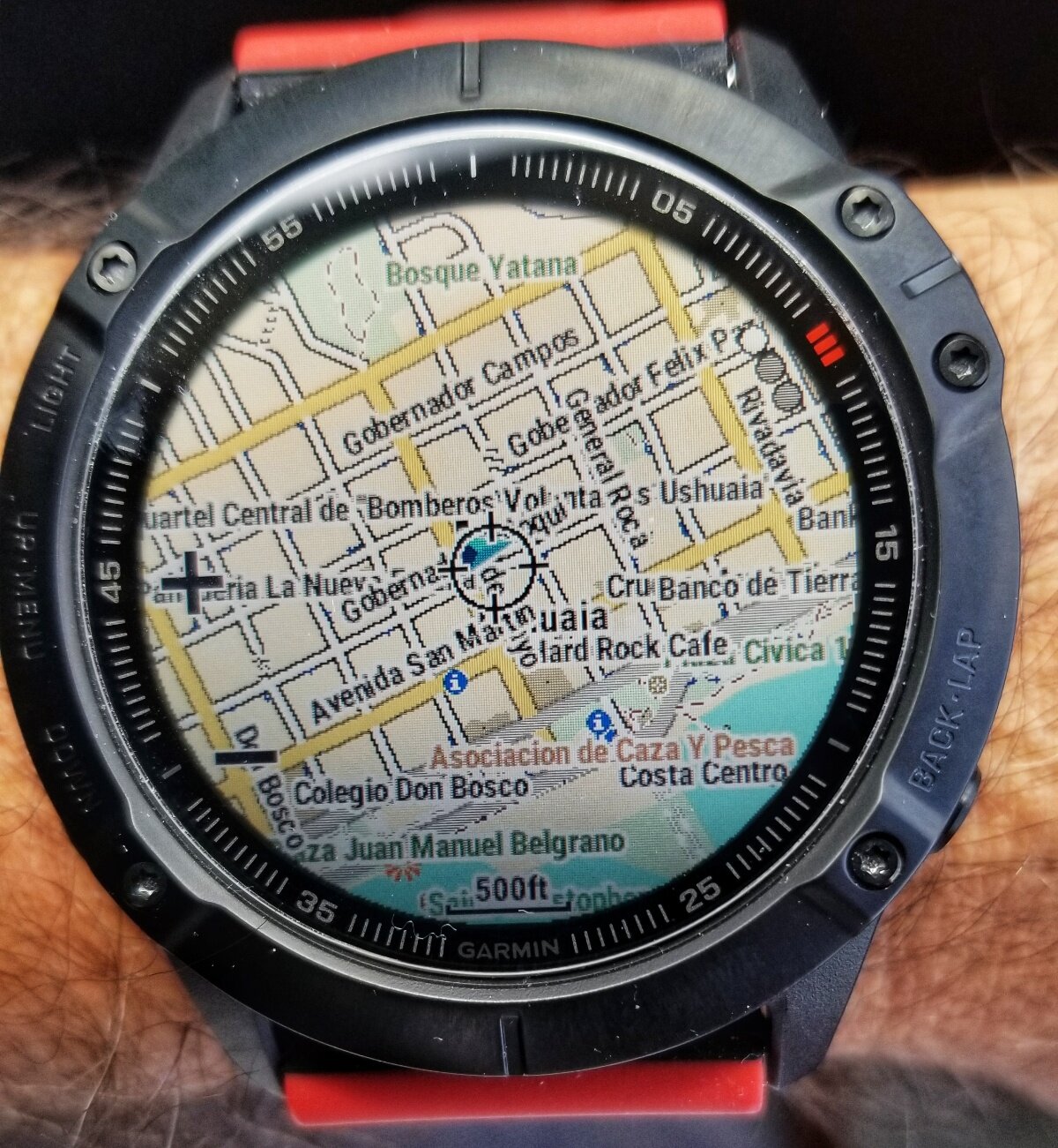
Detailed street map of Ushuaia, zoomed out here for a wide view, location indicated by the blue icon in center of display.
The Garmin FENIX 6X Pro is a very serious bit of technology that I am test driving for REI on this expedition. I have preloaded topographic maps for all of the western states at 1:24,000 scale, as well as nationwide coverage at 100,000 scale! In addition, I installed maps for Ushuaia, Argentina and Stanley, Falkland Islands, and it is capable of accessing Birdseye satellite images too. It links to your smartphone and Internet via Bluetooth and Wifi, but is capable of functioning for up to two weeks without connection or charging to other devices. WOW! And, oh yeah, it also tells the time (among many, many other things).

Dismal, cloudy, gray Spokane.

Northern Arizona - Grand Canyon

Last flight to Ushuaia.
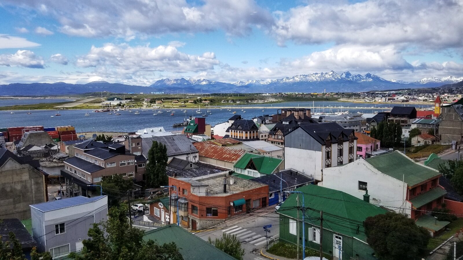
Ushuaia, Argentina, bottom of South America!

My breakfast buddy, a Dolphin Gull.
posted on this silly blog are brought to you by the camera kit assembled below for my upcoming work in Antarctica, consisting of two camera bodies and three lenses, a wide-angle for macro and landscapes, a mid-range lens, and a zoom telephoto for distant wildlife.

I also carry the Nikon camera in my float coat for shooting videos and when the conditions are rough and wet. All the stuff laid out on the dry bag are batteries and chargers, my GoPro, tripod, lens wipes, headlamp, scale card, etc. Yes, it’s a lot to carry in the field, but the results are more than worth the effort.
off the North Island of New Zealand, killing tourists exploring the active volcanic crater. Link to news stories: https://www.bbc.com/news/world-asia-50708727 and https://www.dailymail.co.uk/news/article-7770695/Volcano-erupts-coast-New-Zealand.html .

On approach with Zegrahm Expeditions in 2015. As exciting as it was to venture into the active edifice, I thought it was crazy risky, but this is the nation that popularized bungee jumping.

Exploring the inner crater and sulfur fumaroles, wearing hard hats and breathing masks.

The crater floor consists of hardened lava perforated by steaming fumaroles.

Sulfur works destroyed in previous eruption in 1914 when 10 miners were killed.
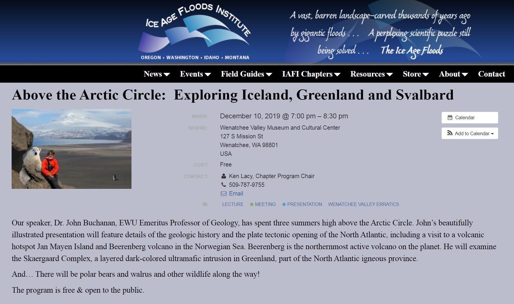
for a talk I’m presenting next week in Wenatchee, Washington, to the Wenatchee Valley Erratics Chapter of the Ice Age Floods Institute. The lecture is free and open to the public. Please don’t throw tomatoes.
to Ushuaia in exactly one week, essentially flying the rocky backbone of both North and South America, more or less. Spokane to Phoenix to Dallas to Buenos Aires to Ushuaia, merely 8,635 mi (~14k km).

in Rapid City, South Dakota.


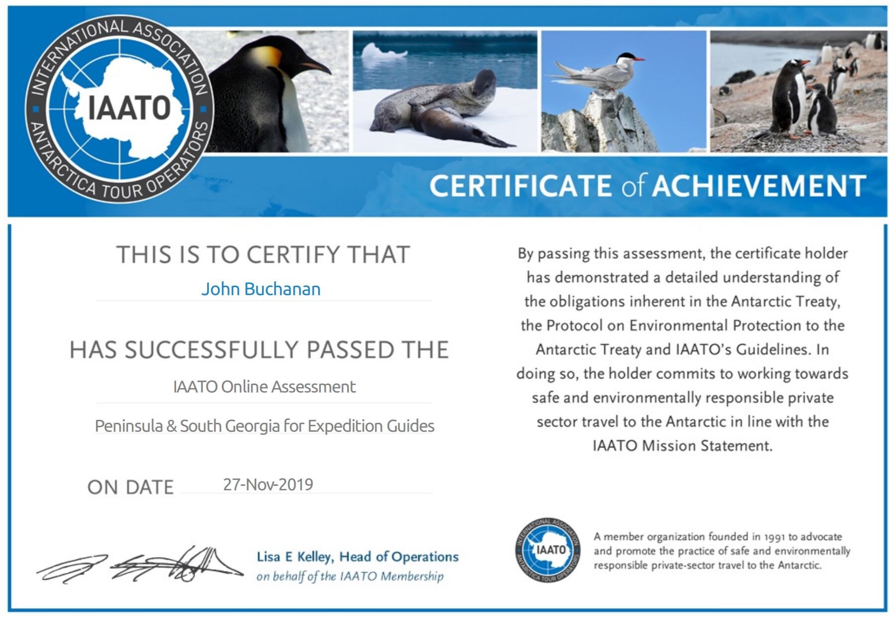
the online assessment to work as a naturalist/guide in Antarctica this season. I’ll be heading to the bottom of the world again, for my fourth season, in mid-December!

I’ll join the Hanseatic Inspiration - a brand spanking new expedition ship just launched in October - for its inaugural voyage to Antarctica. This holiday voyage will disembark from Ushuaia, Argentina, then on to the Falklands, South Georgia, Elephant Island and the Antarctic Peninsula.
The Rectory and Castleton Tower, about 400 feet above the ground. Here are some images acquired from my residence with my big 500 mm lens, about 2.2 miles away.

Look close for the dark speck - nearly at the middle of the image - that’s the slackliner at the midpoint between The Rectory (left) and Castleton Tower (right).

First slackliner approaching the Tower.

Second slackliner resting before the final chug as sunset approaches.

Sister Superior group, at sunset, a bit further down the ridge. Two rescues occurred here on two successive days this last week.


the next transit of Mercury, so here are a couple of unexciting images showing the tiny planet’s silhouette as it migrated across the Sun’s face in its orbit.

Mercury near the mid-point of the transit.

Mercury approaching egress at the end of the transit.
Image info: Shot with Canon EOS 5Diii with EF 100-400mm f/4.5-5.6 lens at 400 mm focal length with solar filter. Note to self: Need more pixels and longer focal length in 2032.
in advance of the transit of Mercury tomorrow morning. Lovely.

The November full Moon is also known as the Beaver Moon or Frost Moon.
across my property, like clockwork, every evening.


across the Sun’s face tomorrow, Veteran’s Day, beginning at sunrise. Unfortunately the event will be well underway when the Sun appears over the rim of Adobe Mesa to the east at around 7:45 am MST, so I will only be able to observe and photograph the last 3.5 hrs of the approximately 5.5 hour slow motion event. I will shoot images with my DSLR through a solar filter mounted on a 400 mm lens, while visually observing the event through the TeleVue Pronto refractor, also outfitted with a solar filter.
There may even be some local residents stopping by for the daytime “star party” as I made the Castle Valley Comments column in the Moab Times-Independent newspaper!

Solar filters are fitted to the front of my small refractor (front) and my Canon DSLR (rear).

Image courtesy Fred Espanek: http://eclipsewise.com/oh/tm2019.html
Friendly reminder and warning: Do NOT look at the Sun through an optical instrument or naked eye without appropriate precautions and certified solar filters.
Learn more here about this interesting event: Don’t Miss Monday’s Rare Transit of Mercury
UPDATE: Weather forecast is clear and sunny tomorrow. Unfortunately, due to low solar activity during the current solar minimum, there are no sunspots on the surface of the Sun: spaceweather.com These would have added a nice compositional element to an image along with the tiny round silhouette of Mercury.

The spotless Sun setting below Porcupine Rim on the eve of the transit.
after such a nice rock climb of Castleton Tower.


The back story: I was given the heads up for this mid-day launch by my crazy base-jumping neighbor so as to be ready outside with my big lens on a gimbaled tripod. These are her friends so she knew the timings, and after I shared these shots with her, she transmitted them on to the jumpers themselves.