Ice front of glacier at end of Garibaldi Fjord.
The Silver Explorer, home away from home for the next six weeks.
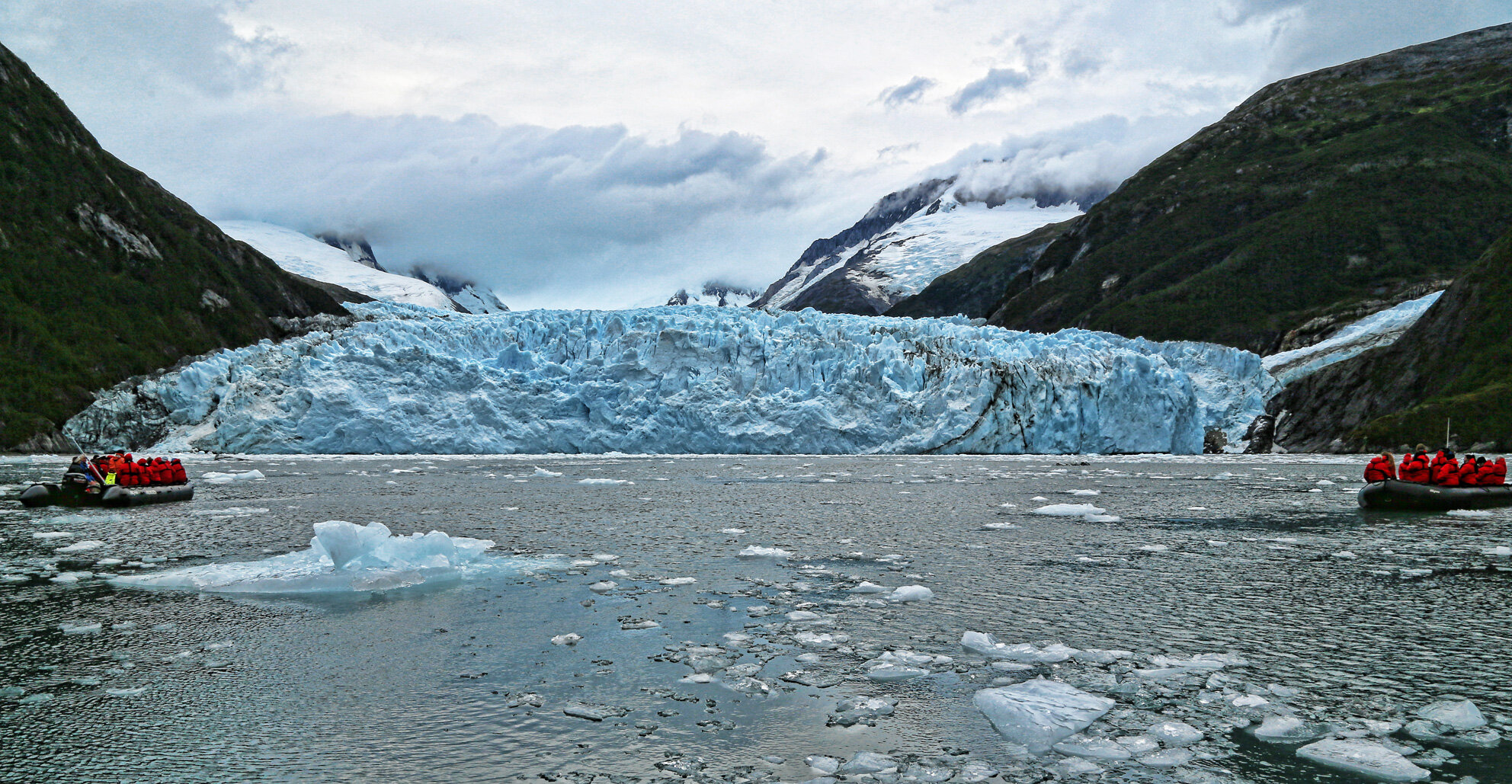
Ice front of glacier at end of Garibaldi Fjord.

The Silver Explorer, home away from home for the next six weeks.
as we make our way westward to the Chilean fjords and channels.
as I wing my way once again to the bottom of South America.

Mima mounds near Four Lakes on the West Plains of Spokane County.
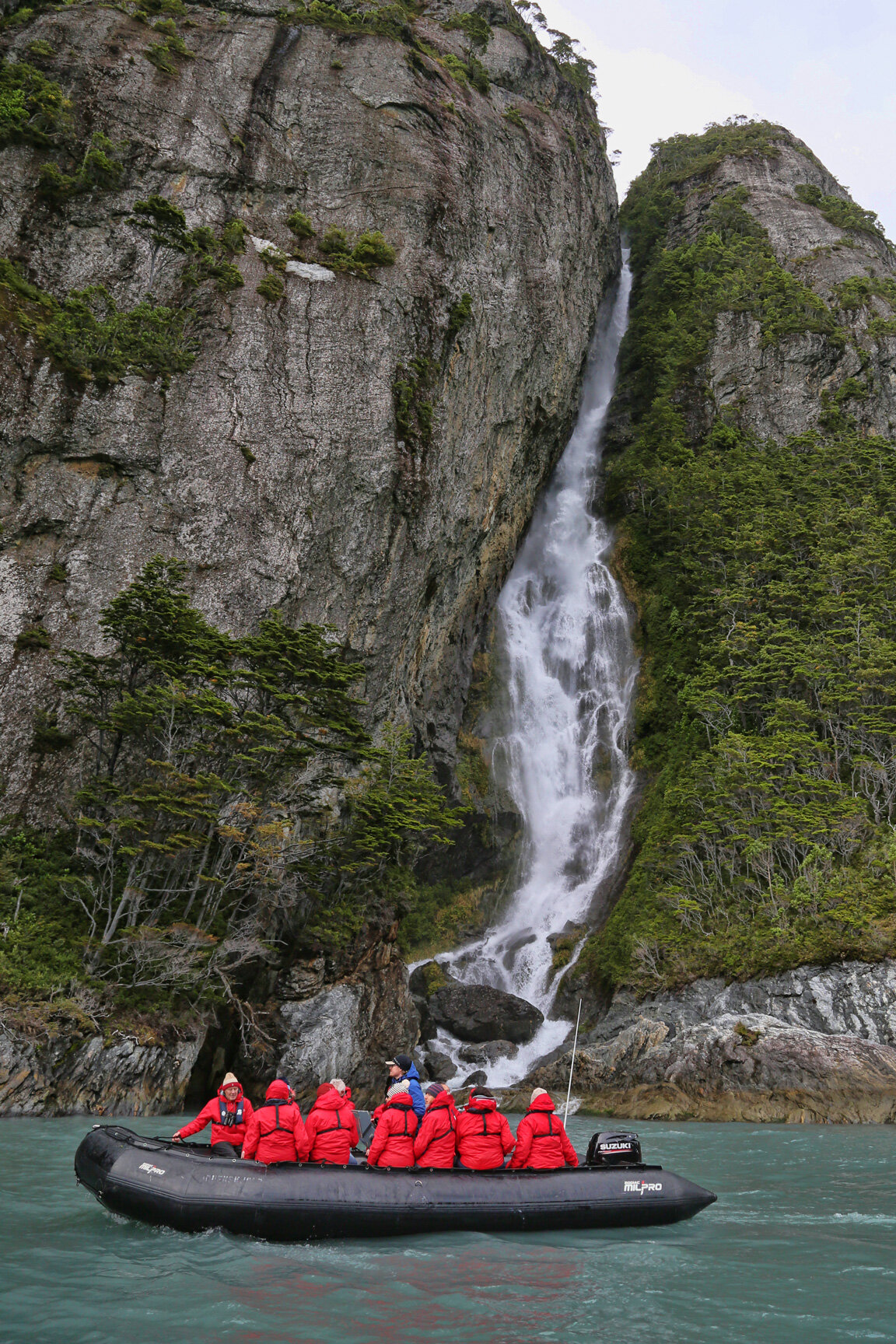
Glaciated landscapes in Tierra del Fuego.

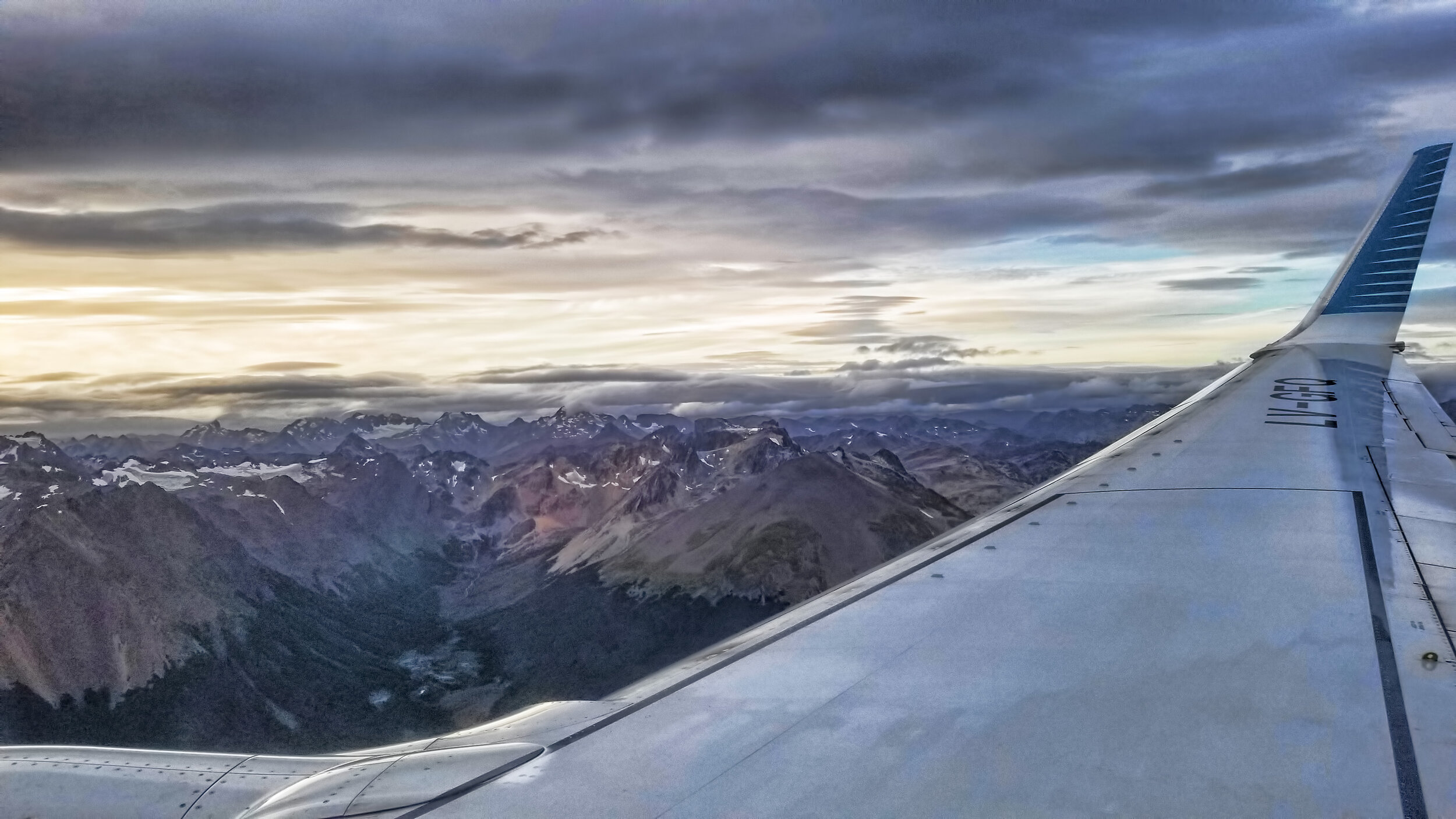
View to west of Beagle Channel on approach to Ushuaia, Argentina.
that some male geologists are capable of giving birth to hefty rocks, in this case, my gallstone that was removed via a laparoscopic procedure. Here is the ~ 2.0 cm diameter behemoth. Yes, I am a very, very proud papa!


Here’s my baby in the neck of the gallbladder before delivery!
early this morning around 4:30 am PST. I get up early so you don’t have to!

Shot with Canon EOS 5Div with 500 mm prime lens, steadied on a monopod, ISO 100, 125th sec at f/4.0.
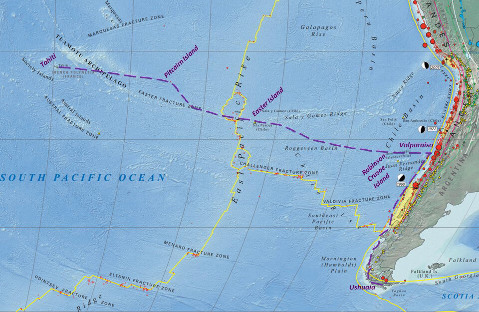
from Ushuaia, Argentina, traversing the Chilean fjord system to Valparaiso, then directly west across the South Pacific, island hopping from Robinson Crusoe Island - Isla Alejandro Selkirk - Isla Salas y Gomez - Easter Island - Ducie Island - Henderson Island - Pitcairn Island - Oeno Island - Marotiri Island - Rapa Iti - Raivavae - and concluding at Pape’ete, Tahiti.
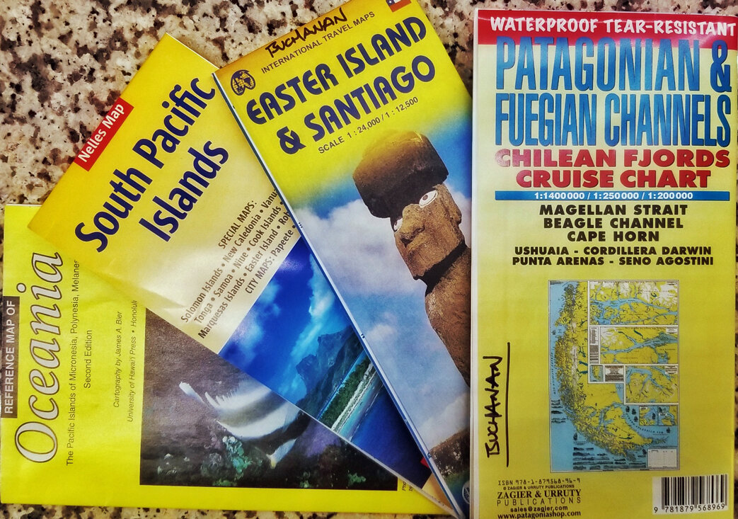
I’ve got lectures on plate tectonics, plutonic structures and volcanism, and glaciers and glacial landforms for the first leg through the Chilean fjords and along the southern Andes ready to go, but am preparing new presentations on hot spots and seamounts, coral reef formation and evolution, and physical oceanography for the Pacific crossing. Interesting trip to pack for too, needing sub-polar gear in the fjords, to shorts and t-shirts and my snorkel kit for the Pacific.
Here’s the link to Apex Expeditions for a look at the detailed itinerary of the Pacific crossing.
after each expedition - including photographic images, GPS waypoints and tracks, lectures and recaps presented on board - is a tedious but necessary task, demanding that one be well organized both during travel and at your home office. But it’s fun to play with some of the data, where shown below is the track we hiked on the Shackleton Walk on South Georgia, between Fortuna Bay and Stromness (see earlier blog post).
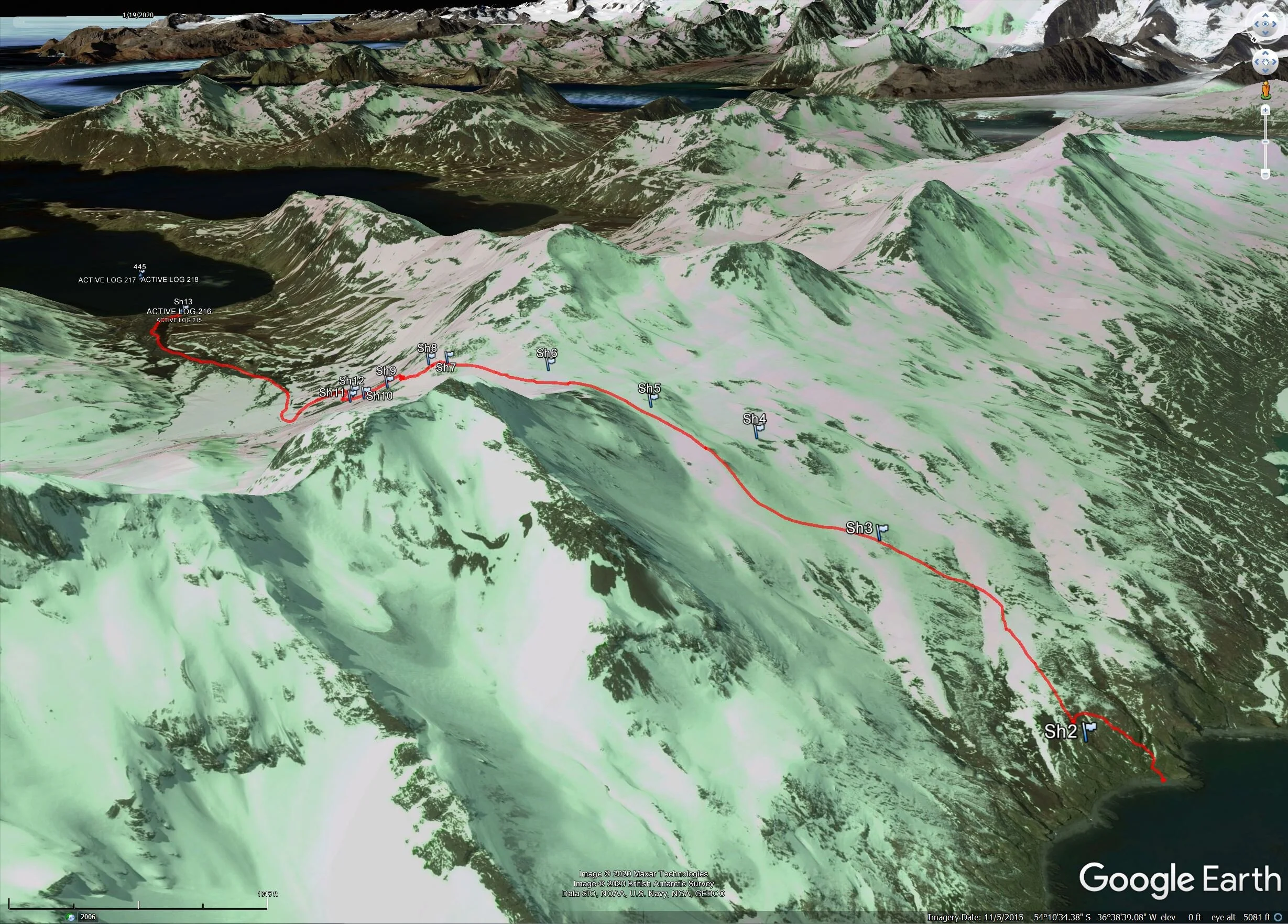
Track was continuously acquired by my Garmin GPSMAP 60CSx, then downloaded to PC using Garmin Basecamp software and USB cable tether, then the file exported as a .GPX file and imported into Google Earth Pro for final conversion to .KML format, and voila!
for an upcoming seminar at Eastern Washington University. A blizzard in the Rockies in early December last year prevented me from getting to campus and making this presentation at that time, so I appreciate having a second opportunity. The event is free and open to the public, but be sure to park legally on campus or they’ll get you. There’s a budget crisis, you know.

of my final leg home, DFW to GEG, early Monday. Port side window seat, of course!

The Red RIver, the border between Texas and Oklahoma. I used data from USGS stream gaging stations along this reach when researching my Ph.D. dissertation in sediment transport in sand bed braided streams. This time of year, at low flow, the distinct meandering thalwag is clearly seen.

Center pivot irrigation circles in southwestern Kansas, tapping into the Ogallala aquifer, lowering groundwater tables for decades in this dry region.
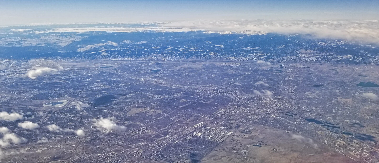
Greater Denver, Colorado Front Range from 37,000 feet.
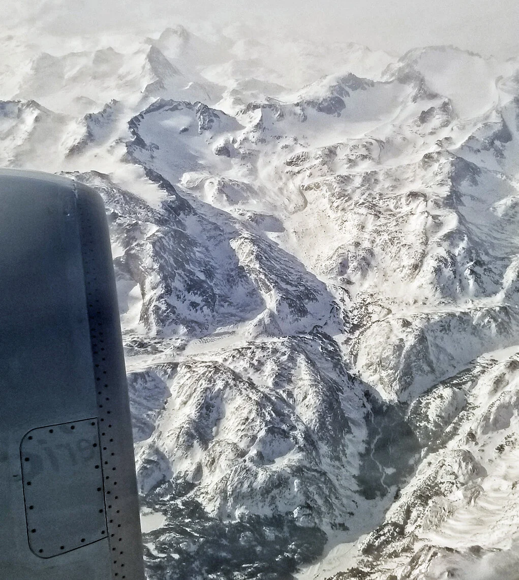
Glacial cirques and other related landforms in the high Wind River Range in central Wyoming.

Dismal, rainy, gray Spokane. Returning just as I left it a month ago. But I am very happy to be safe at home, and to enjoy these opportunities for worldwide travel.
Repeat after me: Geologists always get window seats.
Perhaps I should petition the airlines to put optically corrected glass in their windows for passionate geologist-photographers? Or maybe for more comfortable seats.
a bit about the new Garmin Fenix 6X Pro watch I used during this last Antarctic voyage. I enabled “expedition mode” on the device where it automatically recorded GPS waypoints during the entire expedition. Here is the result, shown below, where each waypoint is tagged with a number, the date and time, and the latitude and longitude. Total distance traveled on this track is 3,894.4 miles. Cool beans!


Detail at South Georgia. Note that blue line does not show the actual track, it just links the waypoints in time.

Lastly, here’s the detail where we operated on the Antarctic Peninsula, where the track was converted to KML and overlayed on Google Earth.
early this morning and this is the view from the port side of the aircraft, with the Beagle Channel and glaciated valleys of Tierra del Fuego. Remember: Geologists always get window seats!

as I return to civilization, the land of trees and the color green. I will miss the long summer days of the southern hemisphere when I head northward tomorrow.


from the Drake Passage! The ship’s position is shown by blue symbol, and water depths are indicated in meters. So far it’s been a good crossing with less than three meter swell, and we’re making good speed in advance of an approaching storm system from the west.


Wave conditions in the Drake Passage from windy.com.
My first year of “retirement” has concluded, allowing me to travel 150 days in 2019, first to Antarctica… then the Arctic… tropical Papua New Guinea… and finally, a return to the bottom of the world. Wow! And 2020 should be even more active!
with its actively calving glacier is one of my favorite operating sites on the Antarctic Peninsula. This is, sadly, our last landing on the icy continent, and now we spend two days at sea heading north, across the Drake Passage, returning to Ushuaia.

A commanding view of the glacier and ship (middle left) from a high vantage point.
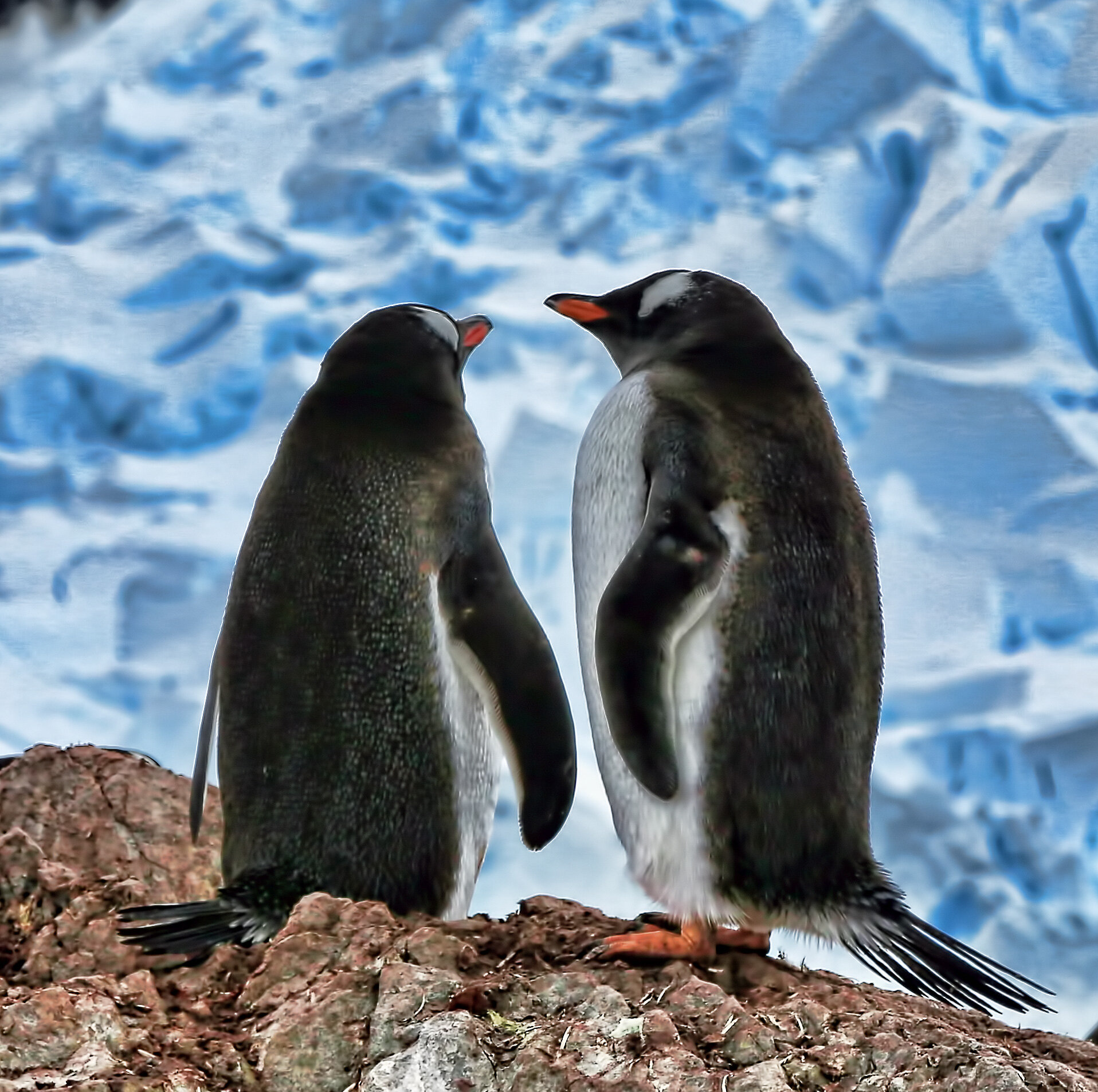
Gentoo Penguins in love.

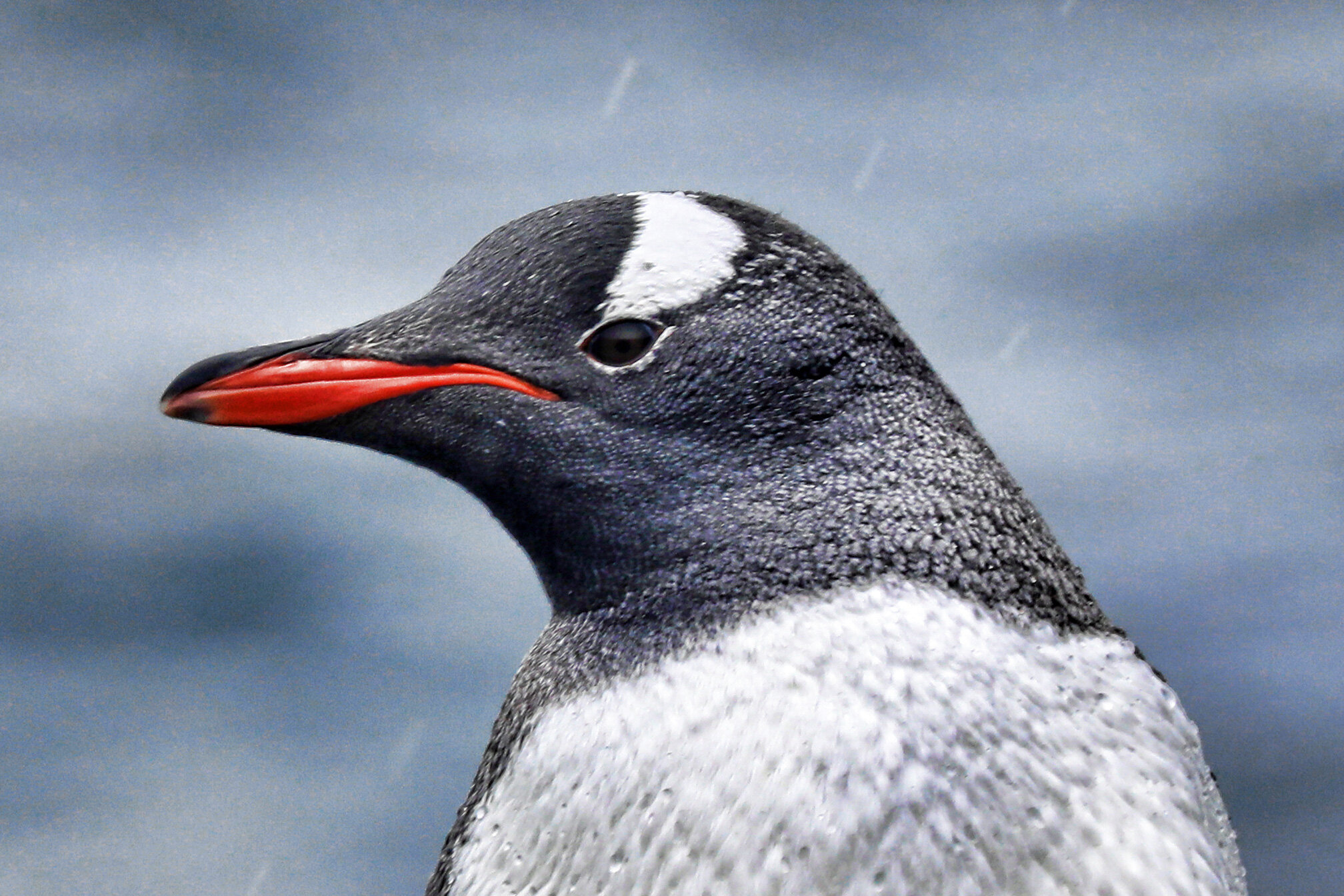
Gentoo adult mugging for camera.
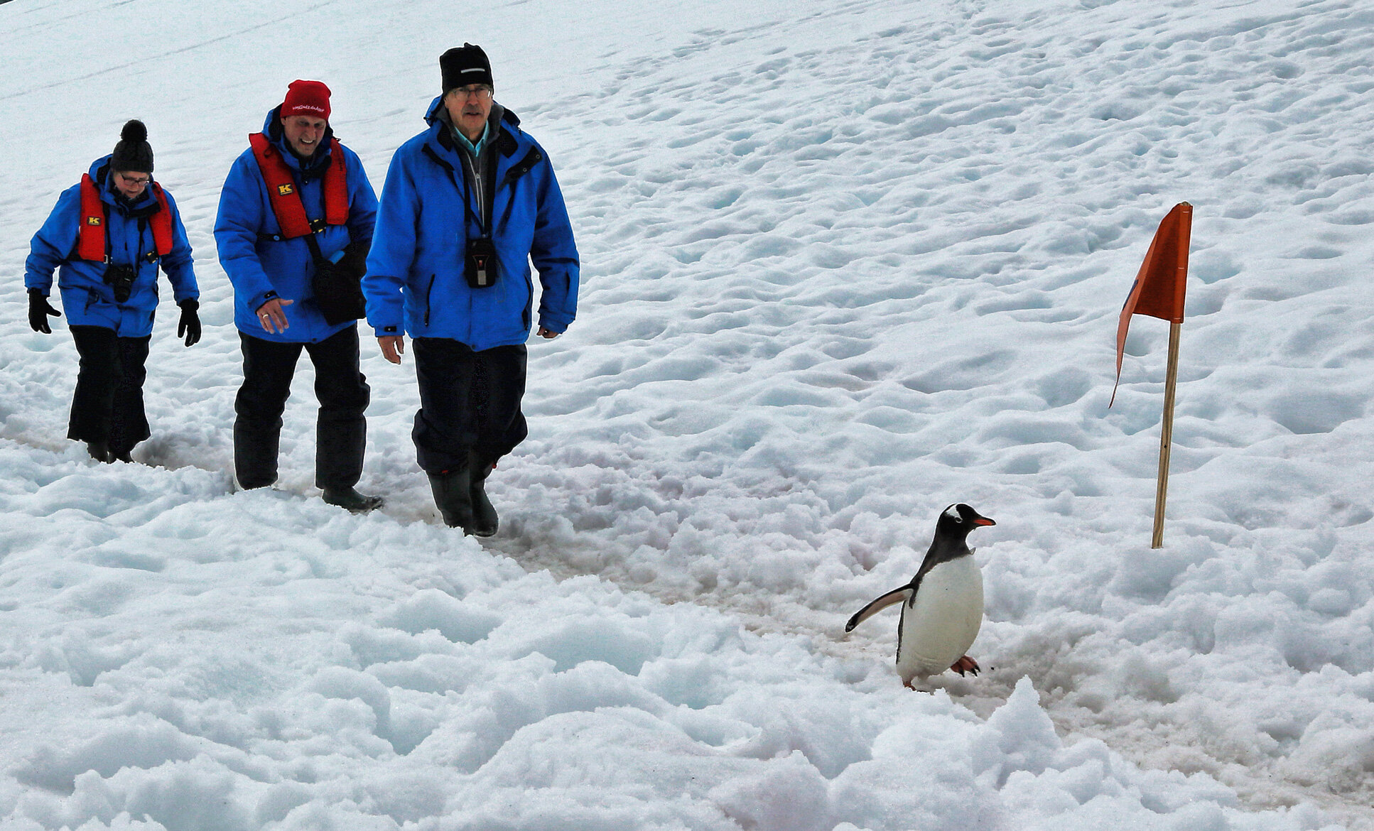
Gentoo leading the humans up the snowy track. Give that penguin a radio!
is the oldest British station in Antarctica, later used as a research station, and now a living museum.


A look inside the pantry.

The sleeping quarters with paintings that make me blush, oh my.

Recently hatched Gentoo Penguin chick.

Slightly older Gentoo chick.

The Snowy Sheathbill, a scavenger, living among the penguins.

is the furthest point south on this voyage, approximately S 65.2 degrees, still well above the Antarctic Circle.

The Hanseatic Inspiration at anchor.

Looking further south, towards the Pole, in the late day sun.

Hanging glacier in the Lemaire Channel.
this morning for a Zodiac exploration of the ice on the Antarctic Peninsula.


Argentine Base Brown.

Brash ice from calving glacier.


Antarctic Shags with chicks.

Weddell seal on ice.
is an active volcano in the Bransfield Strait, evidenced by rising steam at low tide in Whalers Bay.


The Biscoe House, part of the British Antarctic Survey station, was destroyed by a lahar in 1969. Ronald Hill stands behind the collapsing structure, the summit of which was the goal of a long hike today.

The celebratory summit party atop Ronald Hill, in approximately 50 knot winds.

View of Whalers Bay on the descent from Ronald Hill.
this morning made the landing at Half Moon Island challenging, but I managed a few shots of the penguins there.

Greenwich Island on approach to Half Moon Island.

Chinstrap Penguin.
Gentoo Penguin.