for an upcoming seminar at Eastern Washington University. A blizzard in the Rockies in early December last year prevented me from getting to campus and making this presentation at that time, so I appreciate having a second opportunity. The event is free and open to the public, but be sure to park legally on campus or they’ll get you. There’s a budget crisis, you know.

Aerial geomorphology...
of my final leg home, DFW to GEG, early Monday. Port side window seat, of course!

The Red RIver, the border between Texas and Oklahoma. I used data from USGS stream gaging stations along this reach when researching my Ph.D. dissertation in sediment transport in sand bed braided streams. This time of year, at low flow, the distinct meandering thalwag is clearly seen.

Center pivot irrigation circles in southwestern Kansas, tapping into the Ogallala aquifer, lowering groundwater tables for decades in this dry region.
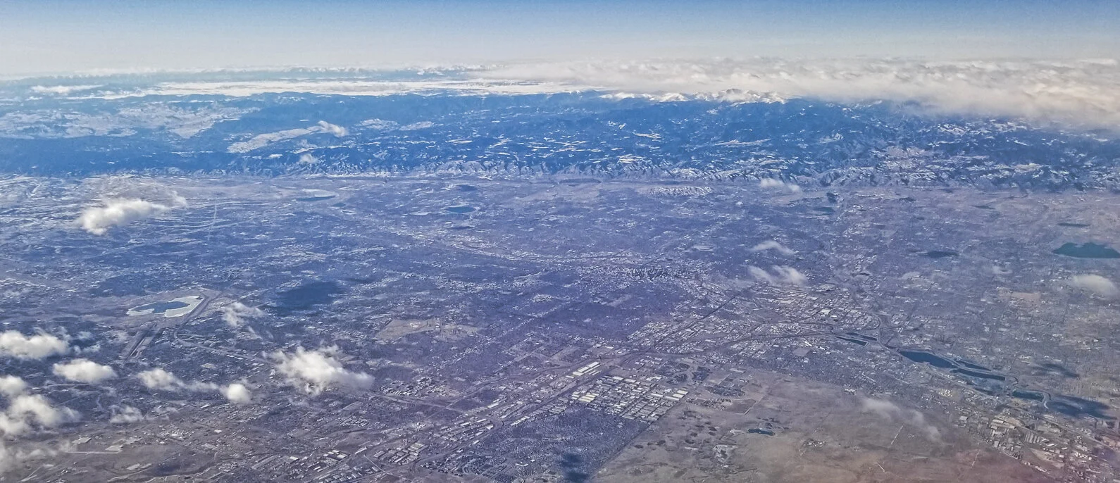
Greater Denver, Colorado Front Range from 37,000 feet.
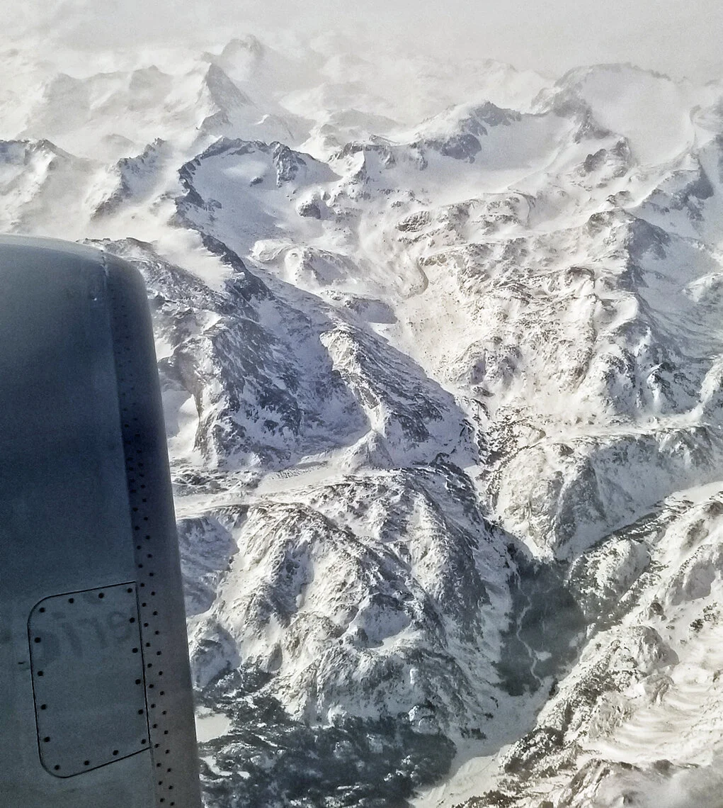
Glacial cirques and other related landforms in the high Wind River Range in central Wyoming.

Dismal, rainy, gray Spokane. Returning just as I left it a month ago. But I am very happy to be safe at home, and to enjoy these opportunities for worldwide travel.
Repeat after me: Geologists always get window seats.
Perhaps I should petition the airlines to put optically corrected glass in their windows for passionate geologist-photographers? Or maybe for more comfortable seats.
Time to nerd out...
a bit about the new Garmin Fenix 6X Pro watch I used during this last Antarctic voyage. I enabled “expedition mode” on the device where it automatically recorded GPS waypoints during the entire expedition. Here is the result, shown below, where each waypoint is tagged with a number, the date and time, and the latitude and longitude. Total distance traveled on this track is 3,894.4 miles. Cool beans!


Detail at South Georgia. Note that blue line does not show the actual track, it just links the waypoints in time.

Lastly, here’s the detail where we operated on the Antarctic Peninsula, where the track was converted to KML and overlayed on Google Earth.
Leaving Ushuaia...
early this morning and this is the view from the port side of the aircraft, with the Beagle Channel and glaciated valleys of Tierra del Fuego. Remember: Geologists always get window seats!

Street art in Ushuaia, Argentina...
as I return to civilization, the land of trees and the color green. I will miss the long summer days of the southern hemisphere when I head northward tomorrow.


Happy New Year...
from the Drake Passage! The ship’s position is shown by blue symbol, and water depths are indicated in meters. So far it’s been a good crossing with less than three meter swell, and we’re making good speed in advance of an approaching storm system from the west.


Wave conditions in the Drake Passage from windy.com.
My first year of “retirement” has concluded, allowing me to travel 150 days in 2019, first to Antarctica… then the Arctic… tropical Papua New Guinea… and finally, a return to the bottom of the world. Wow! And 2020 should be even more active!
Neko Harbour...
with its actively calving glacier is one of my favorite operating sites on the Antarctic Peninsula. This is, sadly, our last landing on the icy continent, and now we spend two days at sea heading north, across the Drake Passage, returning to Ushuaia.

A commanding view of the glacier and ship (middle left) from a high vantage point.
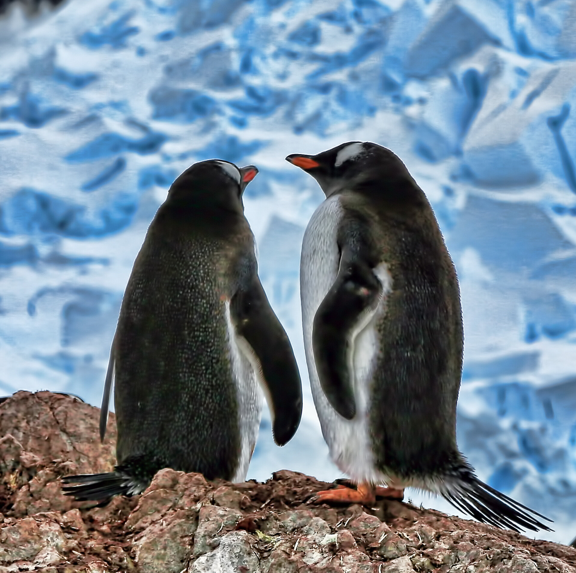
Gentoo Penguins in love.

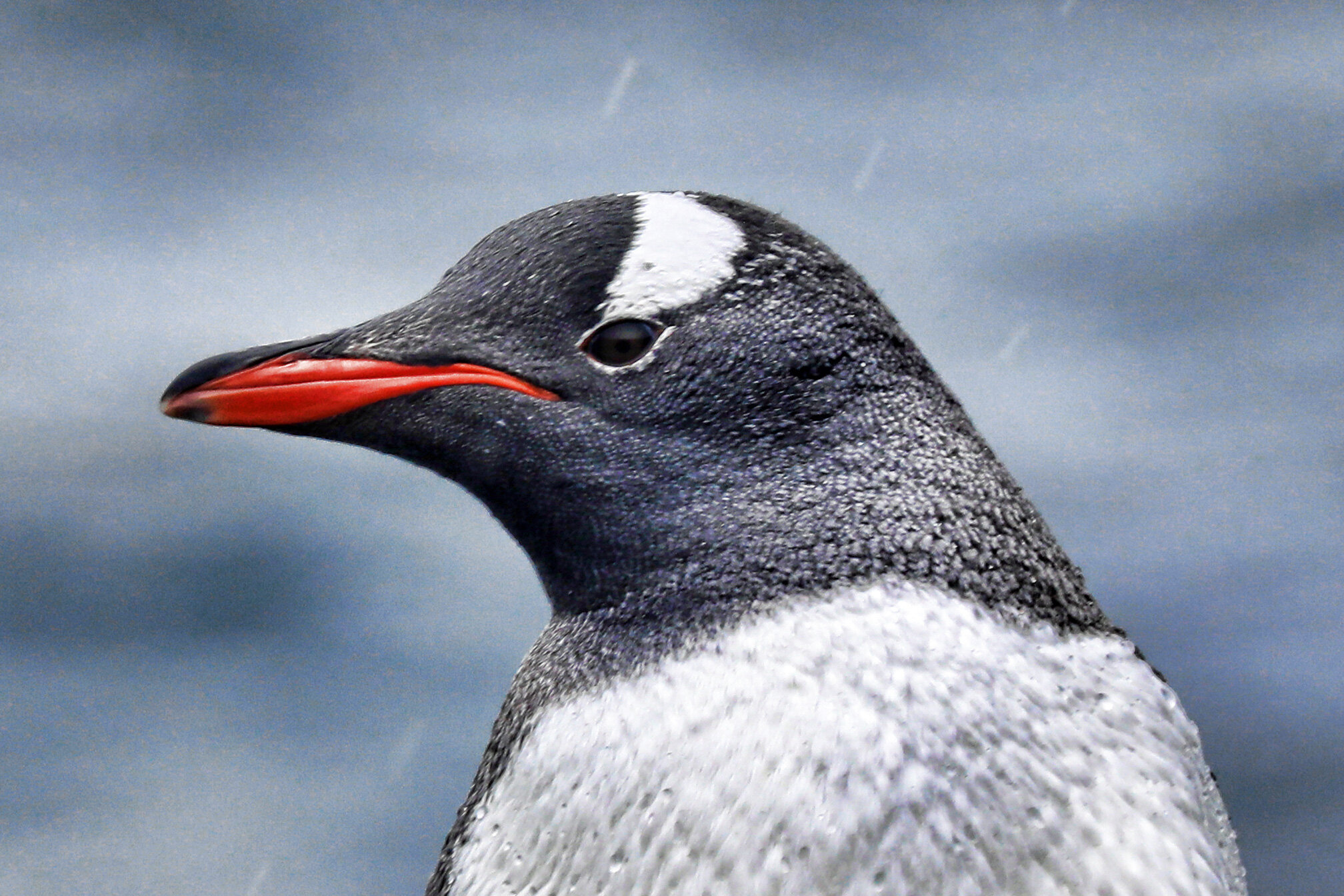
Gentoo adult mugging for camera.
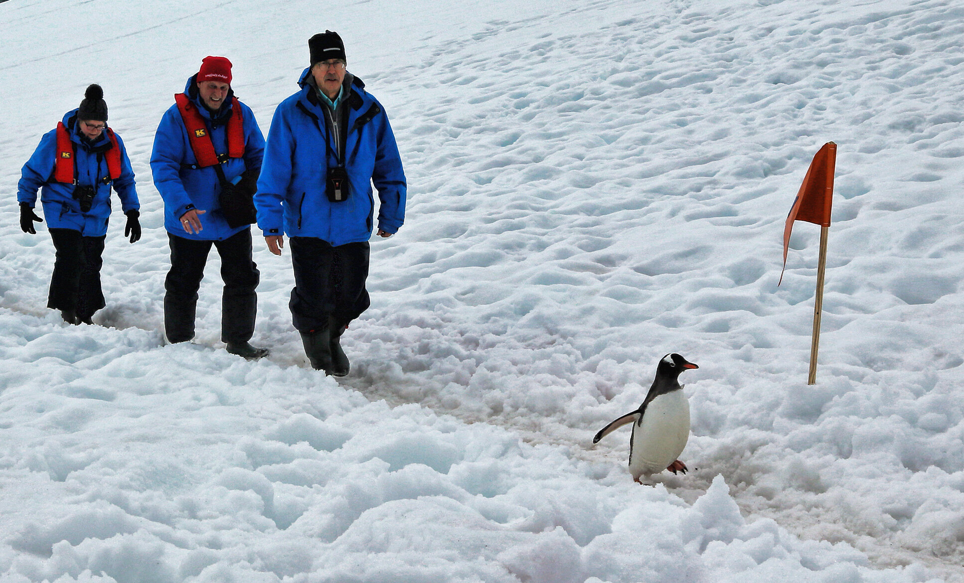
Gentoo leading the humans up the snowy track. Give that penguin a radio!
Port Lockroy on Goudier Island...
is the oldest British station in Antarctica, later used as a research station, and now a living museum.


A look inside the pantry.

The sleeping quarters with paintings that make me blush, oh my.

Recently hatched Gentoo Penguin chick.

Slightly older Gentoo chick.

The Snowy Sheathbill, a scavenger, living among the penguins.
Sunrise in the Neumayer Channel...

Petermann Island...
is the furthest point south on this voyage, approximately S 65.2 degrees, still well above the Antarctic Circle.

The Hanseatic Inspiration at anchor.

Looking further south, towards the Pole, in the late day sun.

Hanging glacier in the Lemaire Channel.
Paradise Bay lived up to its name...
this morning for a Zodiac exploration of the ice on the Antarctic Peninsula.


Argentine Base Brown.

Brash ice from calving glacier.


Antarctic Shags with chicks.

Weddell seal on ice.
Deception Island caldera...
is an active volcano in the Bransfield Strait, evidenced by rising steam at low tide in Whalers Bay.


The Biscoe House, part of the British Antarctic Survey station, was destroyed by a lahar in 1969. Ronald Hill stands behind the collapsing structure, the summit of which was the goal of a long hike today.

The celebratory summit party atop Ronald Hill, in approximately 50 knot winds.

View of Whalers Bay on the descent from Ronald Hill.
Wretched weather in the South Shetland Islands...
this morning made the landing at Half Moon Island challenging, but I managed a few shots of the penguins there.

Greenwich Island on approach to Half Moon Island.

Chinstrap Penguin.
Gentoo Penguin.
Paulet Island in the Weddell Sea...
is home to ~ 140,000 nesting Adelie Penguins!


Absolutely disgustingly filthy little beasts when in large number during breeding cycle. But cute!
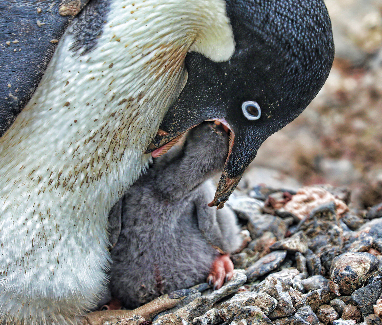
Adelie parent feeding its chick.

Adelie mugging for the camera.
Cruising the Weddell Sea...
after passing through the Antarctic Sound last evening, targeting the enormous iceberg A-68 that broke from the Larson Ice Shelf in July 2017.

Guests on the foredeck, awestruck by the immense size of the tabular iceberg A-68.

Annotated satellite image showing iceberg A-68 which is blocking ice from the Weddell Sea gyre from entering the Antarctic Sound. We will attempt a landing at Paulet Island (red circle) later in the day.

Reflection of the ship’s officers in the radar image of the ice front (green) and ship’s position (center of orange circle).

Preparing for allowing guests to venture out on a stable piece of sea ice, while the captain repositions the ship. Nearing the end of my first year of “retirement,” I could not be happier and am very grateful for these opportunities to travel and to continue to lecture about geology!
Orcadas Base in the South Orkney Islands...
is an Argentine station established in 1904, and provides the longest meteorological record in Antarctica.


Zodiac operations are quite sporting...
on the Hanseatic Inspiration as the boats are craned down from the top deck by the bosun and his very capable team, with drivers aboard, from about 80 feet above the water.

Note the port side crane near rear of ship.

The bosun operating the crane, smiling for his picture. You can see the starboard side crane here.

My view as the Zodiac is swung over the port side! Very exciting, especially in windy conditions. Like I said, sporting.
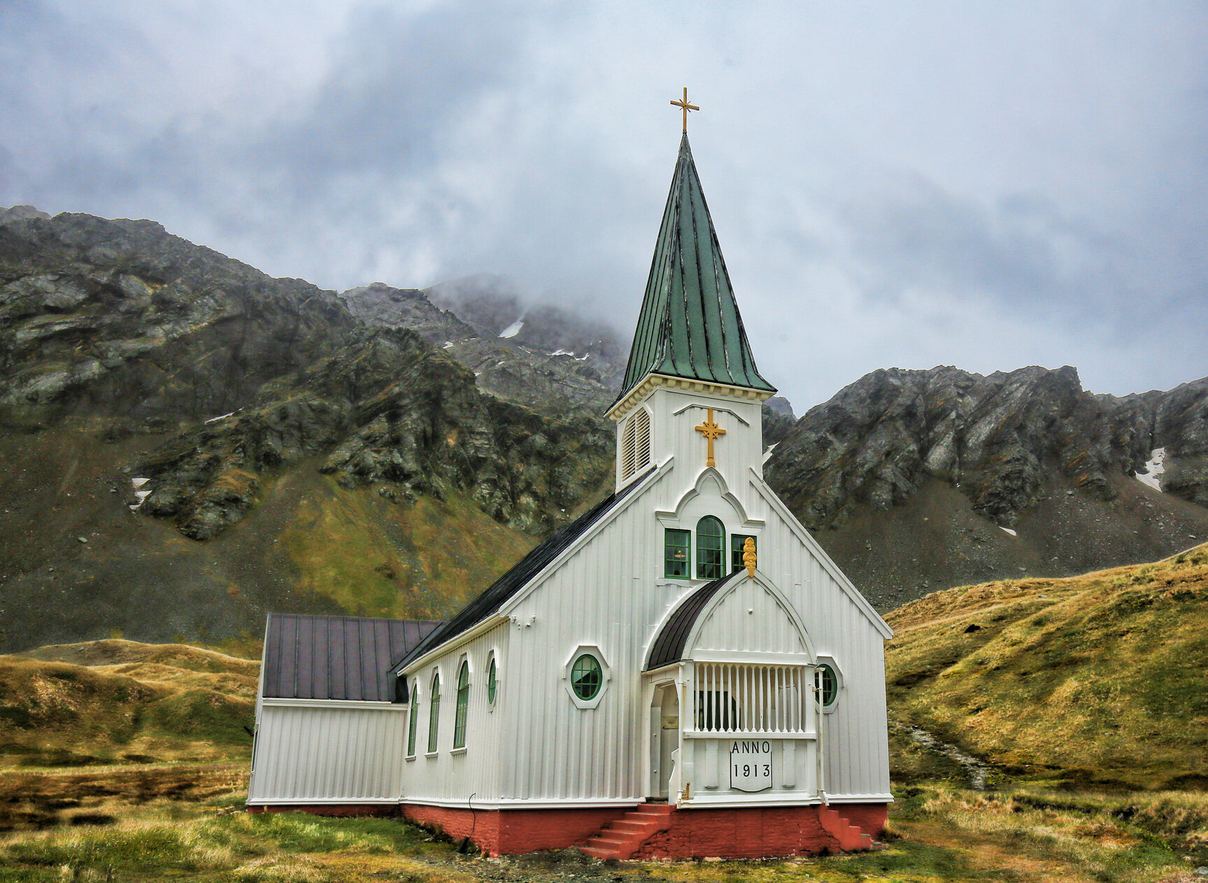
Christmas in Grytviken...
was observed in the historic church at the whaling station, standing beyond the industrial grunge of a thankfully bygone era.


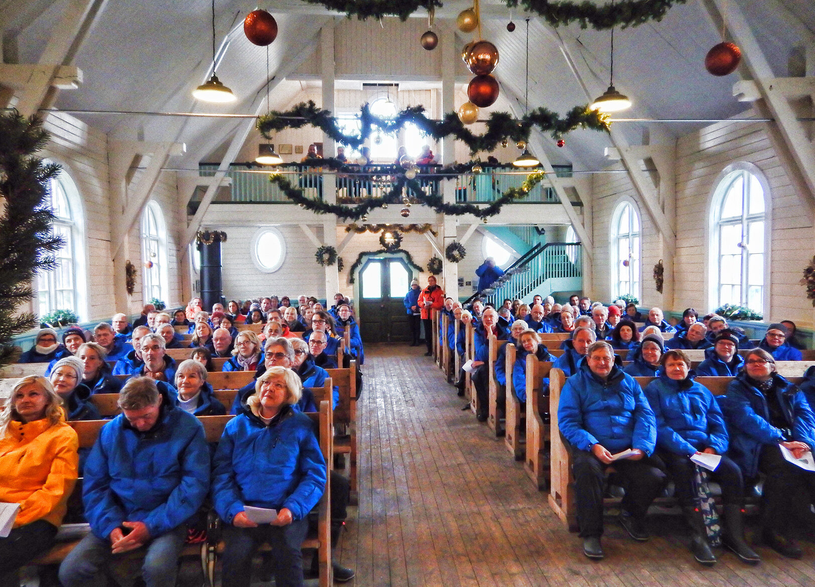
There were several seasonally appropriate songs, and I presented a short reading from the 1902-03 journals of Scott and Shackleton during their Christmas experience in Antarctica as they attempted to reach the South Pole. At the conclusion, the church bells were rung, reverberating throughout the rocky fjord. All in all, a lovely day in a richly historic location.

The ship’s photographer contributed this image of me addressing the flock from the pulpit.
Walking in Shackleton's footsteps...
from Fortuna Bay to Stromness, the last four miles of his historic trek across South Georgia.

Landing site in Fortuna Bay on Worsley Beach, with Antarctic Fur Seals.

Gaining higher elevation, with commanding view of Fortuna Bay.

Small alpine lake at high point of crossing.

View down valley toward Stromness whaling station, at right edge of bay.

The Shackleton Waterfall.

Stromness whaling station to which Shackleton returned, unrecognizable after years at sea. From here he organized a return to Elephant Island to rescue the rest of his stranded crew. Epic!

Topographic map of route from IATTO Field Operations Manual.
This was an absolutely fabulous hike on a terrific day, on Christmas Eve!
Battle of beachmasters...
at Jason Harbour, South Georgia, as captured by the ship’s photographer. For some reason, the expedition leader tasked me with keeping an eye on this particularly excited fellow.

Antarctic Fur Seals can be very aggressive, particularly male beachmasters, defending their territory for their harems of females during mating season.
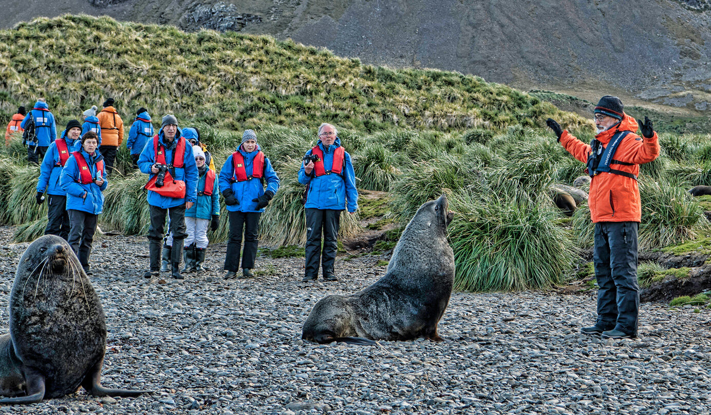
You must stand tall against their charges, here so that guests may pass to return to the landing site.