continues to indicate the compromised air quality that persists at night due to suspended fire smoke throughout southeastern Utah.
Not Mars! Waning gibbous Moon captured shortly after midnight during “moderate” air quality.
continues to indicate the compromised air quality that persists at night due to suspended fire smoke throughout southeastern Utah.
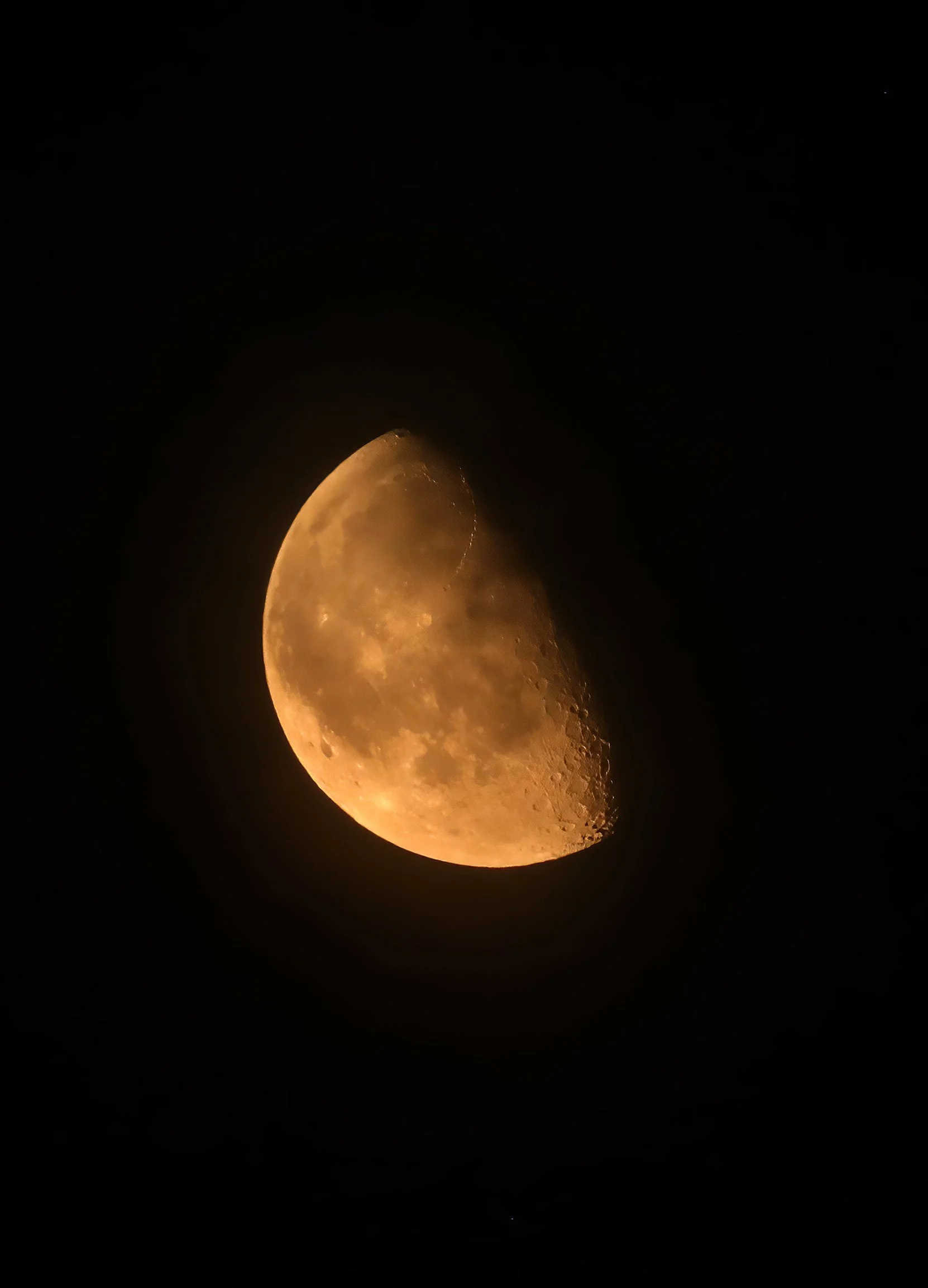
Not Mars! Waning gibbous Moon captured shortly after midnight during “moderate” air quality.
according to Smokey the Bear standing watch at the entrance to our community. The fire smoke in the air was so dense yesterday afternoon that if - goodness forbid - a fire had occurred in the valley, we’d have been largely unaware. Let’s be extra vigilant, folks!

No fireworks! And apparently Smokey still loves beaver, too.
greets the dawn, the result of raging wildfires across the region. Air quality is unhealthy and getting worse.

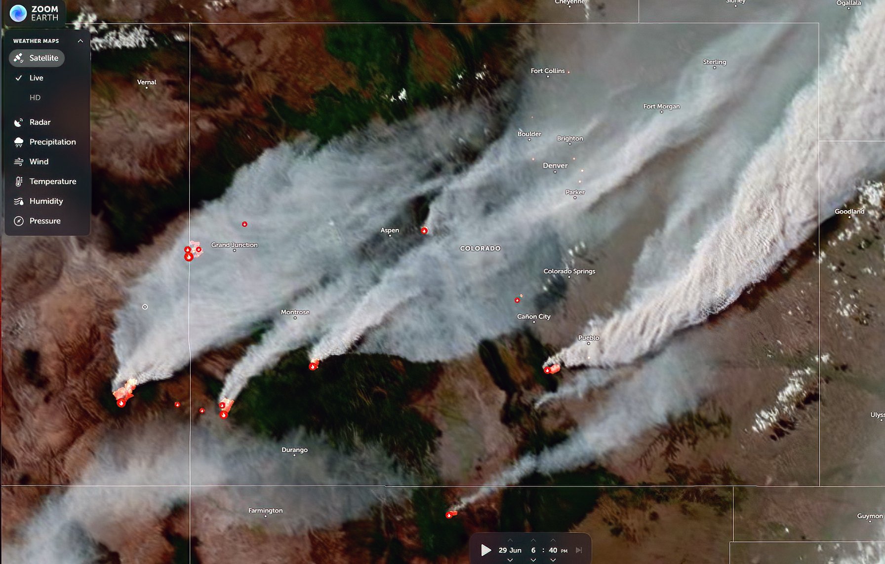
Last night’s satellite image captured early in the evening showing fire smoke plumes and heat sources in southeastern Utah and Colorado.
MID-DAY UPDATE: Air quality continues to deteriorate throughout the day. Here are a couple of views around 1:00 pm MDT.

UPDATE at 5:00 pm MDT: Air quality has turned to very unhealthy. Round Mountain is no longer visible and the Tower has all but vanished from sight. Hell on Earth.

7:30 pm MDT: A late-day shift in the winds is driving the edge of the smoke plume across Parriott Mesa. Air quality is improving rapidly. Hallelujah!
once again at dawn, this time from the Snyder fire on the Utah-Colorado state line southwest of Fruita, Colorado and from the Babylon fire in the Abajo Mountains. It’s going to be a horrible, terrible, no good summer throughout the West I’m afraid.

ADDED: Full smoky Moon this evening.
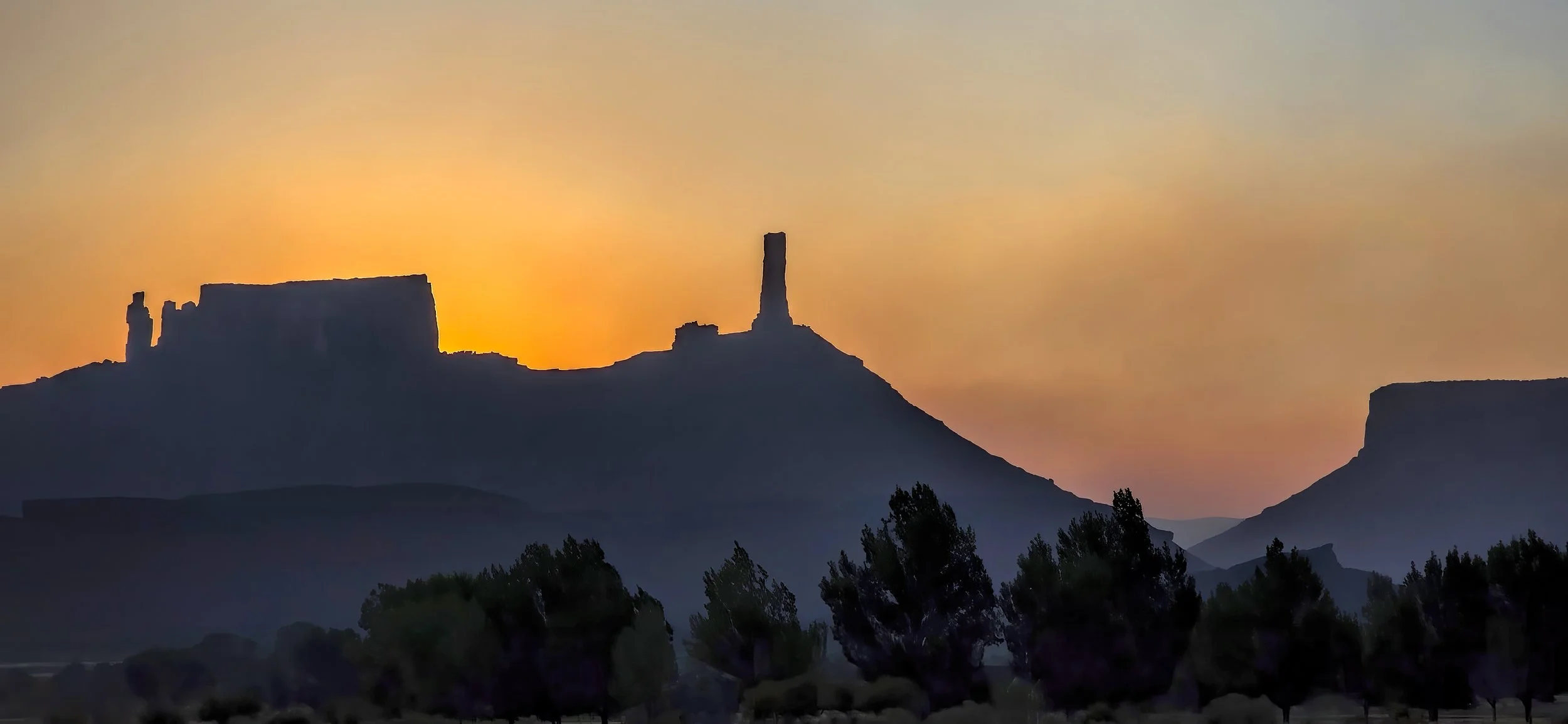
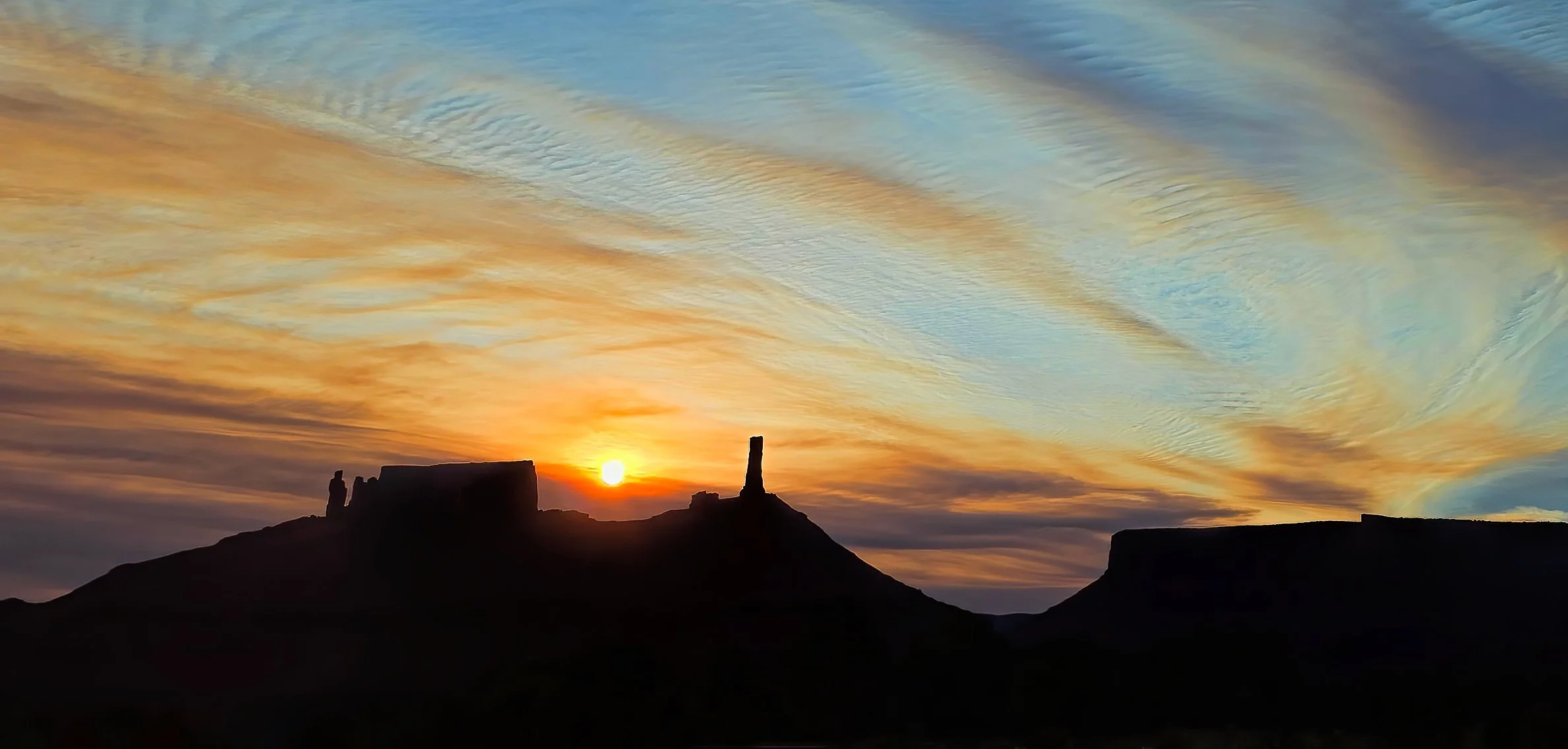
greets Castle Valley this morning. While the colorful refraction of the Sun’s rays through the smoke plume can be lovely, I still prefer smoke free skies.

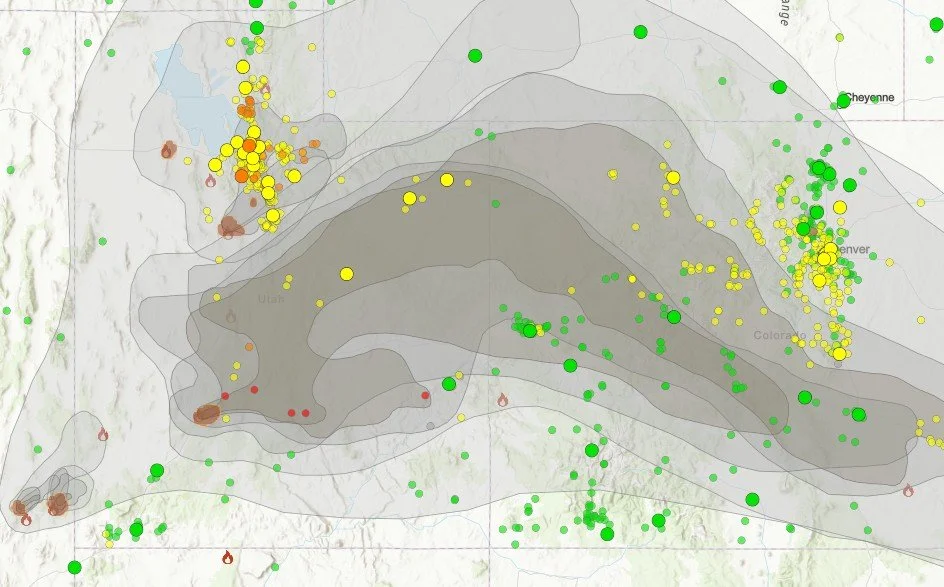
ADDED: Mid-day smoke plume map. Air quality this afternoon has significantly deteriorated and is horrible. It’s going to be one of those summers.
Another indispensable website and app during fire season: Watch Duty. I highly recommend an annual membership for $25 to support their valuable work (no commission earned).

ADDED: Mid-afternoon satellite image of smoke plume from the Cottonwood Fire near Beaver, Utah.

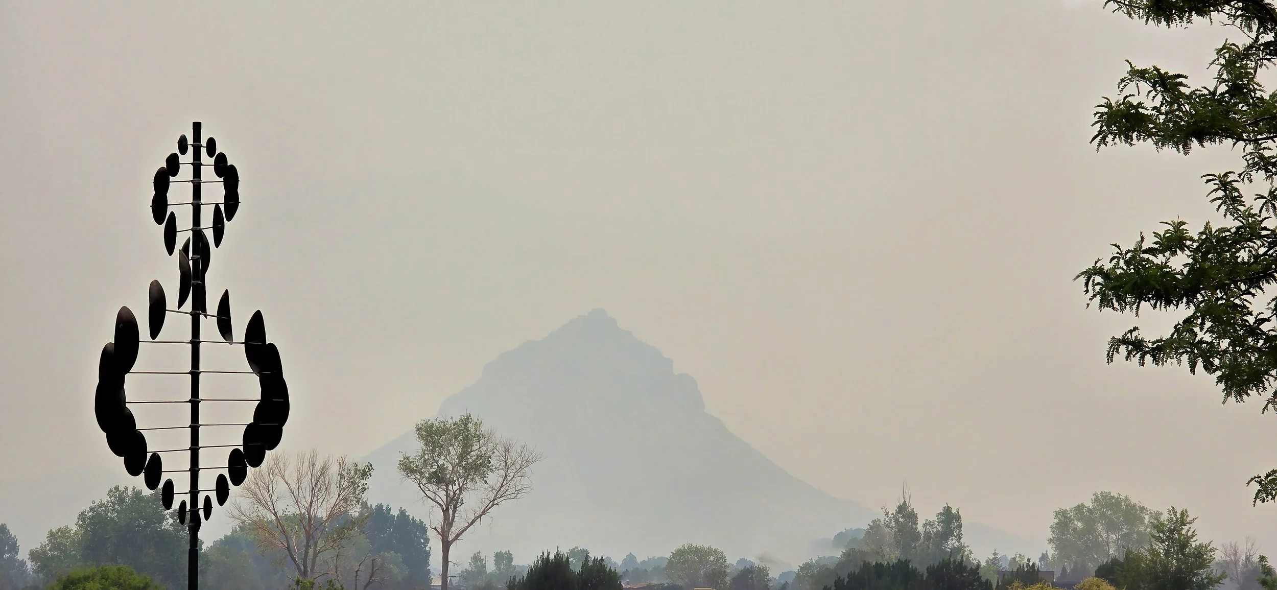
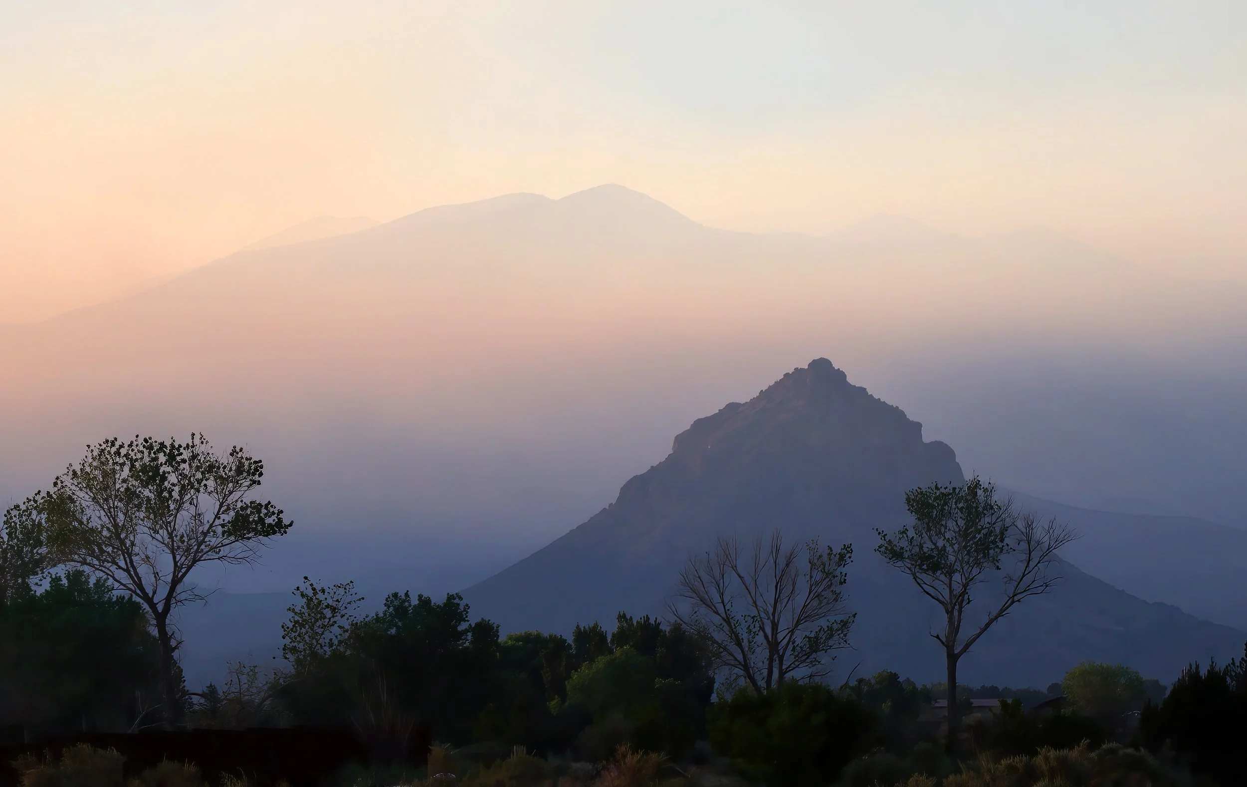
The La Sal Mountains have nearly vanished in the thick smoky haze at 3:00 pm MDT.

Downwinders: Air quality is now well into the unhealthy range in the Moab - Castle Valley area and likely to get worse. Here’s the smoke plume at 5:00 pm MDT. Round Mountain has completely disappeared from view.

24 June 2026 UPDATE: Shortly after sunrise, around 7:00 am MDT. Air quality remains firmly in the unhealthy category. Ugh.
diminishes air quality across Utah and Colorado, frustrating my attempt at solstice sunrise photography earlier in the morning. A large range fire southwest of Provo is responsible. I dread fire season.

The hazy view at high noon.

Useful link to Fire and Smoke Map 4.2. (You may have to turn on the plume mapping function in the settings.)