parallels the south bank of the Colorado River downstream from Moab, Utah, then winds through a narrow, meandering Wingate-walled canyon before ultimately cresting out at Hurrah Pass.

The “Birthing Rock” in the Kane Creek area displays a variety of petroglyphs attributed to the Ute Indians who lived in the area from 1300 AD up to 1880. This image spans an area of about two meters square to give a sense of scale.

End of the ride today at Hurrah Pass, 20 miles out-and-back, with 1,800 feet elevation gain.
Panoramic view from summit of Hurrah Pass, near the crest of the Kane Creek anticline. Look closely and one can spy the solar evaporation pond terraces across the Colorado River. (Click image to enlarge.)
View across Kane Springs Creek from below Hurrah Pass, where the Cutler Formation is exposed in the valley bottom. (Click image to enlarge.)
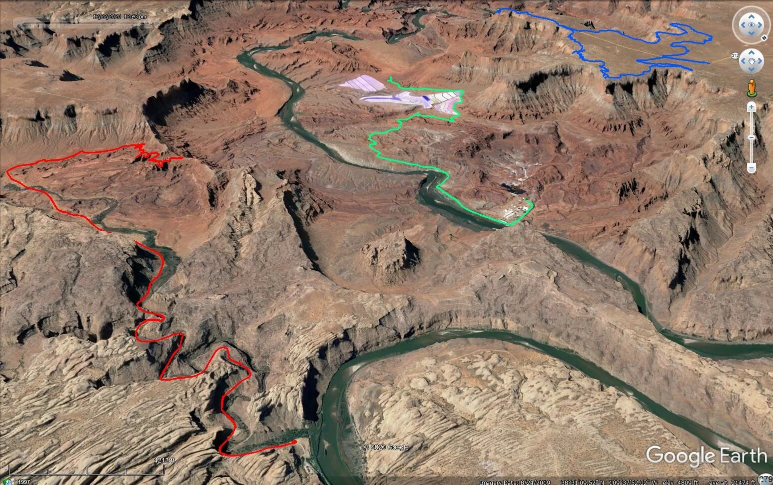
Kane Creek Road to Hurrah Pass (red) completes a triptych of rides in and around the Intrepid Potash solution mining operation. The green and blue tracks show previous rides in the area on the Potash Road and at Dead Horse Point State Park, respectively.