at the edge of the Pintler Wilderness in Montana, my first stop on my drive south.

Hopper and Gomer...
are my neighbor’s llamas, but they meet me at the fence line every day for a treat. I get all the enjoyment without any of the upkeep. Thought I’d snap a couple of quick portraits to share with their owner.


Seasonal arrivals in the wetlands...
are triggering my migratory instincts as well. It’s about time to head south.
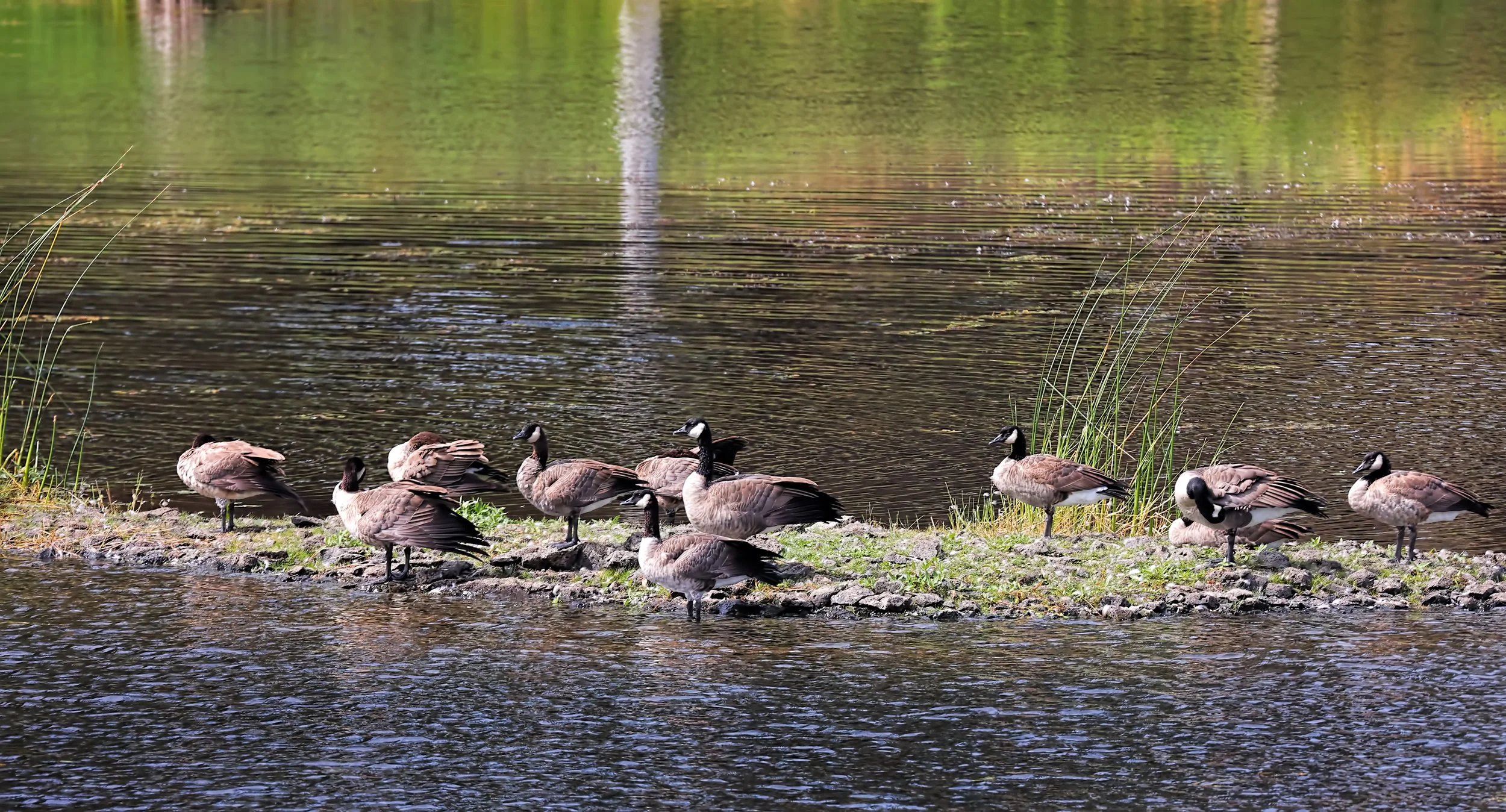
Canada Geese (Branta canadensis).
The perfect wall hanging...
for an unabashed cartophile, this shaded relief printing of the classic Moab 1:250,000 quadrangle is quite stunning. Keep in mind that in the image below the paper is completely flat, yet the map pops in the third dimension. I just mounted and framed this print and it will hang in my high desert hacienda in red rock country. Perfect place.

24 x 32 inch print of the Moab, Utah 1:250,000 scale topographic quadrangle (1969).

Close detail view of the Moab and Castle Valley area, Utah.
Dig artistic wall maps? Then Muir Way is the place. I wish I had more wall space.
My northern spirit animal...
visits this evening at dusk.

Great Horned Owl (Bubo virginianus).

A terrible situation is developing...
in eastern Washington where the Gray Fire erupted two days ago, burning more than 10,000 acres and destroying more than 185 homes and structures in and around the community of Medical Lake. A “State of Emergency” has been declared in Spokane County and my residence is under a Level 2 (Get Set) evacuation order.
Current information here: Watch Duty - Gray Fire.
Fire mapping: Fire Information for Resource Management Systems US/Canada.

Image by C. Pritchard taken on 18 August 2023 from northeastern shore of Medical Lake.
UPDATE 22 August 2023: A burn perimeter map has been released showing the affected 10,014 acres with the ignition source located at a youth ranch west of Medical Lake. My residence still remains in a Level 2 (Get Set) evacuation status. Rain is in the forecast!

Gray Fire burn perimeter map southwest of Spokane, Washington.
UPDATE 22 August 2023 at 5 pm PST: Evacuation areas are being downgraded and my residence is no longer under any evacuation warning. Feeling extraordinarily fortunate.
An annular solar eclipse...
will traverse the southwestern United States in about two months time. I’m getting prepared for this rare and interesting astronomical event, the center line for which is a short distance south of Moab, Utah. I’ll be camping there with all my telescopic and photographic gear.

More information here: Eclipse America 2023.
Terrific zoomable map: Interactive Google Map showing center line.

IMPORTANT: All observers regardless of location will require appropriate eye protection to view this event!
A literal night owl...
caught at the bird bath by the trail camera last evening following a very hot day.

Great Horned Owl (Bubo virginianus).

Days later: Elusive during the daytime, but a frequent visitor under the cover of darkness.
After the burn...
at the leading edge of the wind driven wildfire. I estimate that only about 40 acres of ponderosa pine forest burned, thanks to the quick aerial response in dousing the fire.

A nicely camouflaged bullsnake...
hiding in the dry grass.
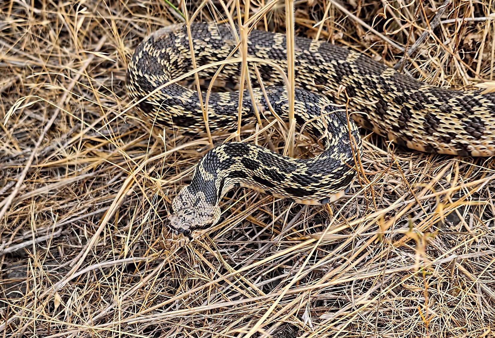
Bullsnake (Pituophis catenifer sayi).
Heroes in yellow shirts...
darkened by carbon black and soot are keeping a watchful presence on the recent nearby wildland fire, managing several pumps and a tangle of fire hoses. I thanked them profusely for their hard work on behalf of the local community. Fortunately rain is in the near forecast.

Cheerful fire crew from Eastside Fire and Rescue, Issaquah, Washington.

Walk your bike! Fish Lake Trail near Spokane, Washington.
Fire near the Fish Lake Trail...
flared up this evening east of town, likely due to sparks along the railroad, with local firefighters and aerial crews immediately attacking the fast spreading fire. I snapped these images with my smartyphone camera on the trail, then retreated for a wider view.


Four AT-802F Fire Boss aircraft attack the fire with several helicopters and a spotter plane in support.


The day after: Still smoldering pine duff at the southwestern edge of the fire margin. The trail is closed and crews are still on site.
This diminutive songbird...
is modeled in metal, but at a considerably larger scale.

Pygmy Nuthatch (Sitta pygmaea), both foreground and background.
Unsponsored plug: If you’re a bird lover, check out Metalbird.
Soaking up the remaining warmth...
of the asphalt surface of the bike trail, this smart reptile enjoys a few moments at sunset.

Common gartersnake (Thamnophis sirtalis).
Deer crossing ahead...
on the wildlife-rich Fish Lake Trail this morning.

Mule deer doe with two fawns (Odocoileus hemionus).
Fallen rock debris swept clear...
of the Fish Lake Trail by a crew from Washington State Parks, yet the hazard of rock topple still remains along this short stretch of passage.

Site in early July 2023, but the rockfall occurred during winter or spring.

Site today following cleanup of fallen debris on the trail. One leaning basalt column remains.

A soft, sedimentary interbed lies below the columnar-jointed basalt lava flow unit and is considerably more erodible. The excavation of the railroad cut in the early 20th century exposed the contact and this will likely have to be maintained in perpetuity. Trail users beware!
Duckling diving lessons...
were underway late this morning, with Minnie, the mamma Mallard, coaching on the sidelines.

Mallard Ducks (Anas platyrhynchos).
Look ma, got something!
Trying to get a turtle to smile...
for the camera is an absolutely impossible task.

A grumpy painted turtle (Chrysemys picta).

A preening cutie...
in the creek while Mom keeps a watchful eye nearby.

Mallard Duck chick (Anas platyrhynchos).

This is the mamma Mallard, named Minnie.
Yielding to Bullwinkle J. Moose...
on the Fish Lake Trail this morning! Huge and magnificent beast!
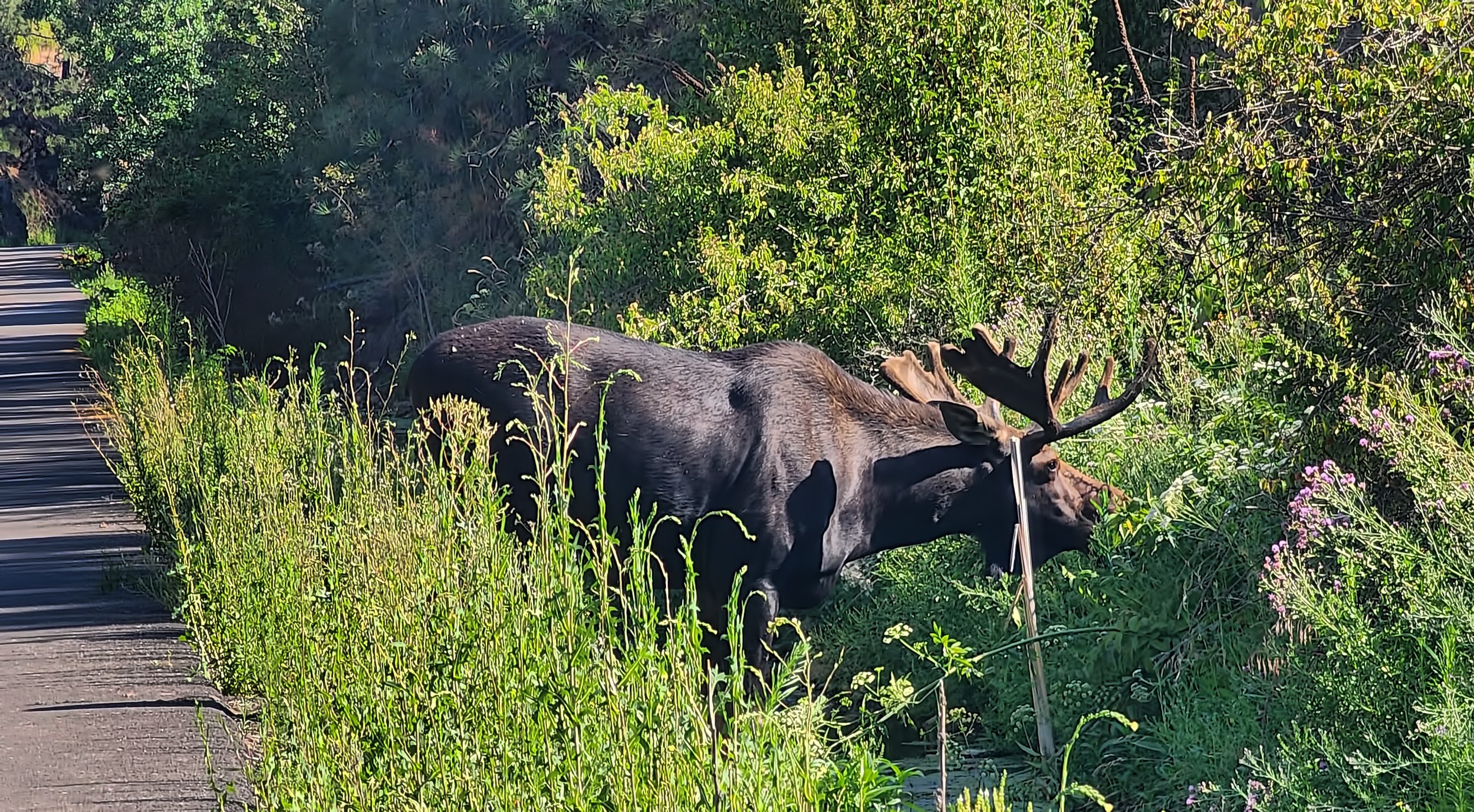
Bull moose (Alces alces).

These snaphots were made with my smartyphone camera from about 35 yards/meters away.